MyTopo
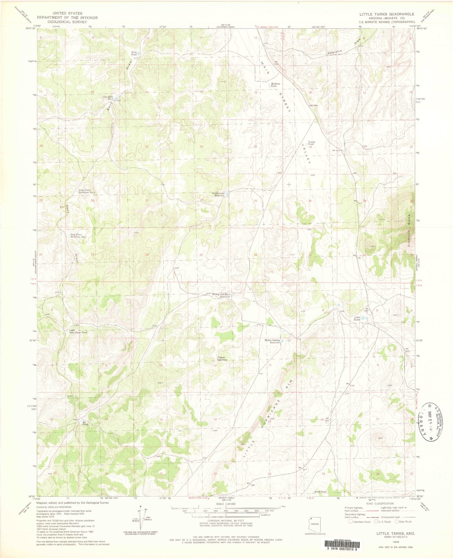
Classic USGS Little Tanks Arizona 7.5'x7.5' Topo Map
Couldn't load pickup availability
Historical USGS topographic quad map of Little Tanks in the state of Arizona. Map scale may vary for some years, but is generally around 1:24,000. Print size is approximately 24" x 27"
This quadrangle is in the following counties: Mohave.
The map contains contour lines, roads, rivers, towns, and lakes. Printed on high-quality waterproof paper with UV fade-resistant inks, and shipped rolled.
Contains the following named places: Alva Shelly Reservoir, Bishop and Burr Reservoir, Cox Tank, Cox-Atkin Tank, Hy Pond, Limestone Reservoir, Little Sevy Draw Pond, Little Tanks, Mudhole Tank, Nina Pond, North Mohave Division, Pothole Reservoir, Rattlesnake Reservoir, Road Pond, Sevy Draw Reservoir Number One, Sevy Draw Reservoir Number Two, Sinkhole Reservoir, Upper Little Joe Pond, Walter Shelley Reservoir, Young Tank