MyTopo
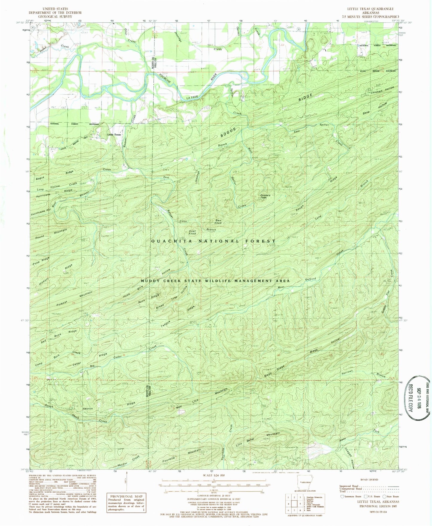
Classic USGS Little Texas Arkansas 7.5'x7.5' Topo Map
Couldn't load pickup availability
Historical USGS topographic quad map of Little Texas in the state of Arkansas. Map scale may vary for some years, but is generally around 1:24,000. Print size is approximately 24" x 27"
This quadrangle is in the following counties: Scott, Yell.
The map contains contour lines, roads, rivers, towns, and lakes. Printed on high-quality waterproof paper with UV fade-resistant inks, and shipped rolled.
Contains the following named places: Bee Knob, Blagg Hollow, Blagg Ridge, Bogus Ridge, Bread Tray Hollow, Buck Ridge, Cedar Ridge, Coon Branch, East Spiller Creek, East Weaver Creek, Fourmile Mountain, Ganders Peak, Garner Creek, Goat Knob, Grassy Flat Creek, Herron Ridge, Hurricane Hollow, Huse Mire Hollow, Janes Creek, Jennings Branch, Jennings Creek, Linn Barker Mountain, Little Texas, Lone Hollow Creek, Lone Oak School, Long Hollow, Mud Lick Mountain, Oller Creek, Panther Suck Hollow, Piney Grove School, Polecat Mountain, Red Buck Ridge, Red Hill School, Rough Ridge, Skaggs Hollow, Spiller Creek, Teague Ridge, Township of Little Texas, Weaver Creek, West Spiller Creek, West Weaver Creek, ZIP Code: 72827