MyTopo
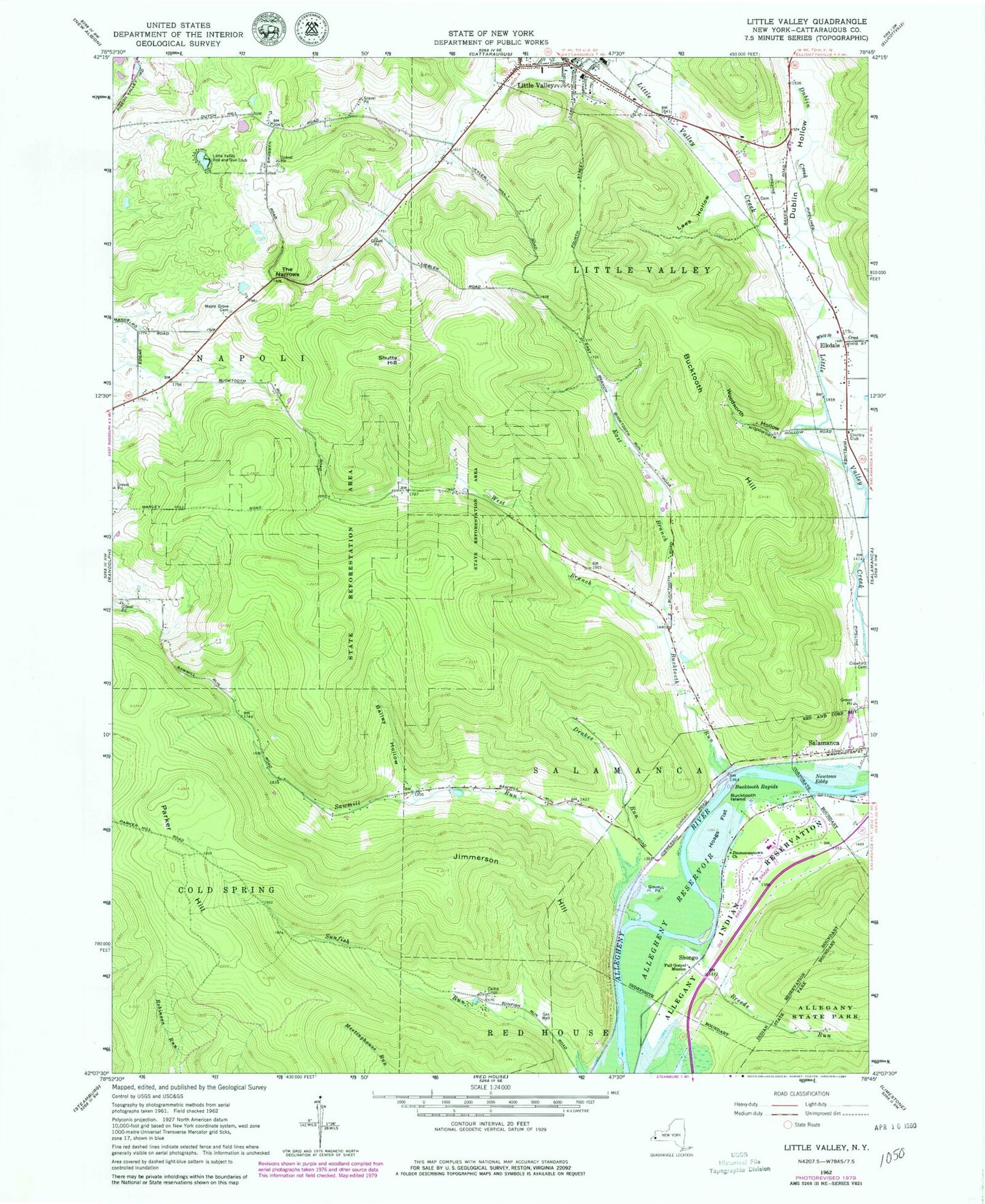
Classic USGS Little Valley New York 7.5'x7.5' Topo Map
Couldn't load pickup availability
Historical USGS topographic quad map of Little Valley in the state of New York. Typical map scale is 1:24,000, but may vary for certain years, if available. Print size: 24" x 27"
This quadrangle is in the following counties: Cattaraugus.
The map contains contour lines, roads, rivers, towns, and lakes. Printed on high-quality waterproof paper with UV fade-resistant inks, and shipped rolled.
Contains the following named places: Bailey Hollow, Breeds Run, Bucktooth Hill, Bucktooth Island, Bucktooth Rapids, Bucktooth Run, Camp Liloli, Drakes Run, Dublin Creek, Dublin Hollow, East Branch Bucktooth Run, Elkdale, Full Gospel Mission, Hoags Flat, Jimmerson Hill, Jimmersontown Church, Lees Hollow, Maple Grove Cemetery, Missionary Indian Church, Newtons Eddy, Parker Hill, Sawmill Run, Shutts Hill, The Narrows, West Branch Bucktooth Run, Whig Street Creek, Woodworth Hollow, Shongo, Little Valley Rod and Gun Club, Town of Coldspring, Town of Little Valley, Town of Salamanca, Village of Little Valley, Hillside Acres, Annis Cemetery, Little Valley Campus Elementary School, First Congregational Church, Saint Michaels Lutheran Church, Valley View Baptist Church, Memorial Library of Little Valley, Little Valley Post Office, Little Valley Volunteer Fire Department, Allegany Indian Reservation Fire Department