MyTopo
Classic USGS Little Wood River Reservoir Idaho 7.5'x7.5' Topo Map
Couldn't load pickup availability
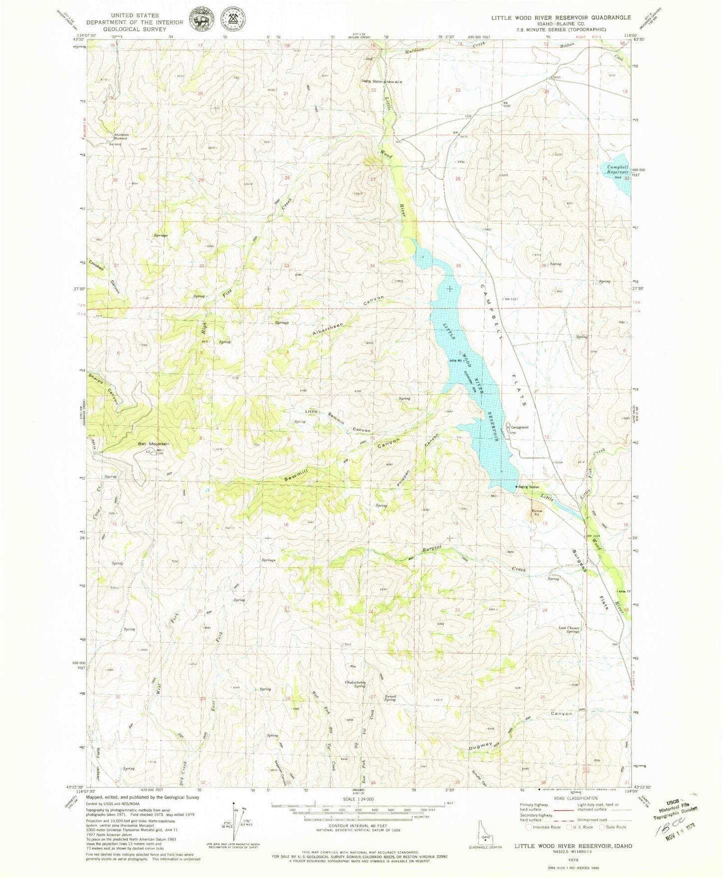
Historical USGS topographic quad map of Little Wood River Reservoir in the state of Idaho. Map scale may vary for some years, but is generally around 1:24,000. Print size is approximately 24" x 27"
This quadrangle is in the following counties: Blaine.
The map contains contour lines, roads, rivers, towns, and lakes. Printed on high-quality waterproof paper with UV fade-resistant inks, and shipped rolled.
Contains the following named places: Alberthsen Canyon, Bell Mountain, Burgess Creek, Burgess Flats, Campbell Dam, Campbell Flats, Campbell Reservoir, Chokecherry Spring, Dugway Canyon, High Five Creek, Last Chance Springs, Little Fish Creek, Little Sawmill Canyon, Little Wood Dam, Little Wood River Reservoir, Muldoon Creek, Muldoon Summit, Phippen Canyon, Sawmill Canyon, Spring Creek, Sunset Spring, West Fork Dry Creek