MyTopo
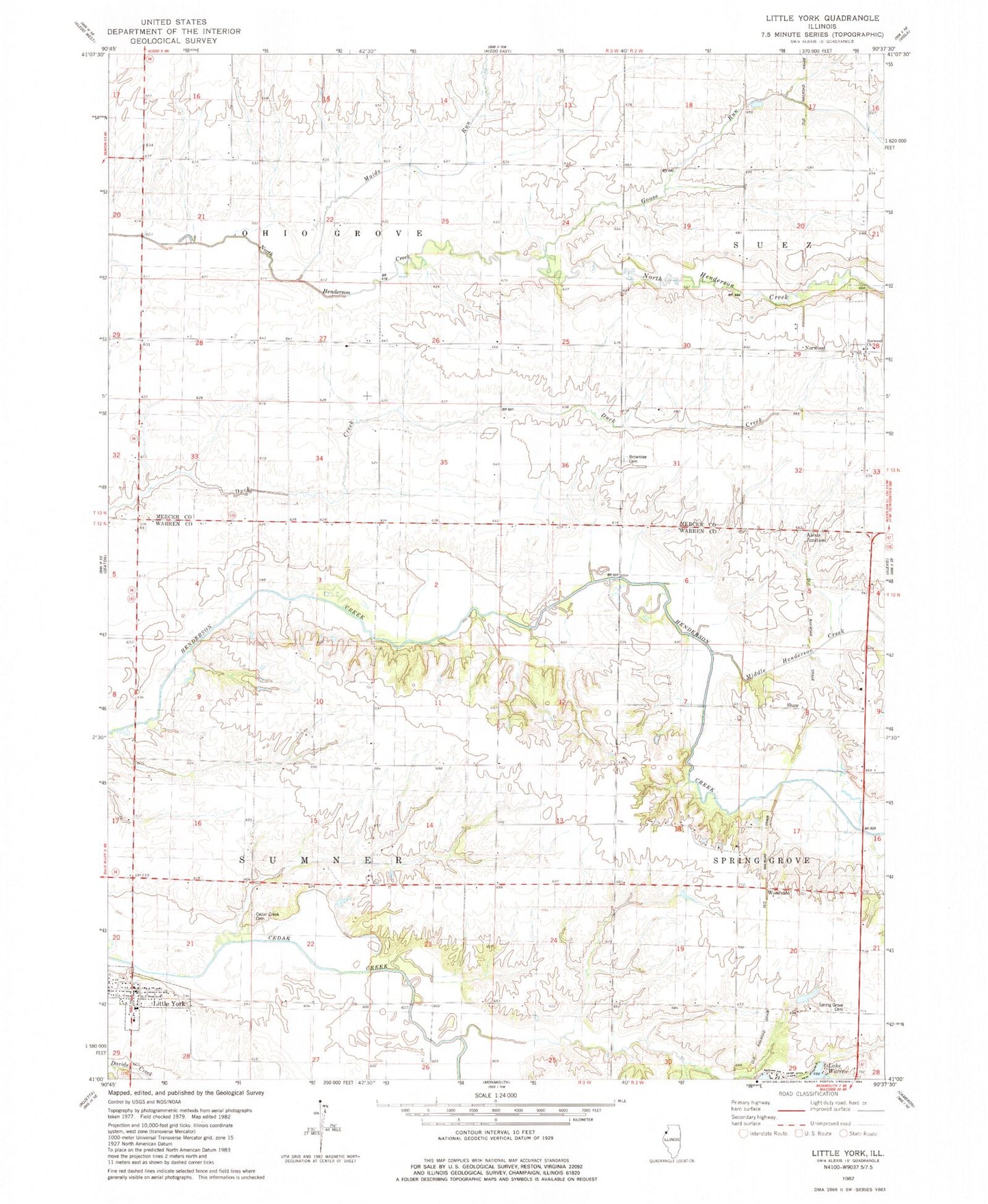
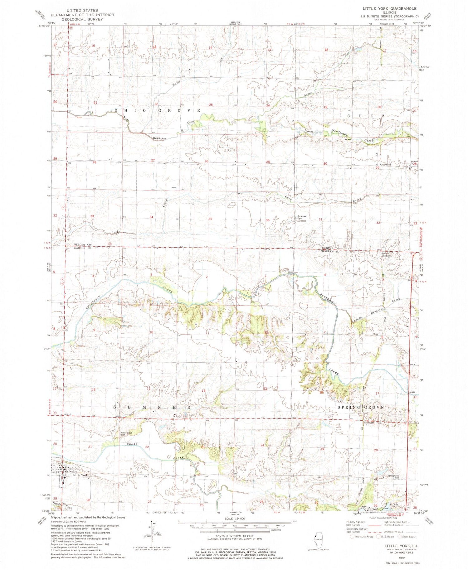
Classic USGS Little York Illinois 7.5'x7.5' Topo Map
Couldn't load pickup availability
Historical USGS topographic quad map of Little York in the state of Illinois. Map scale may vary for some years, but is generally around 1:24,000. Print size is approximately 24" x 27"
This quadrangle is in the following counties: Mercer, Warren.
The map contains contour lines, roads, rivers, towns, and lakes. Printed on high-quality waterproof paper with UV fade-resistant inks, and shipped rolled.
Contains the following named places: Alexis Junction, Brownlee Cemetery, Brownlee Cemetery Prairie Nature Preserve, Brownlee School, Cedar Creek Cemetery, Cedar Creek Church, Cedar Creek School, Centerville School, Duck Creek Post Office, Duck Creek School, Foster School, Goose Run, Lake Warren Dam, Legal Corner School, Little York, Little York Cemetery, Little York Fire Protection District, Little York Post Office, Lone Star School, M A M Trail Airport, Maids Run, McGaw School, Middle Henderson Creek, Norwood, Norwood Church, Robb School, Roney Lake, Roney Lake Dam, Shaw, Spring Grove, Spring Grove Cemetery, Spring Grove Cemetery Prairie Nature Preserve, Township of Ohio Grove, Township of Sumner, Union School, Village of Little York, Woodvale