MyTopo
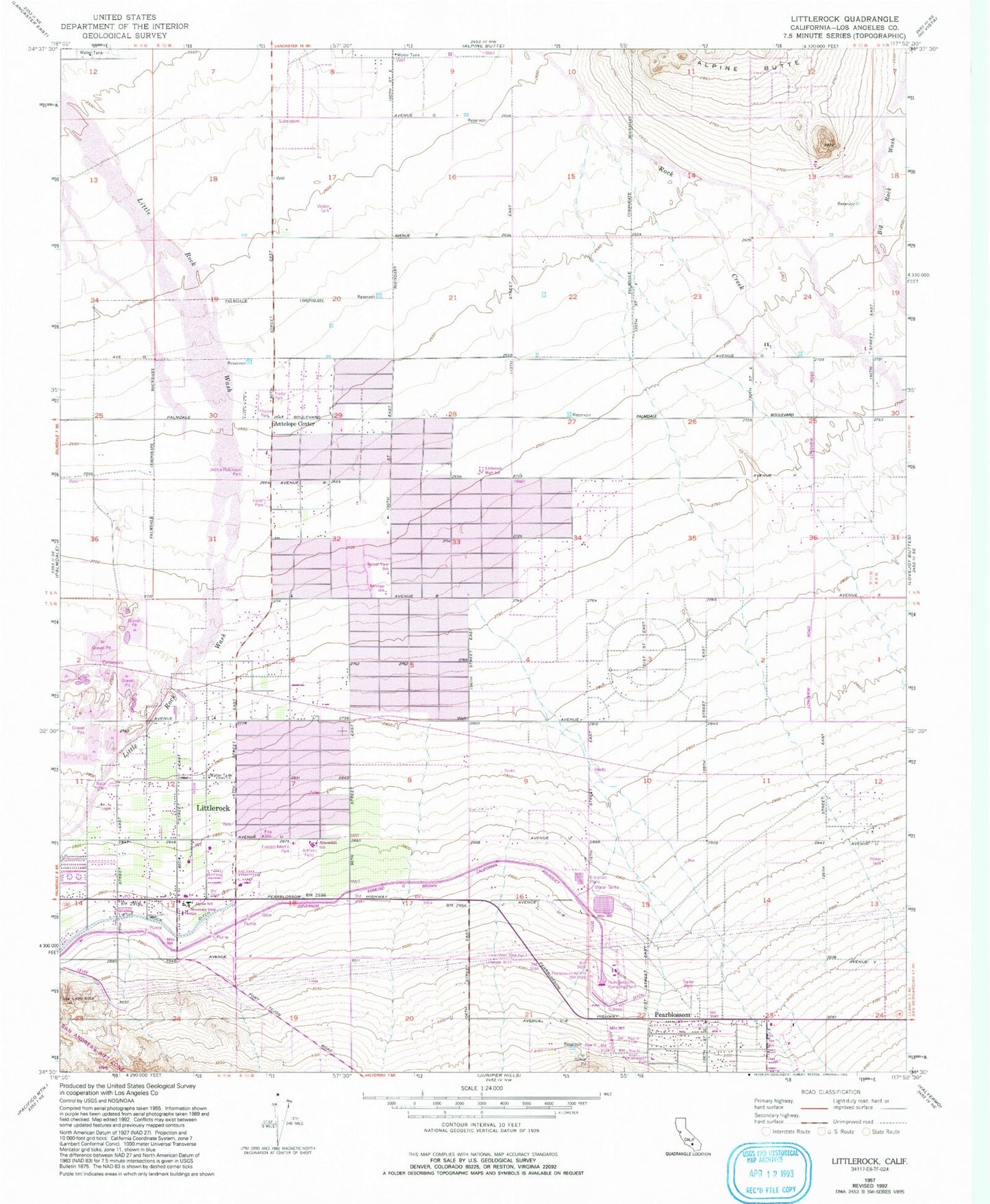
Classic USGS Littlerock California 7.5'x7.5' Topo Map
Couldn't load pickup availability
Historical USGS topographic quad map of Littlerock in the state of California. Map scale may vary for some years, but is generally around 1:24,000. Print size is approximately 24" x 27"
This quadrangle is in the following counties: Los Angeles.
The map contains contour lines, roads, rivers, towns, and lakes. Printed on high-quality waterproof paper with UV fade-resistant inks, and shipped rolled.
Contains the following named places: Almondale Middle School, Alpine Elementary School, Antelope Center, Antelope Elementary School, Assembly of God Church, Avenue T Park, Church of Christ, Church of Jesus Christ of Latter Day Saints, Cornerstone Church of Littlerock, Daisy Gibson Elementary School, Everett Martin Park, First Missionary Baptist Church, Fountain of the World Church, Foursquare Church of Pearblossom, Jackie Robinson Park, Jehovah's Witnesses of Littlerock, Little Rock Ditch, Littlerock, Littlerock Branch County of Los Angeles Public Library, Littlerock Census Designated Place, Littlerock High School, Littlerock Post Office, Littlerock Presbyterian Church, Living In Christ Faith Ministry, Los Angeles County Fire Department Station 79, Los Angeles County Fire Department Station 92, Mountain View School, Pearblossom, Pearblossom Arts Center, Pearblossom Community Methodist Church, Pearblossom District Ranger Office, Pearblossom Park, Pearblossom Post Office, Pearblossom Pumping Plant, Pearblossom Spilling Basin 1-061 Dam, Sun Village Census Designated Place, Sunset View School