MyTopo
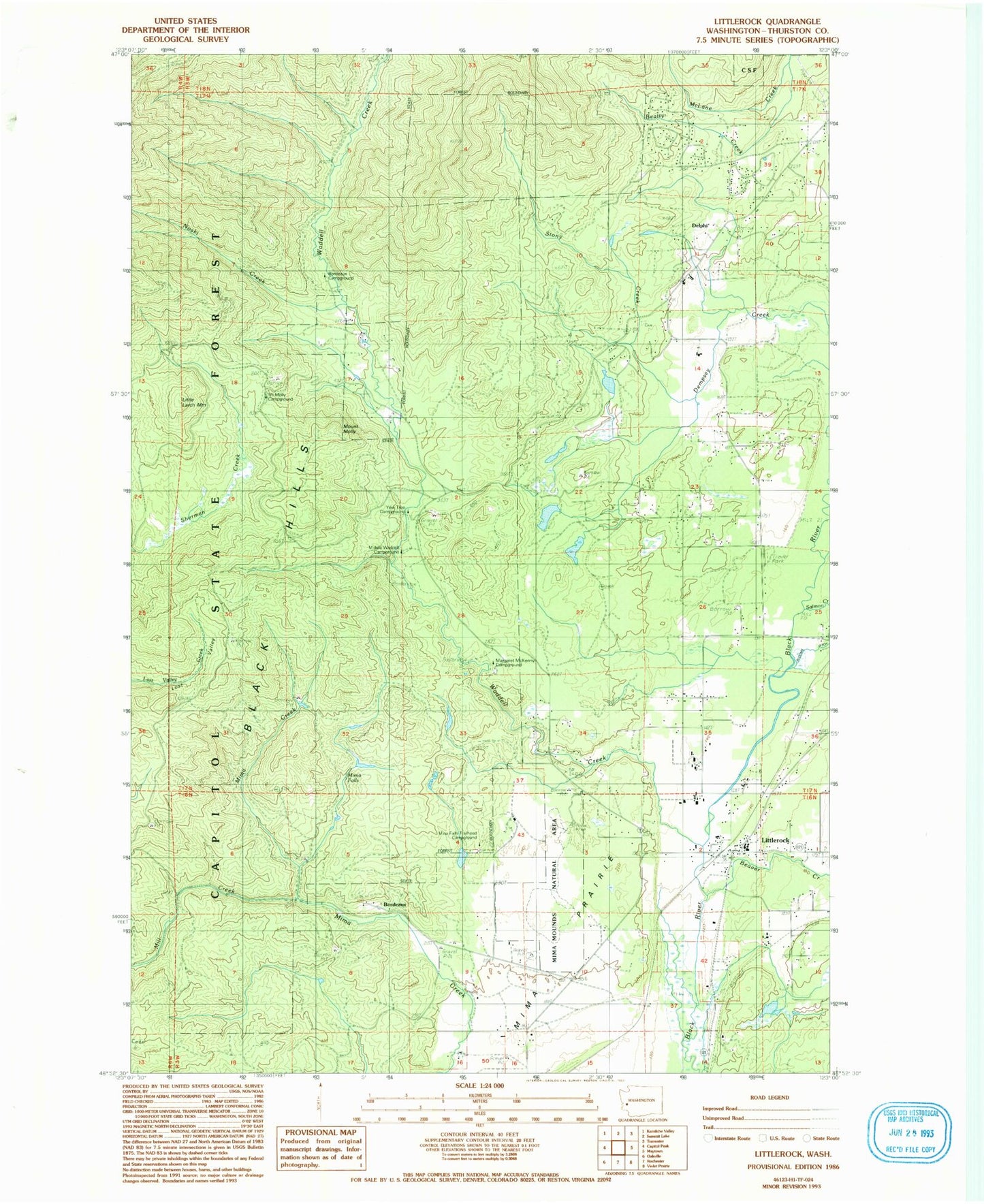
Classic USGS Littlerock Washington 7.5'x7.5' Topo Map
Couldn't load pickup availability
Historical USGS topographic quad map of Littlerock in the state of Washington. Typical map scale is 1:24,000, but may vary for certain years, if available. Print size: 24" x 27"
This quadrangle is in the following counties: Thurston.
The map contains contour lines, roads, rivers, towns, and lakes. Printed on high-quality waterproof paper with UV fade-resistant inks, and shipped rolled.
Contains the following named places: Beatty Creek, Beaver Creek, Blooms Ditch, Bordeaux (historical), Delphi, Mill Creek, Mima Prairie, Salmon Creek, Stony Creek, Waddell Creek, Mina Falls Trailhead Campground, Middle Waddel Campground, Yew Tree Campground, Mima Falls, Margaret McKenny Campground, Mount Molly, Mount Molly Campground, Bordeaux Campground, Mima Mounds Natural Area, Little Larch Mountain, Littlerock, Darlin Creek, Noski Creek, Rutledge Farm, Walentiny Dam, Lake Lucinda Dam, Lake Lucinda, Bade Rotor and Wing Service Heliport (historical), Thurston Co Fire District 11 station 5, Thurston County Fire District 5 Station 52