

MyTopo
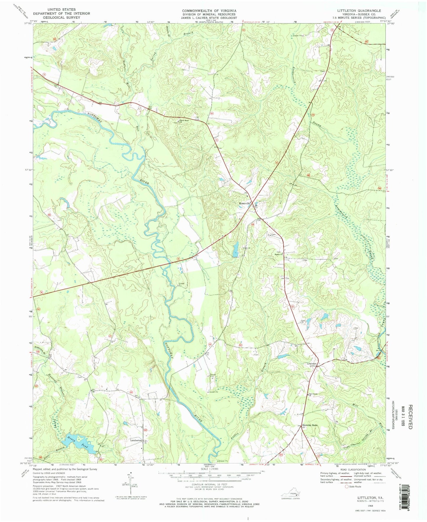
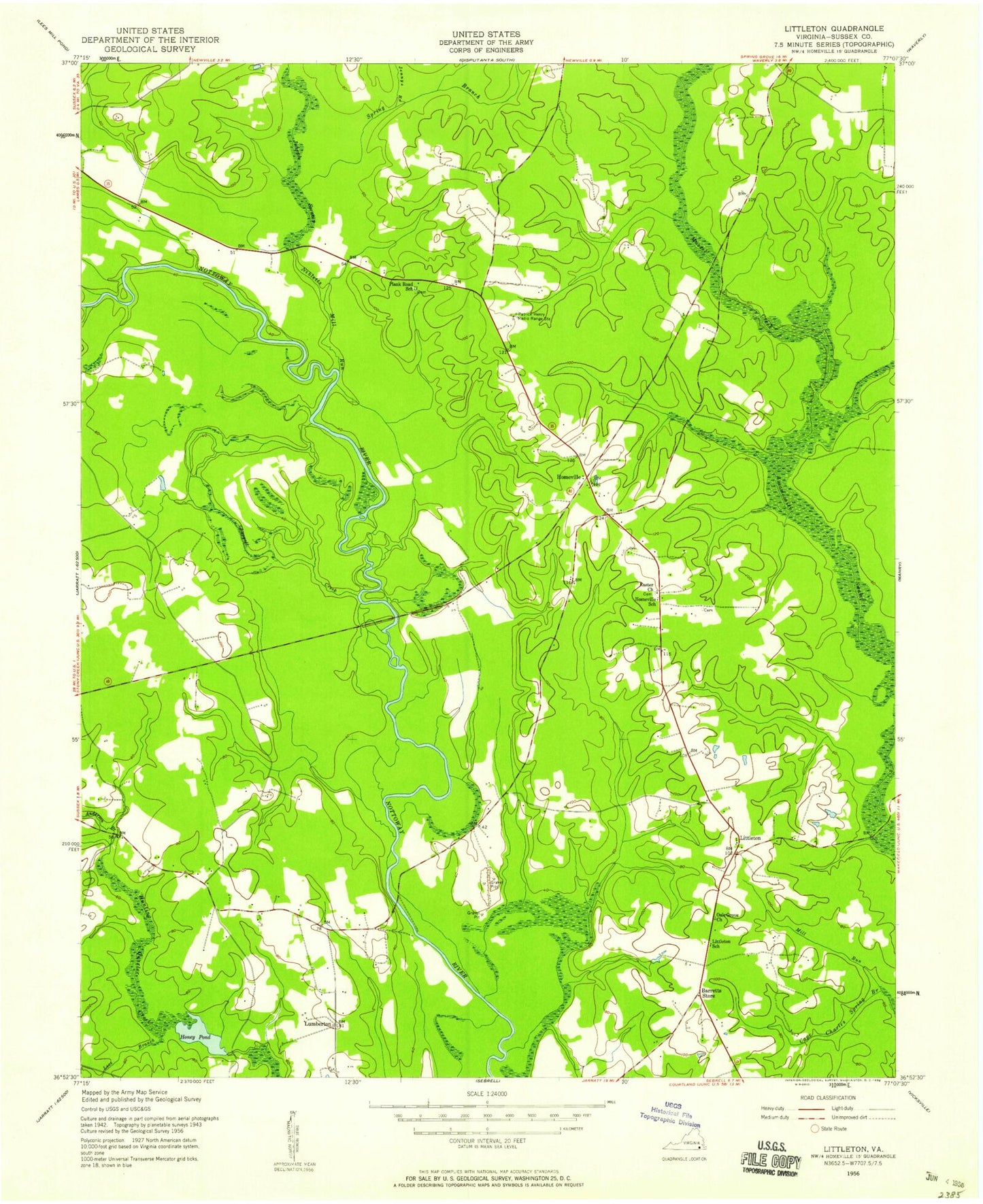
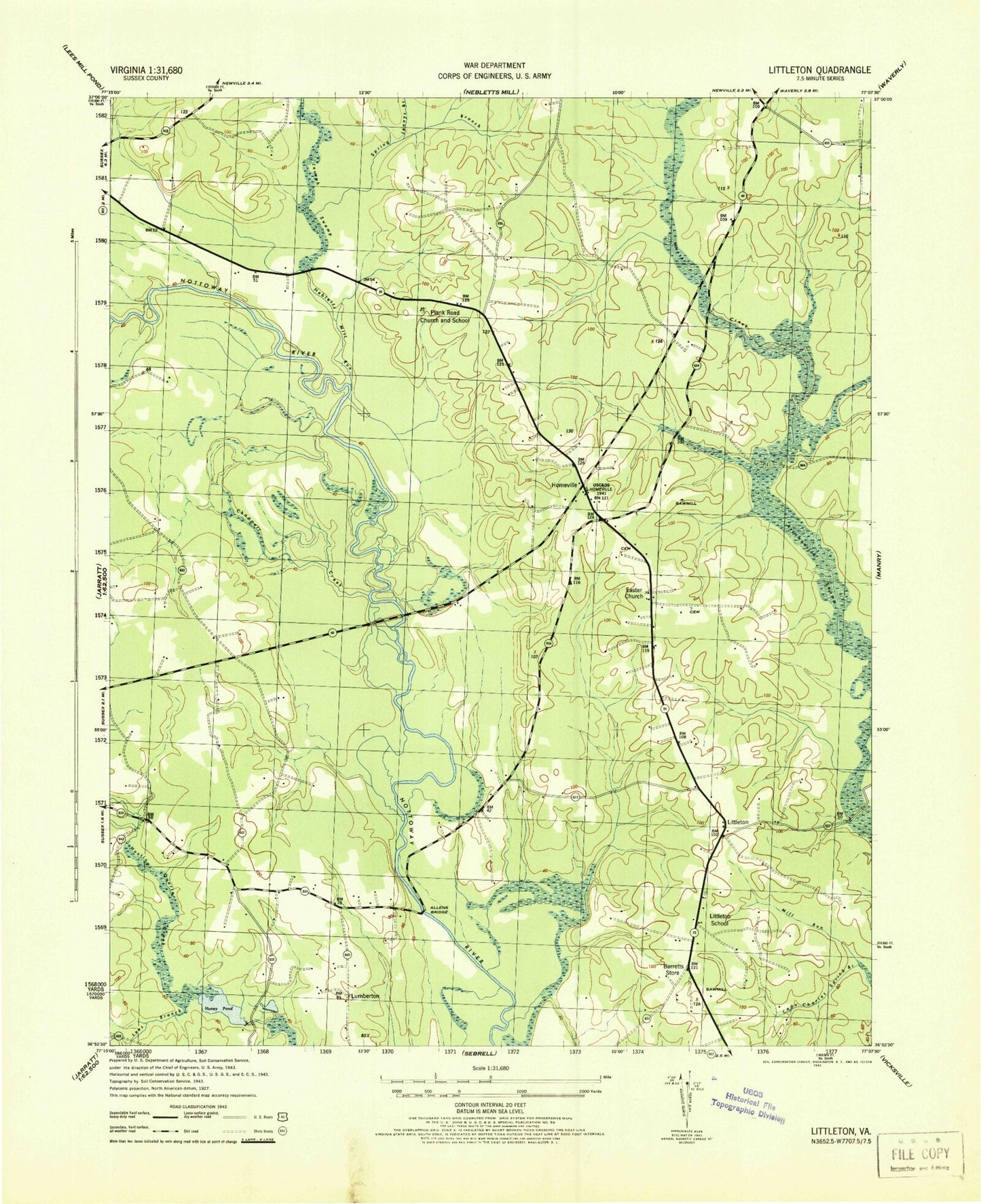
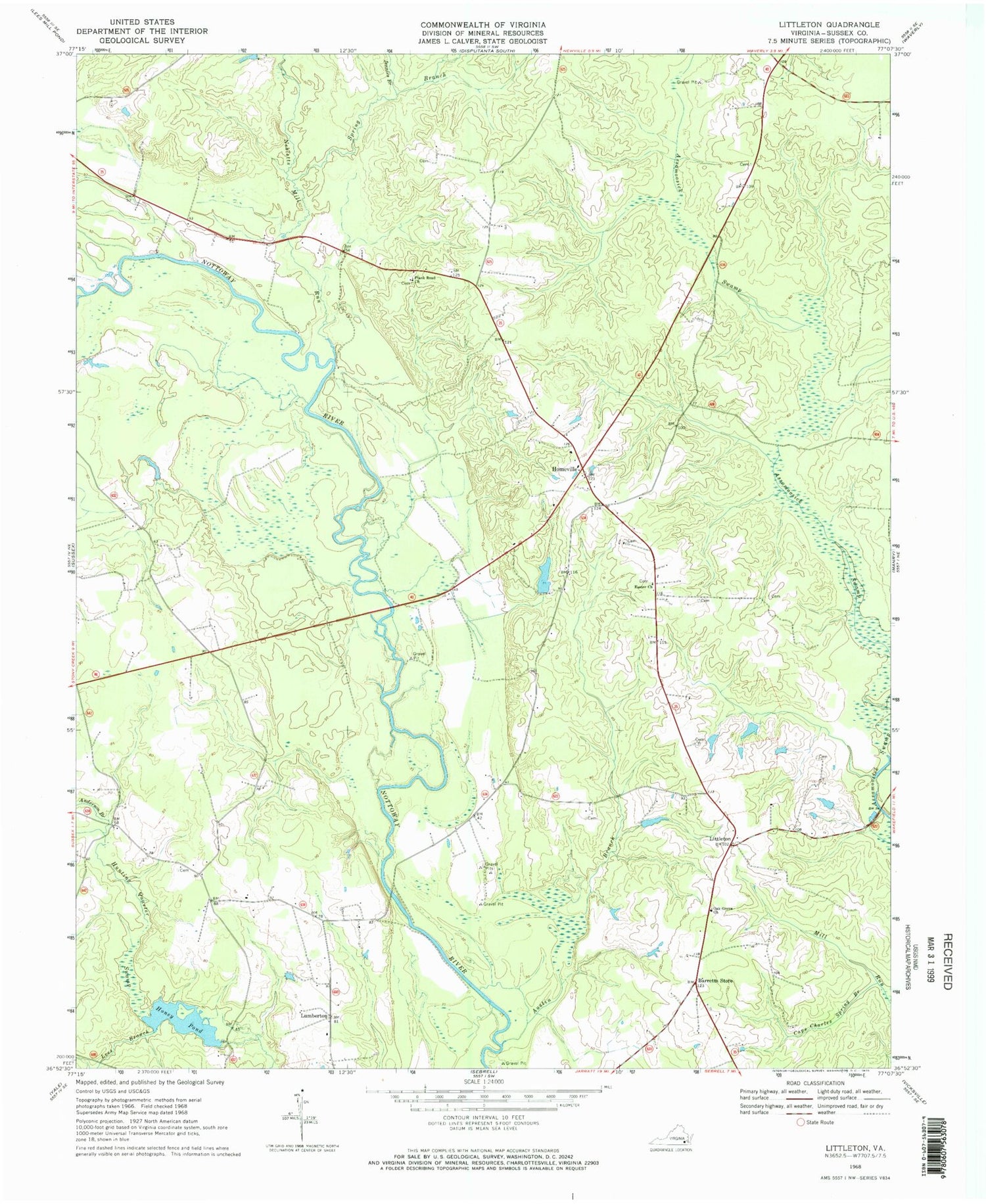
Classic USGS Littleton Virginia 7.5'x7.5' Topo Map
Couldn't load pickup availability
Historical USGS topographic quad map of Littleton in the state of Virginia. Map scale may vary for some years, but is generally around 1:24,000. Print size is approximately 24" x 27"
This quadrangle is in the following counties: Sussex.
The map contains contour lines, roads, rivers, towns, and lakes. Printed on high-quality waterproof paper with UV fade-resistant inks, and shipped rolled.
Contains the following named places: Allens Bridge, Anderson Branch, Austin Branch, Barretts Store, Burt, Cape Charles Spring Branch, Church, Easter Cemetery, Easter Church, Homeville, Homeville School, Honey Dam, Honey Pond, Jennies Branch, Lees Branch, Littleton, Littleton School, Lumberton, Mussel Swamp, Nebletts Mill Run, Newville District, Oak Grove Church, Oakland Cemetery, Patrick Henry Radio Range Station, Plank Road Church, Plank Road School, Renney Dam, Renney Pond, Spring Branch, Underhill Branch