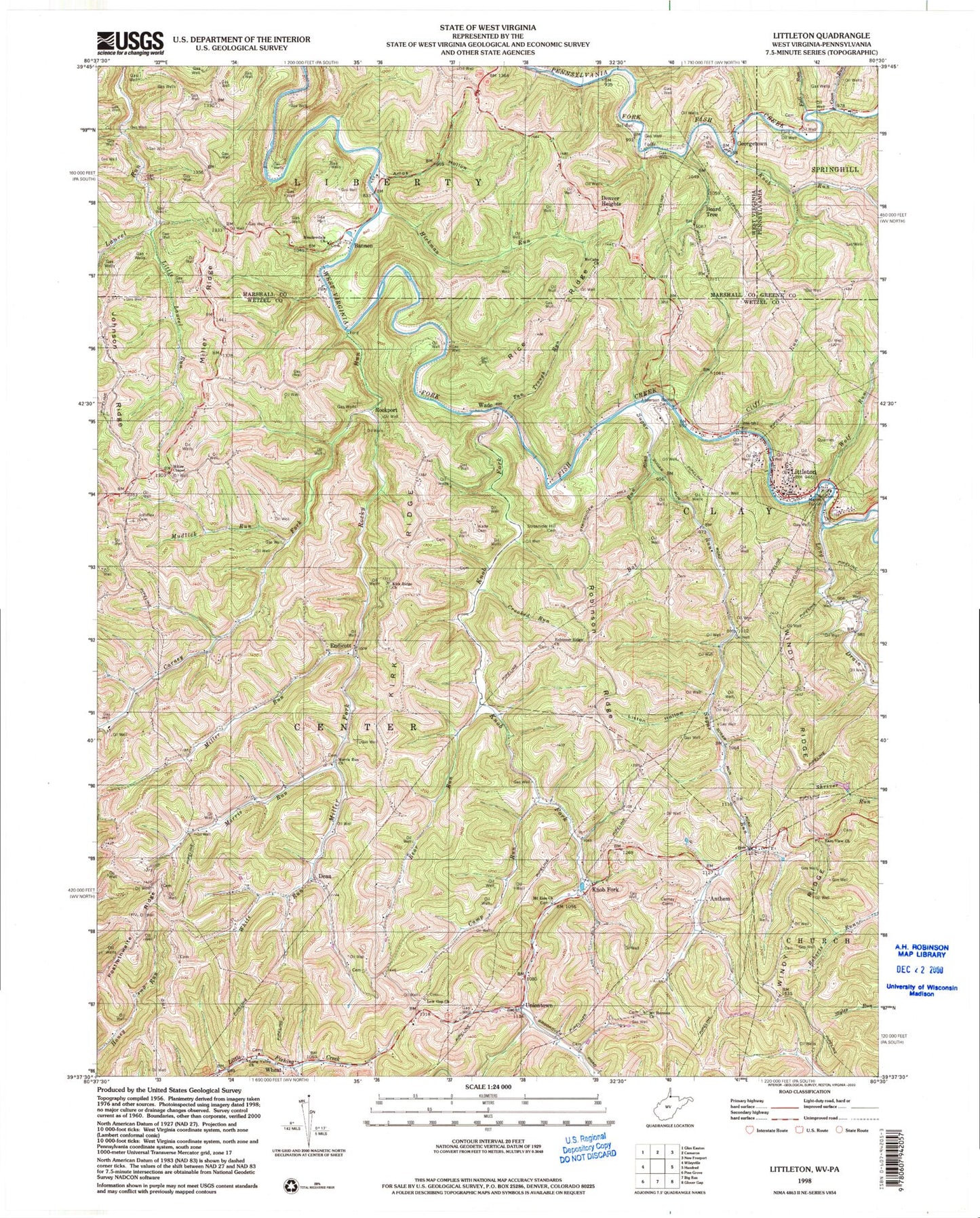
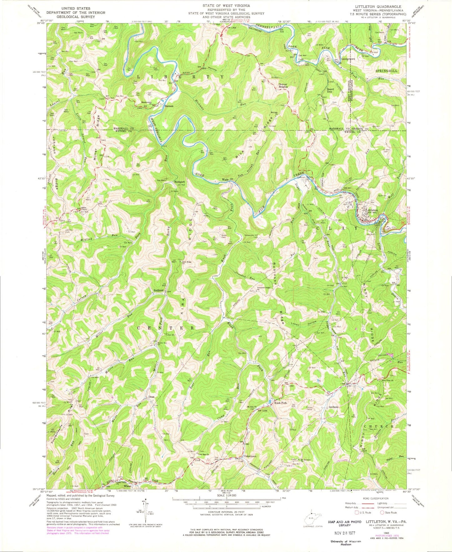
MyTopo
Classic USGS Littleton West Virginia 7.5'x7.5' Topo Map
Couldn't load pickup availability
Historical USGS topographic quad map of Littleton in the states of West Virginia, Pennsylvania. Map scale may vary for some years, but is generally around 1:24,000. Print size is approximately 24" x 27"
This quadrangle is in the following counties: Greene, Marshall, Wetzel.
The map contains contour lines, roads, rivers, towns, and lakes. Printed on high-quality waterproof paper with UV fade-resistant inks, and shipped rolled.
Contains the following named places: Amos Hollow, Anderson Bethel Cemetery, Anthem, Bannen, Bat Run, Bear Run, Bear Run School, Beaverdam School, Bellton Mill School, Board Tree, Board Tree Cemetery, Board Tree Tunnel, Camp Run, Carney Cemeteries, Carney Fork, Carney Fork Church, Cliff Run, Coon Run, Crooked Run, Dean, Denver Heights, Denver Heights School, Dewey School, East View Cemetery, East View Church, East View School, Endicott, Fall Run, Fall Run-Wild Cat Hollow School, Fanlight School, Georgetown, Green Valley School, Hays School, Hickman Run, Horner Cemetery, Hutches Cemetery, Isaac Run, Johnson Ridge, Jolliffee Cemetery, Kirk Ridge, Kirk Ridge Church, Knob Fork, Knob Run, Liston Hollow, Liston School, Little Laurel Run, Littleton, Littleton Cemetery, Littleton Census Designated Place, Littleton Church of God, Littleton Post Office, Long Drain, Long Valley Cemetery, Long Valley Church, Low Gap Cemetery, Low Gap Church, Martin Tunnel, McCabe Cemetery, McCabe Church, Meadowdale Cemetery, Meadowdale Church, Miller Chapel, Miller Fork, Miller Ridge, Miller Run, Moore Cemetery, Morris Cemetery, Morris Run, Morris Run Church, Morris Run School, Mount Herman Cemetery, Mount Hermon Church, Mount Zion Cemetery, Mount Zion Church, Mudlick Run, Potts School, Rice Ridge, Rice School, Ride Ridge Church, Ridge Ridge Cemetery, Robinson Ridge, Robinson Ridge Church, Robinson Ridge School, Rockport, Rocky Run, Stottlemire Run, Strosnider Hill Cemetery, Sugar Grove School, Sugar Run, Tan Trough Run, Uniontown, Wade, Wade Cemetery, Walnut Grove School, Wheat, White Run, Windy Ridge, Wolf Run, ZIP Code: 26581