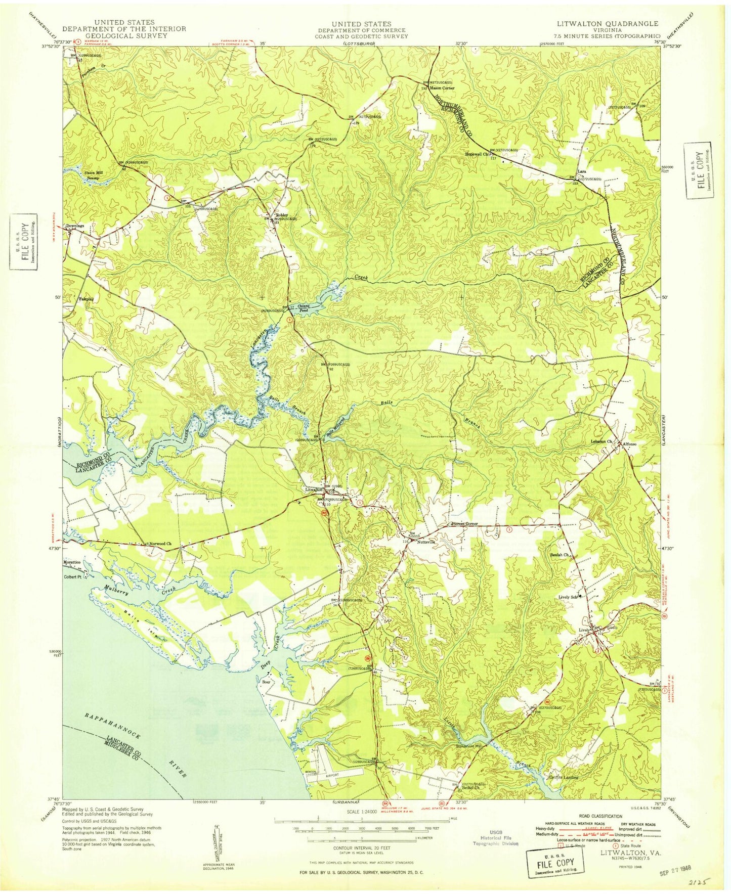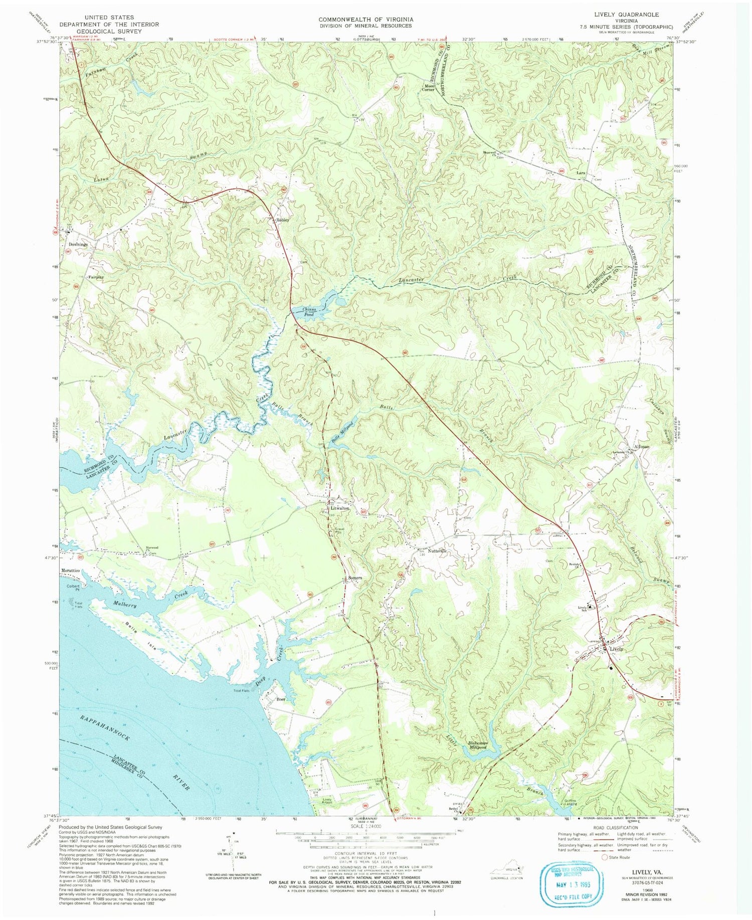
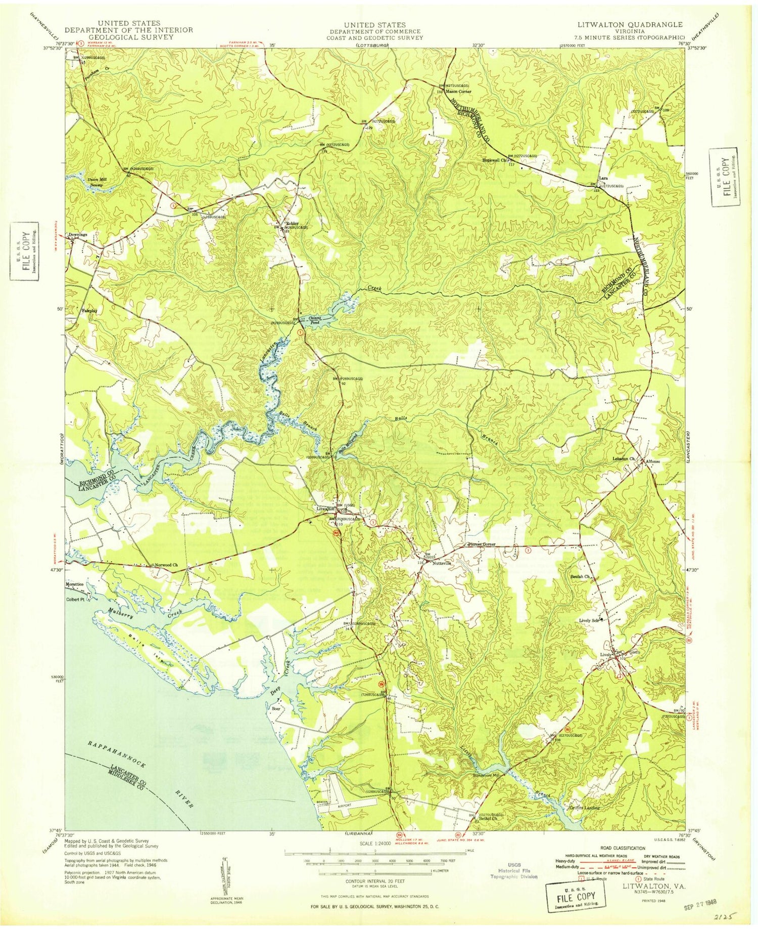
MyTopo
Classic USGS Lively Virginia 7.5'x7.5' Topo Map
Couldn't load pickup availability
Historical USGS topographic quad map of Lively in the state of Virginia. Map scale may vary for some years, but is generally around 1:24,000. Print size is approximately 24" x 27"
This quadrangle is in the following counties: Lancaster, Middlesex, Northumberland, Richmond.
The map contains contour lines, roads, rivers, towns, and lakes. Printed on high-quality waterproof paper with UV fade-resistant inks, and shipped rolled.
Contains the following named places: Alfonso, Balls Branch, Balls Mill, Balls Millpond, Balls Millpond Dam, Belle Isle, Bethel Cemetery, Bethel Church, Beulah Cemetery, Beulah Church, Blackmore Millpond Dam, Blakemore Millpond, Boer, Bridgetown, Bush School, Chinns Dam, Chinns Mill, Chinns Pond, Colbert Point, Deep Creek, District 4, Downings, Fairplay, Foxs Mill Dam, Griffins Landing, Hopewell Cemetery, Hopewell Church, Lanier-Davis Dam, Lara, Lebanon Baptist Church Cemetery, Lebanon Church, Litwalton, Lively, Lively Post Office, Lively School, Maon Church, Marsh Dam, Moon Corner, Morattico Old Mill Pond, Mount Zion Baptist Church, Mulberry Creek, Norwood Baptist Church Cemetery, Norwood Church, Nuttsville, Nuttsville Post Office, Pierces Corner, Pollards Mill, Robley, Somers, Upper Lancaster Volunteer Fire Department, Upper Lancaster Volunteer Rescue Squad, Wells His Creek, Woodhouse Landing, ZIP Codes: 22460, 22503