MyTopo
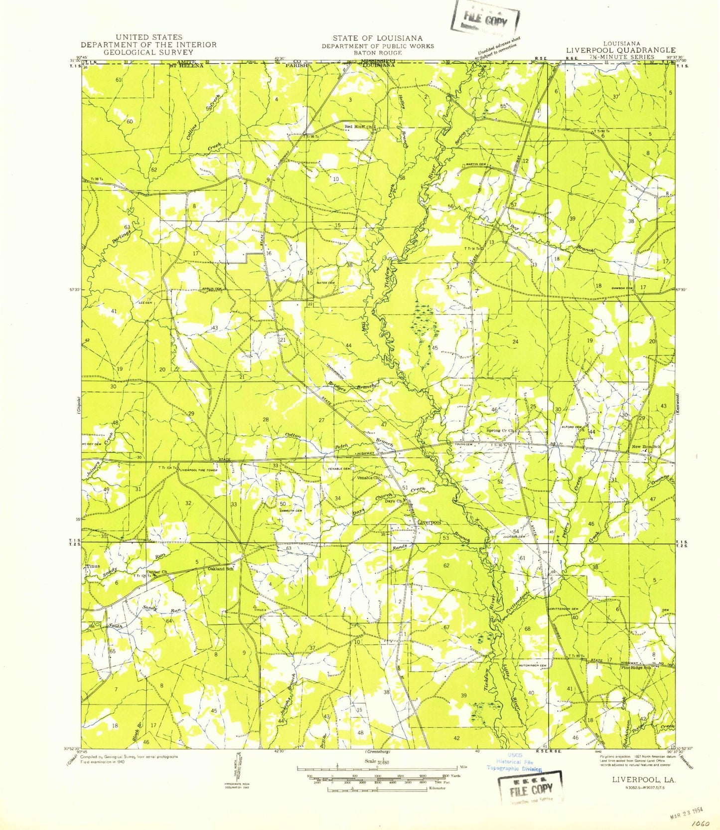
Classic USGS Liverpool Louisiana 7.5'x7.5' Topo Map
Couldn't load pickup availability
Historical USGS topographic quad map of Liverpool in the state of Louisiana. Map scale may vary for some years, but is generally around 1:24,000. Print size is approximately 24" x 27"
This quadrangle is in the following counties: Amite, St. Helena.
The map contains contour lines, roads, rivers, towns, and lakes. Printed on high-quality waterproof paper with UV fade-resistant inks, and shipped rolled.
Contains the following named places: Alford Cemetery, Allen Cemetery, Anglin Cemetery, Bates Cemetery, Bridges Branch, Bridges Cemetery, Carruth Cemetery, Center Church, Centerville School, Collins Creek, Cotton Patch Branch, Crittenden Cemetery, Crittenden Creek, Crooked Creek, Dawson Cemetery, Day Branch, Day Cemetery, Day Church, Day Church Creek, Easleyville, Frazier Cemetery, Halley Branch, Jackson Cemetery, Lee Cemetery, Liverpool, Martin Cemetery, McCoy Cemetery, Mill Creek, Mud Creek, New Zion Baptist Church, New Zion Church, New Zion School, North Helena Volunteer Fire Department, Old Venable Cemetery, Peters Creek, Pine Ridge Church, Pine Ridge United Methodist Church, Rand Branch, Red Bluff Church, Smith Cemetery, Spring Airport, Spring Branch, Spring Creek, Spring Creek Church, Spring Creek Missionary Baptist Church, Venable Church, Ward One, Young Cemetery