MyTopo
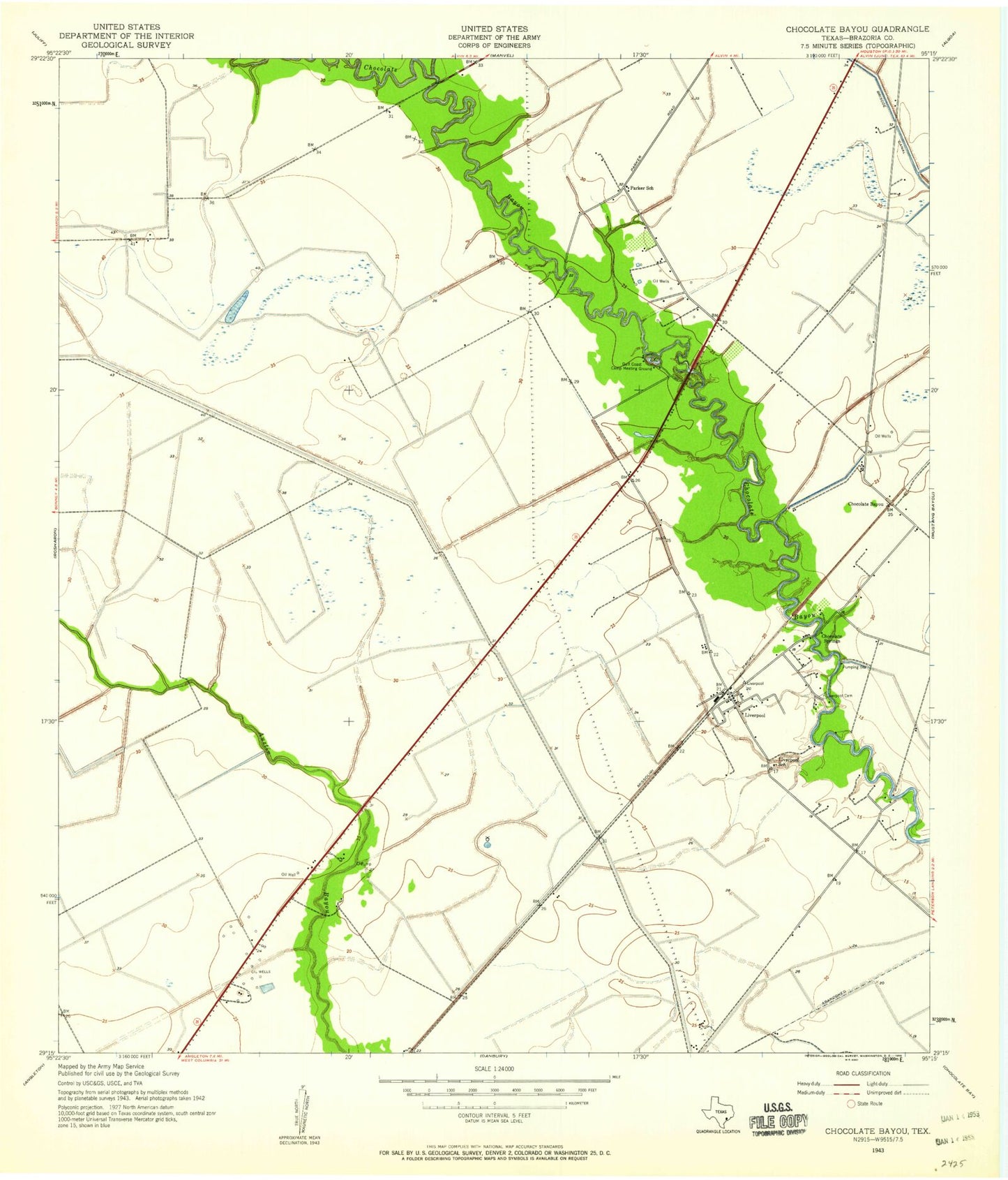
Classic USGS Liverpool Texas 7.5'x7.5' Topo Map
Couldn't load pickup availability
Historical USGS topographic quad map of Liverpool in the state of Texas. Map scale may vary for some years, but is generally around 1:24,000. Print size is approximately 24" x 27"
This quadrangle is in the following counties: Brazoria.
The map contains contour lines, roads, rivers, towns, and lakes. Printed on high-quality waterproof paper with UV fade-resistant inks, and shipped rolled.
Contains the following named places: Alvin-Pearland Division, Bell Lateral, Camp Mohawk, Chocolate Bayou, Chocolate Springs, City of Liverpool, Corner Bayou, Dingle Lake Number 1, Dingle Lake Number 1 Levee, Dingle Lake Number 2, Dingle Lake Number 2 Levee, Garrett Dam, Garrett Farms Airport, Garrett Lake, Garrett Lakes, Garrett Ranch Airport, J-D Ranch Airport, Liverpool, Liverpool Cemetery, Liverpool Police Department, Liverpool Post Office, Liverpool Volunteer Fire Department, Minard Pegasus Airport, Pearland Branch Library, Rowan Oil Field, Songbird Ranch Airport, South Texas Water Company Canal, Toy Airpark, ZIP Code: 77577