
MyTopo
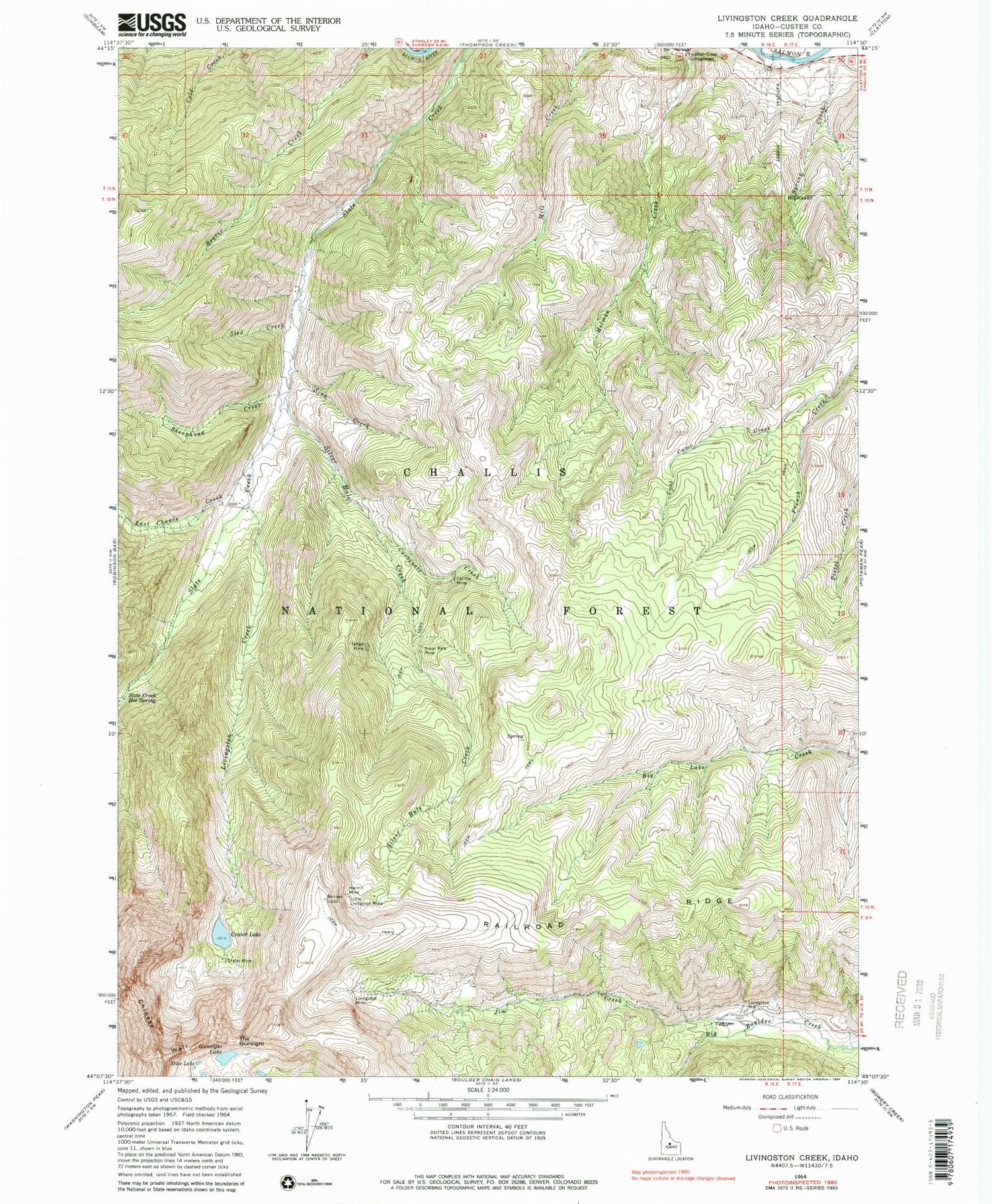
Classic USGS Livingston Creek Idaho 7.5'x7.5' Topo Map
Couldn't load pickup availability
Historical USGS topographic quad map of Livingston Creek in the state of Idaho. Map scale may vary for some years, but is generally around 1:24,000. Print size is approximately 24" x 27"
This quadrangle is in the following counties: Custer.
The map contains contour lines, roads, rivers, towns, and lakes. Printed on high-quality waterproof paper with UV fade-resistant inks, and shipped rolled.
Contains the following named places: Cal-Ida Mine, Carbonate Creek, Chinese Wall, Coal Camp Fork, Crater Lake, Crater Mine, Dike Lake, Gunsight Lake, Hermit Mine, Holman Creek, Holman Creek Campground, Hoodoo Mine Number One Dam, Jim Creek, Last Chance Creek, Little Livingston Mine, Livingston Creek, Livingston Mill, Livingston Mine, Railroad Ridge, Sheephead Creek, Silver Rule Creek, Silver Rute Mine, Sink Creek, Sled Creek, Spring Creek, Tango Mine, The Gunsight, Thompson Creek, ZIP Code: 83227


