MyTopo
Classic USGS Livingston Alabama 7.5'x7.5' Topo Map
Couldn't load pickup availability
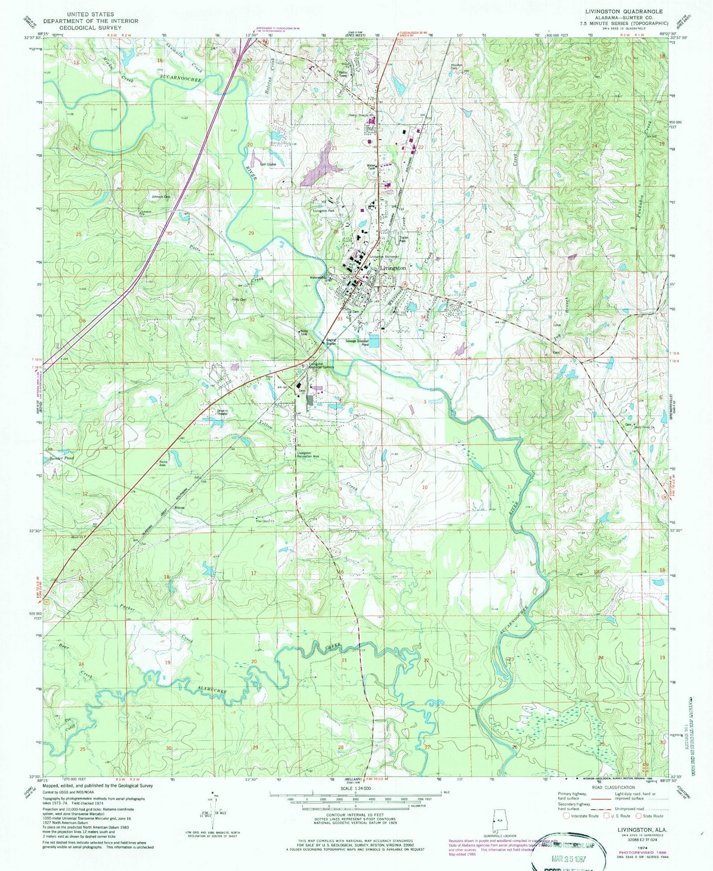
Historical USGS topographic quad map of Livingston in the state of Alabama. Map scale may vary for some years, but is generally around 1:24,000. Print size is approximately 24" x 27"
This quadrangle is in the following counties: Sumter.
The map contains contour lines, roads, rivers, towns, and lakes. Printed on high-quality waterproof paper with UV fade-resistant inks, and shipped rolled.
Contains the following named places: Baldwin Hill, Bear Creek, Bibb Graves Hall, Brock Hall, Brown Brick Creek, Cedar Creek, Central Sumter Division, City of Livingston, Ennis Tartt Dam, Ennis Tartt Pond, First Baptist Church, First Presbyterian Church, Foust Hall, Friend Church, Hannah Branch, Hixon, Hixon Church, Holetah Creek, Homer Fieldhouse, Houston Cemetery, Johnson Baptist Church, Johnson Cemetery, Jug Branch, Lake L U, Lake L U Dam, Livingston, Livingston Fire and Rescue, Livingston High School, Livingston Memorial Gardens, Livingston Park, Livingston Police Department, Livingston Post Office, Livingston Recreation Area, Miuka Creek, Moon Hall, Morning Star Second Baptist Church, Parker Creek, Pine Grove Baptist Church, Pine Grove School, Potts Cemetery, Potts Creek, Pruitt Hall, Reed Hall, Sandy Creek, Seldon Hall, Shady Grove Baptist Church, Shady Grove School, Shiloh Church, Shumulla Creek, Sisk Hall, Speith Hall, Stickney Hall, Sumter, Sumter County, Sumter County Area Vocational School, Sumter County Courthouse, Sumter County Sheriff's Office, Sumter County Training School, Sumter Pond, Sumter Riding Club, Sumter State Park, Tartt Field, The Cutoff, Tiger Stadium, Tutwiler Library, University of West Alabama, Wallace Hall, Webb Hall, Whiterock Creek, Yellow Creek, Young Hall