MyTopo
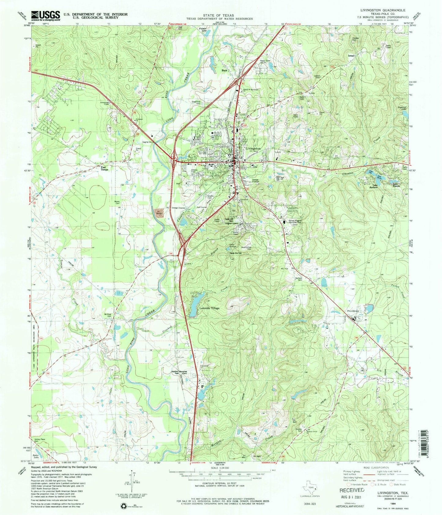
Classic USGS Livingston Texas 7.5'x7.5' Topo Map
Couldn't load pickup availability
Historical USGS topographic quad map of Livingston in the state of Texas. Map scale may vary for some years, but is generally around 1:24,000. Print size is approximately 24" x 27"
This quadrangle is in the following counties: Polk.
The map contains contour lines, roads, rivers, towns, and lakes. Printed on high-quality waterproof paper with UV fade-resistant inks, and shipped rolled.
Contains the following named places: Camp Cho Yen, Camp Cho-Yeh, CHI Saint Luke's Health - Memorial Livingston, Choates Creek, Churton Corporation Dam, Crooked Creek, East Tempe, East Tempe Church, Forest Hill Cemetery, Henderson Lake, Henderson Lake Dam, Israel, KETX-AM (Livingston), KETX-FM (Livingston), Lake Jobe, Lake Jobe Dam, Lake Thunderbird, Lake Thunderbird Dam, Lakeside Village Estates Lake, Lakeside Village Estates Lake Dam, Lamont, Lima Branch, Livingston, Livingston City Hall, Livingston City Park, Livingston Elementary School, Livingston Intermediate School, Livingston Junior High School, Livingston Lookout, Livingston Police Department, Livingston Post Office, Livingston Volunteer Fire Department Station 1, Livingston Volunteer Fire Department Station 2, Livingston Volunteer Fire Department Station 3, Lone Star Emergency Medical Service, Morgan Creek, Mount Rose Church, Peebles Cemetery, Polk County Constable's Office Precinct 1, Polk County Constable's Office Precinct 4, Polk County Courthouse, Polk County Jail, Polk County Museum, Polk County Sheriff's Office, Providence, Restland Memorial Cemetery, Tempe Creek, Texas Forest Service Livingston Office, Town of Livingston