MyTopo
USGS Classic Lizard Head Peak Wyoming 7.5'x7.5' Topo Map
Couldn't load pickup availability
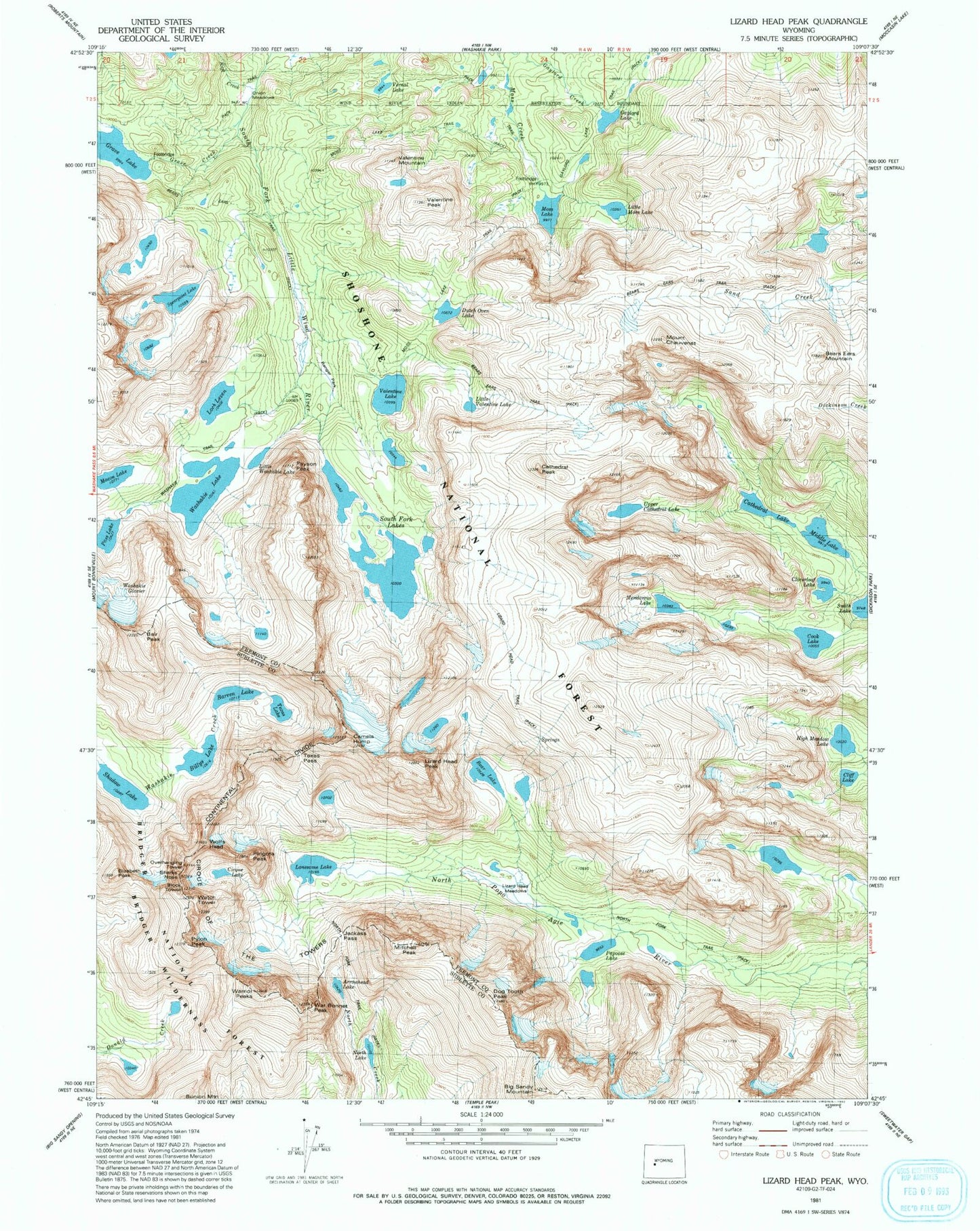
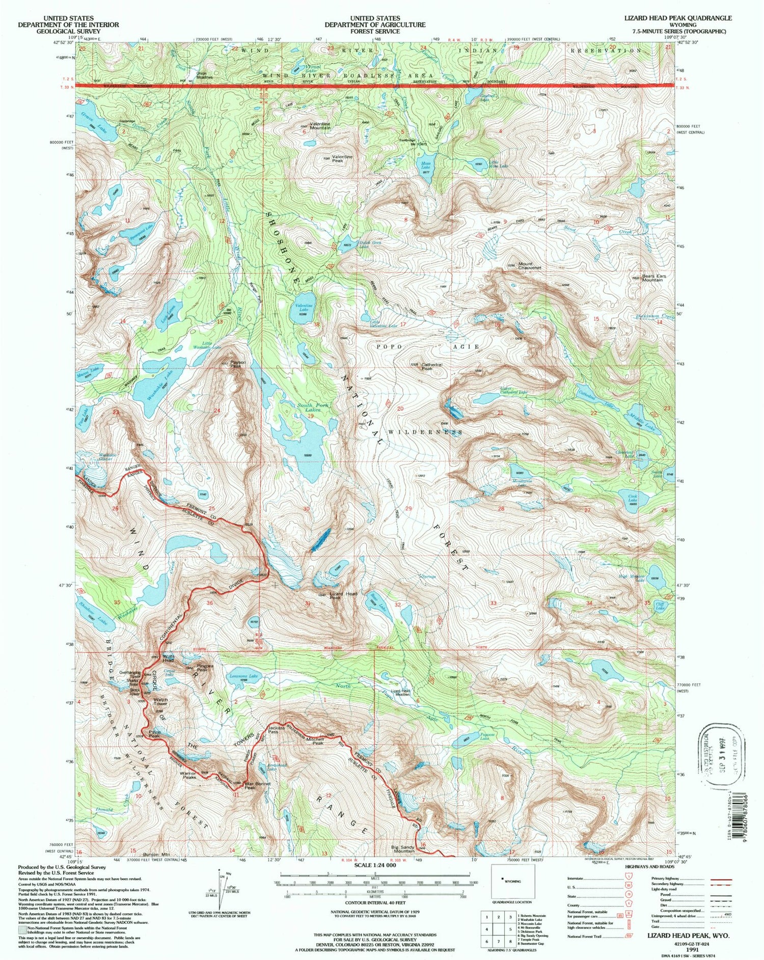
Historical USGS topographic quad map of Lizard Head Peak in the state of Wyoming. Scale: 1:24000. Print size: 24" x 27"
This quadrangle is in the following counties: Fremont, Sublette.
The map contains contour lines, roads, rivers, towns, lakes, and grids including latitude / longitude and UTM / MGRS. Printed on high-quality waterproof paper with UV fade-resistant inks.
Contains the following named places: Arrowhead Lake, Barren Lake, Bear Lake, Bears Ears Mountain, Big Sandy Mountain, Billys Lake, Block Tower, Camels Hump, Cathedral Lake, Cathedral Peak, Mount Chauvenet, Cirque Lake, Cirque of the Towers, Cliff Lake, Cloverleaf Lake, Cook Lake, Dutch Oven Lake, Elizabeth Peak, Gaylord Lake, Grave Creek, High Meadow Lake, Jackass Pass, Little Moss Lake, Little Valentine Lake, Lizard Head Meadows, Lizard Head Peak, Lizard Head Trail, Loch Leven, Lonesome Lake, Macon Lake, Middle Lake, Mitchell Peak, Moss Lake, North Lake, Onion Meadows, Overhanging Tower, Pass Lake, Payson Peak, Pingora Peak, Pylon Peak, Raft Creek, Ranger Park, Shadow Lake, Sharks Nose, South Fork Lakes, Spearpoint Lake, Texas Lake, Texas Pass, Upper Cathedral Lake, Valentine Lake, Valentine Mountain, Vernal Lake, War Bonnet Peak, Warrior Peaks, Washakie Glacier, Washakie Lake, Washakie Trail, Watch Tower, Wolfs Head, Papoose Lake, Dog Tooth Peak, Little Washakie Lake, Valentine Peak, Mendarrin Lake, Gaylord Lake Trail, Moss Lake Trail, Bair Peak