MyTopo
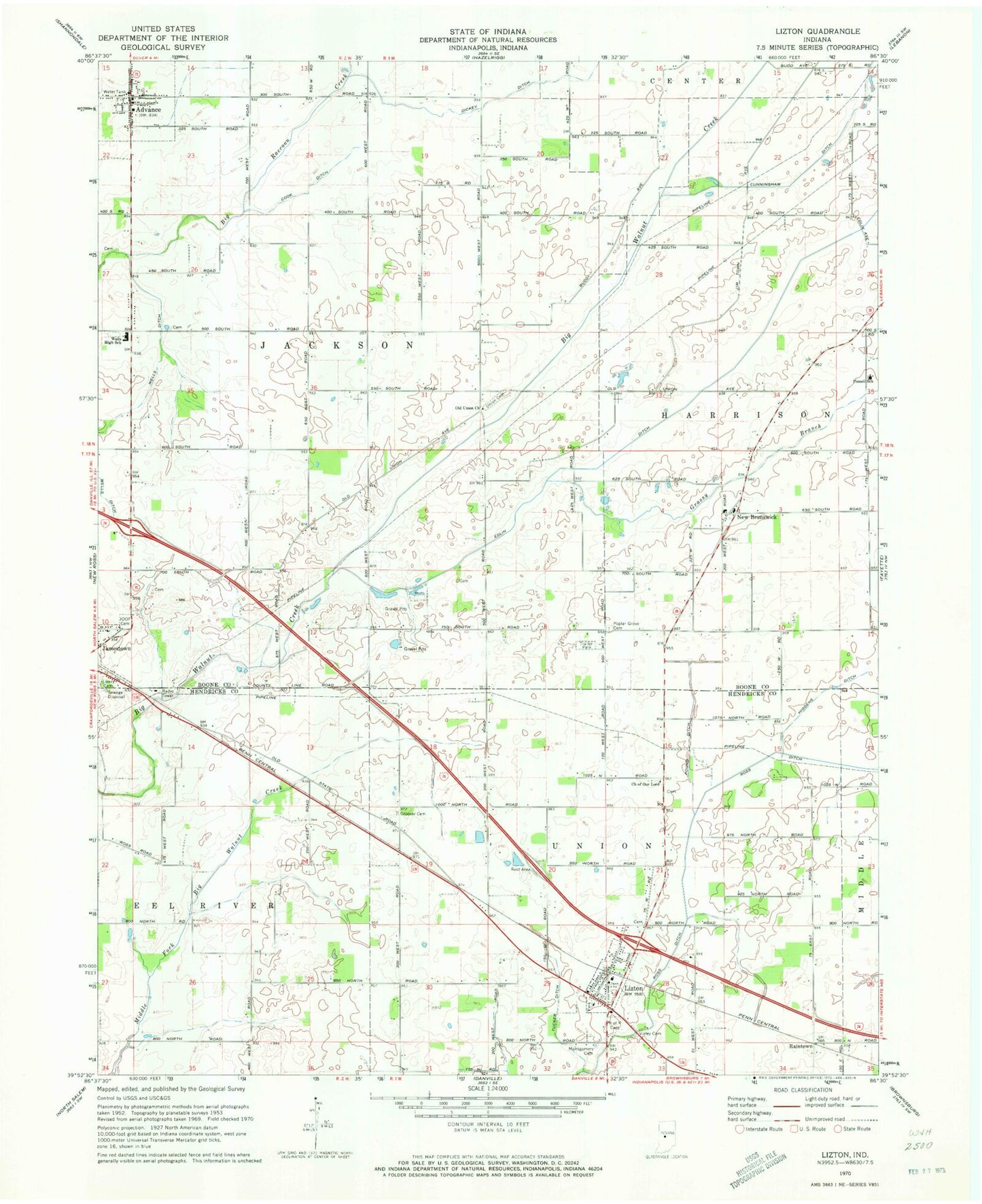
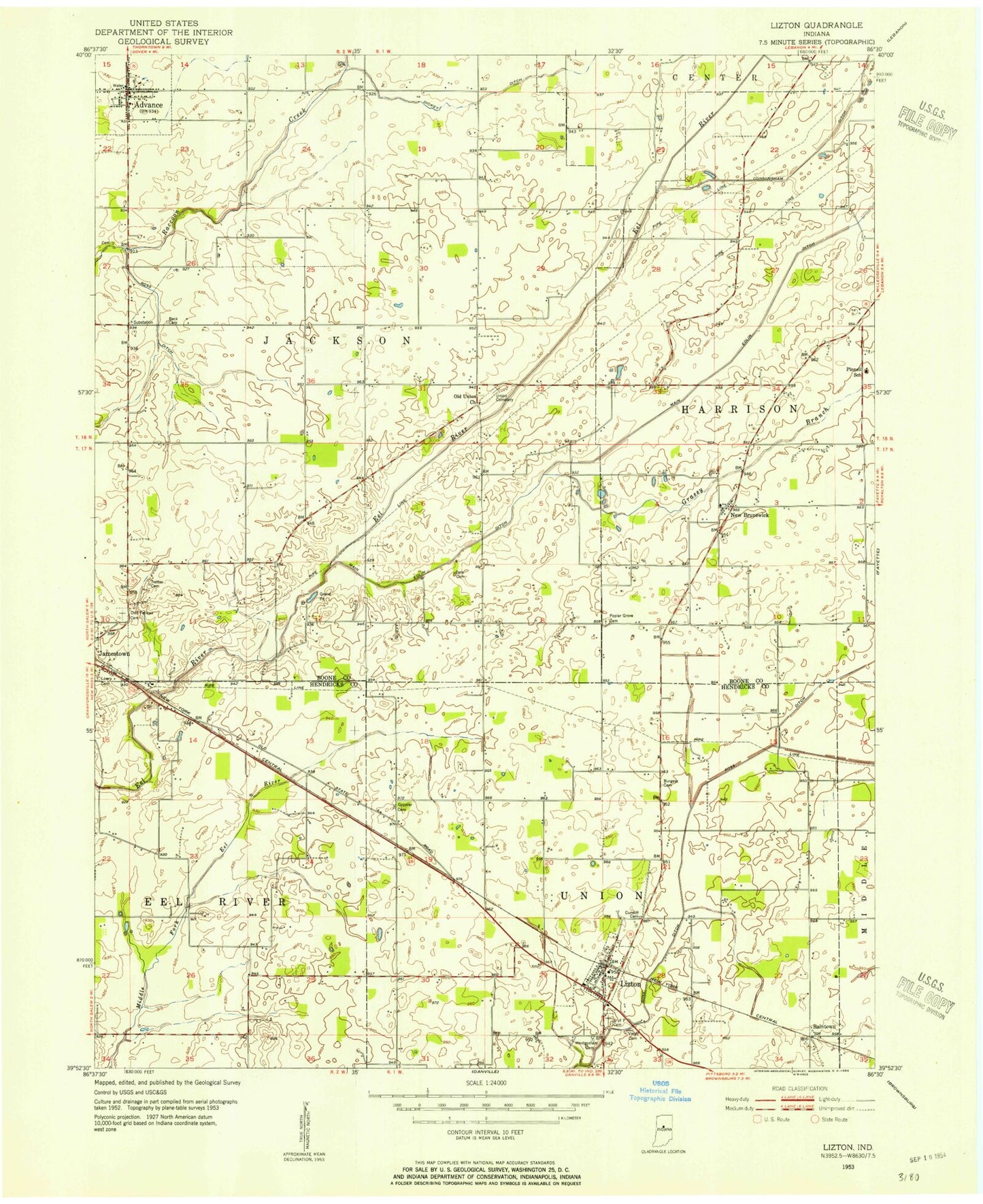
Classic USGS Lizton Indiana 7.5'x7.5' Topo Map
Couldn't load pickup availability
Historical USGS topographic quad map of Lizton in the state of Indiana. Map scale may vary for some years, but is generally around 1:24,000. Print size is approximately 24" x 27"
This quadrangle is in the following counties: Boone, Hendricks.
The map contains contour lines, roads, rivers, towns, and lakes. Printed on high-quality waterproof paper with UV fade-resistant inks, and shipped rolled.
Contains the following named places: Advance, Advance Police Department, Advance Post Office, Advance Volunteer Fire Department, Advance Volunteer Fire Department Station 51, Bergs Airport, Church of Our Lord, Cook Ditch, Cundiff Cemetery, Cunningham Ditch, Dickey Ditch, Edlin Ditch, Gossett Neff Cemetery, Grassy Branch, Griffith Cemetery, Groover Cemetery, Haffner Airport, Higgens Ditch, Hood Field, Jamestown Independent Order of Odd Fellows Cemetery, Keeny Ditch, Lizton, Lizton - Union Township Volunteer Fire Department, Lizton Knights of Pythias Cemetery, Lizton Post Office, Lowry Cemetery, Montgomery Cemetery, New Brunswick, Old Union Church, Pinnell School, Poplar Grove Cemetery, Pound Ditch, Raccoon Creek, Raintown, Reimer Aerodrome, Ross Ditch, South Fork Eel River, South Fork Prairie, Town of Advance, Town of Lizton, Township of Jackson, Township of Union, Tri-West High School, Tri-West Junior High School, Tucker Ditch, Union Cemetery, Vieley Cemetery, Wells Ditch, Wells High School, ZIP Codes: 46147, 46149