MyTopo
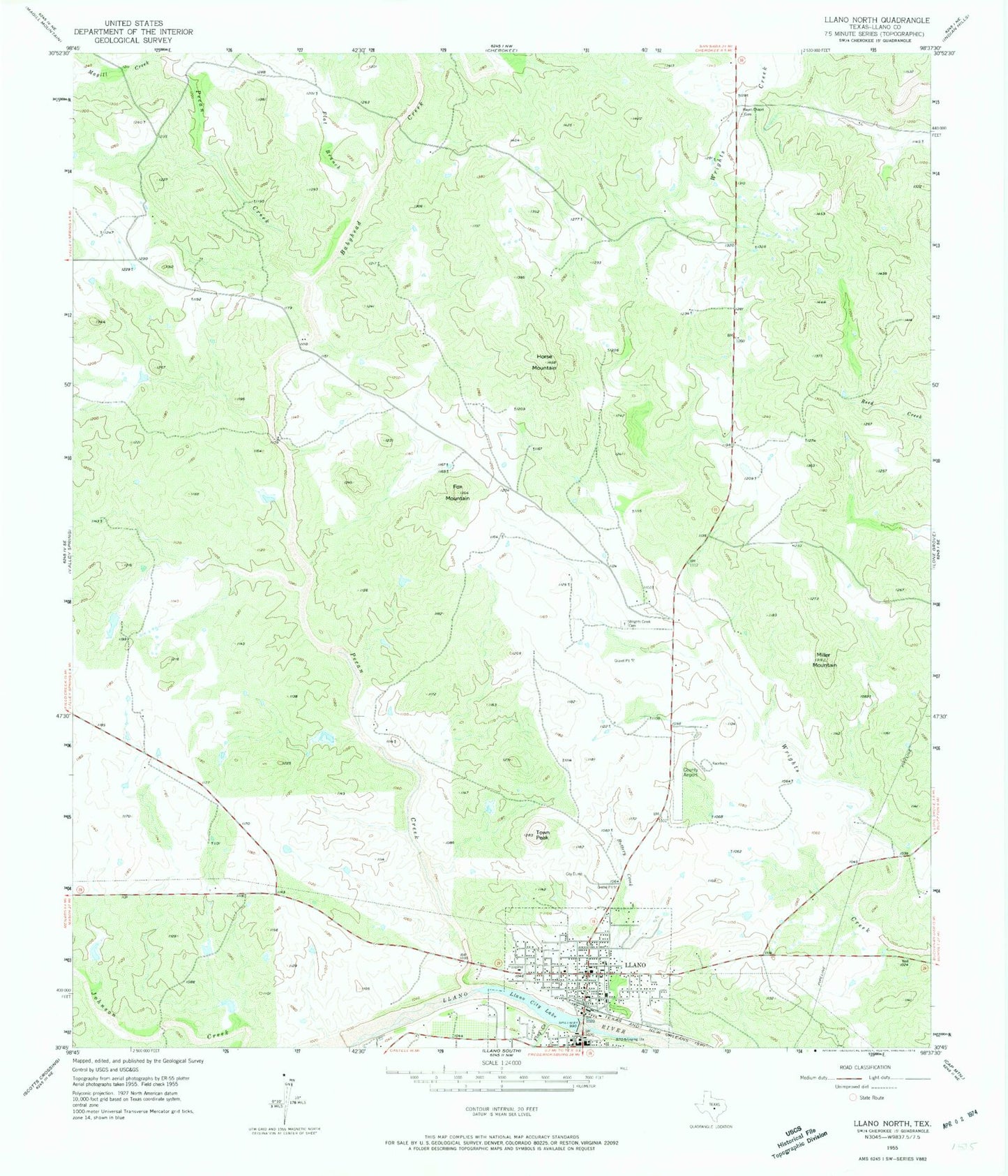
Classic USGS Llano North Texas 7.5'x7.5' Topo Map
Couldn't load pickup availability
Historical USGS topographic quad map of Llano North in the state of Texas. Typical map scale is 1:24,000, but may vary for certain years, if available. Print size: 24" x 27"
This quadrangle is in the following counties: Llano.
The map contains contour lines, roads, rivers, towns, and lakes. Printed on high-quality waterproof paper with UV fade-resistant inks, and shipped rolled.
Contains the following named places: Babyhead Creek, Buttery Creek, Flag Creek, Flat Branch, Fox Mountain, Horse Mountain, Llano, Llano City Lake, Magill Creek, Mayes Chapel Cemetery, Miller Mountain, Pecan Creek, Town Peak, Wrights Creek Cemetery, Llano Municipal Airport, Llano River Dam, Llano River Lake, Llano Park Dam, Llano Park Lake, Moss Dam 2, Moss Lake 2, Llano North Division, Hill Country Wildlife Museum, Llano County Museum, Holy Trinity Catholic Church, United Methodist Church, Llano County Courthouse, Badu Building, Llano County Courthouse Historic District, Southern Hotel, City of Llano, Llano Volunteer Fire Department Station 2, Llano Volunteer Fire Department Station 1, Lan - Tex Theater, Llano Police Department, Llano County Sheriff's Office, Llano County Constable's Office Precinct 4, Llano City Hall