MyTopo
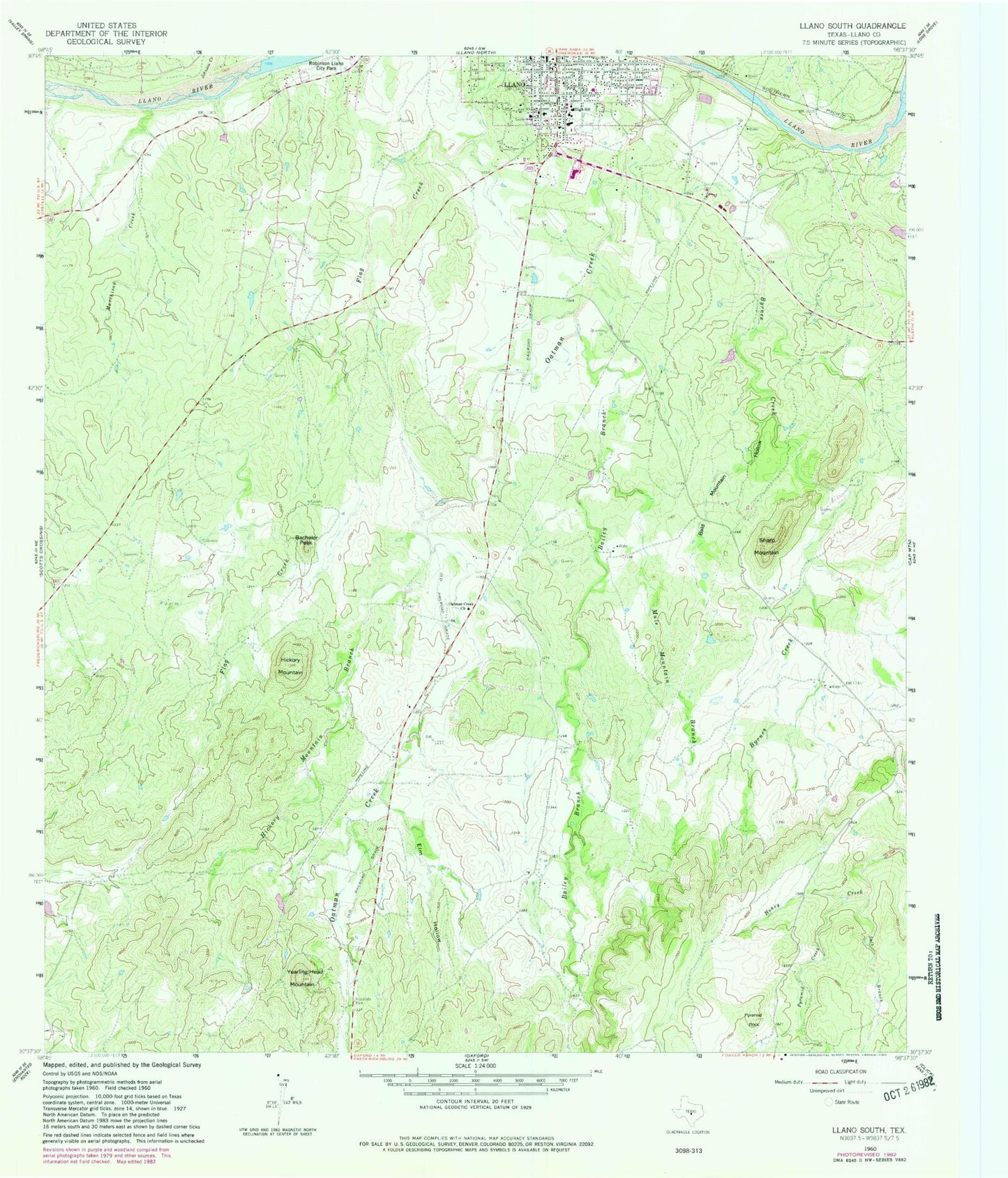
Classic USGS Llano South Texas 7.5'x7.5' Topo Map
Couldn't load pickup availability
Historical USGS topographic quad map of Llano South in the state of Texas. Map scale may vary for some years, but is generally around 1:24,000. Print size is approximately 24" x 27"
This quadrangle is in the following counties: Llano.
The map contains contour lines, roads, rivers, towns, and lakes. Printed on high-quality waterproof paper with UV fade-resistant inks, and shipped rolled.
Contains the following named places: Bachelor Peak, Bailey Branch, Bald Mountain Hollow, Baylor Scott and White Medical Center - Llano, Byrnes Creek, Clymer Cemetery, Elm Hollow, First Presbyterian Church, Flying D Airport, Grace Episcopal Church, Hickory Mountain, Hickory Mountain Branch, Hopf Field, Johnson Creek, Llano City Park, Llano County, Llano County Emergency Medical Service, Llano Elementary School, Llano High School, Llano Junior High School, Llano Post Office, Marchison Creek, Mule Mountain Branch, Oatman Creek, Oatman Creek Church, Pyramid Creek, Pyramid Rock, Saint James Lutheran Church, Salt Branch, Sharp Mountain, Yearling Head Mountain, ZIP Code: 78643