
MyTopo
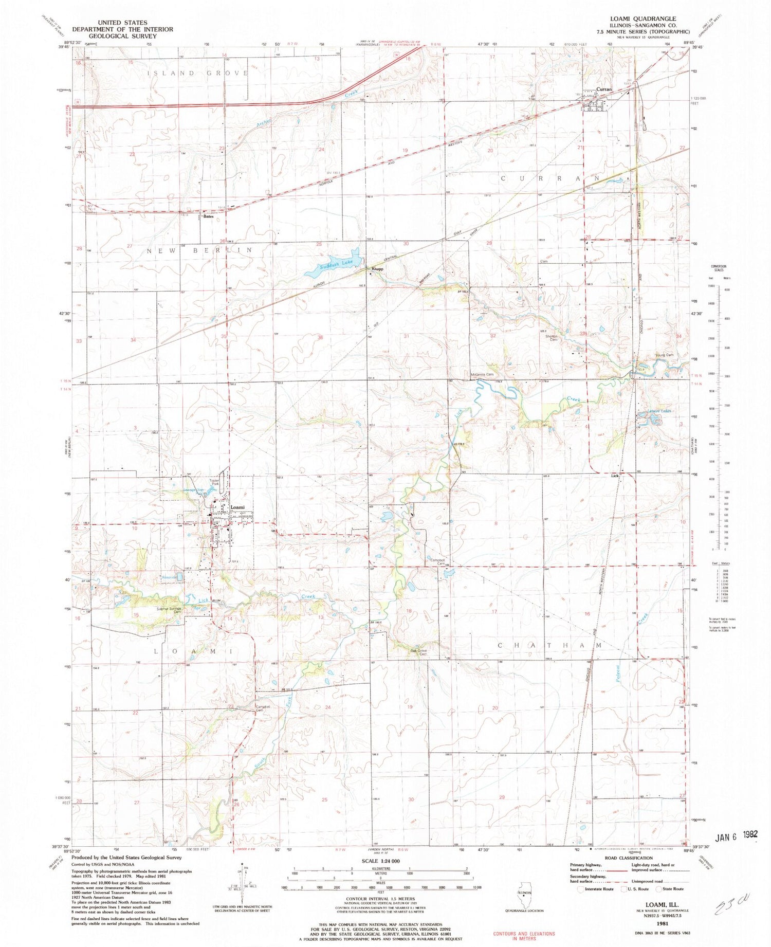
Classic USGS Loami Illinois 7.5'x7.5' Topo Map
Couldn't load pickup availability
Historical USGS topographic quad map of Loami in the state of Illinois. Map scale may vary for some years, but is generally around 1:24,000. Print size is approximately 24" x 27"
This quadrangle is in the following counties: Sangamon.
The map contains contour lines, roads, rivers, towns, and lakes. Printed on high-quality waterproof paper with UV fade-resistant inks, and shipped rolled.
Contains the following named places: Allen School, Bates, Campbell Cemetery, College Corner School, Curran, Fairplay School, Highwater Mark School, Hong Kong School, Johns Creek, Knapp, Lake Loami, Leisure Lakes, Loami, Loami Christian Church, Loami Elementary School, Loami Fire Department, Loami Post Office, Loami United Methodist Church, McGinnis Cemetery, Mound Grove School, Oak Grove Cemetery, Oak Grove School, Oak Ridge School, Patterson Cemetery, Patton School, Pleasant View School, Reyhan Heliport, Shelton Cemetery, South Fork Lick Creek, South Fork School, Springfield Southwest Airpark, Sudduth, Sudduth Lake, Sudduth Lake Dam, Sulphur Springs Cemetery, Township of Chatham, Township of Curran, Township of Loami, Village of Curran, Village of Loami, WNNS-FM (Springfield), Young Cemetery, ZIP Code: 62661


