MyTopo
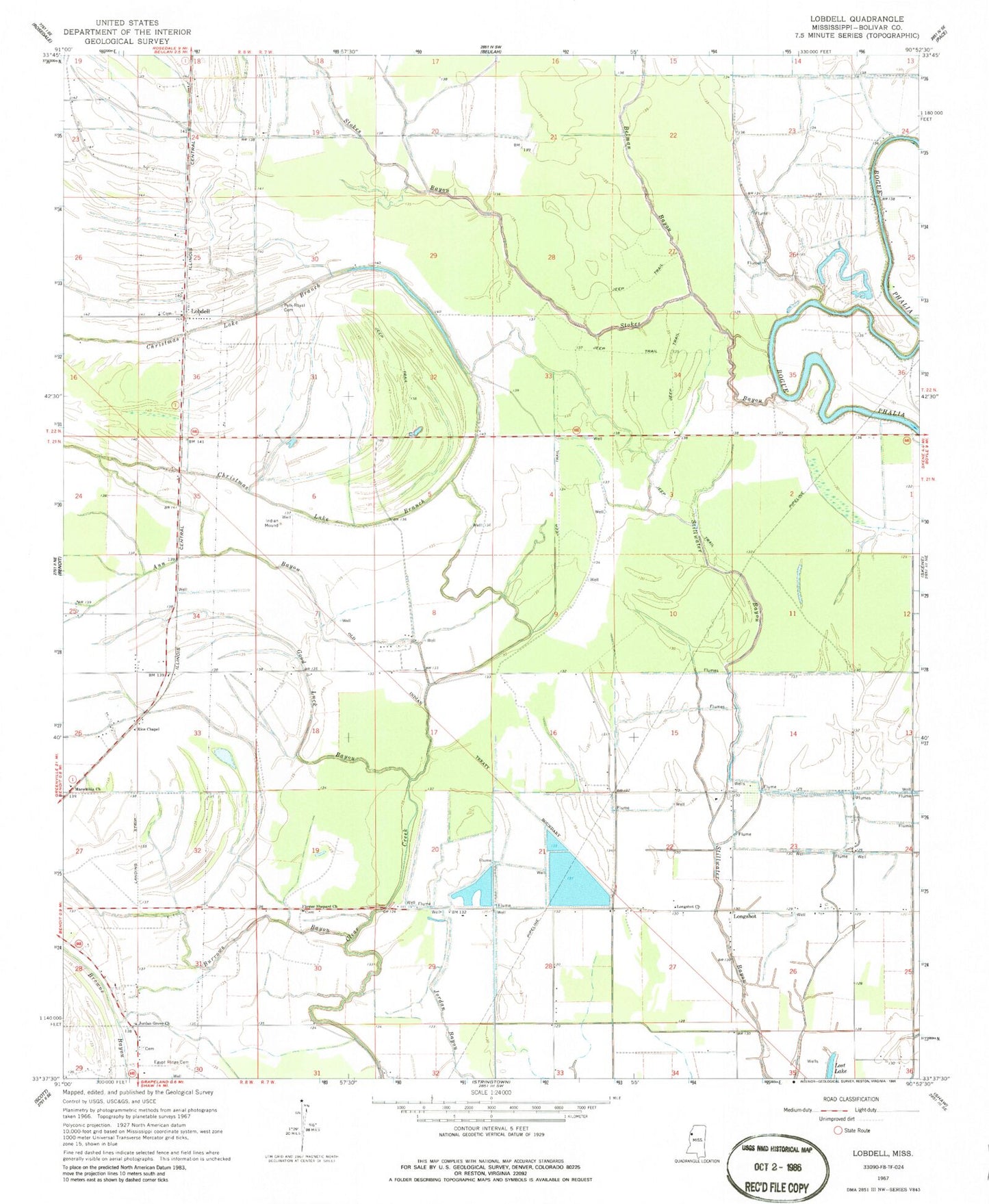
Classic USGS Lobdell Mississippi 7.5'x7.5' Topo Map
Couldn't load pickup availability
Historical USGS topographic quad map of Lobdell in the state of Mississippi. Map scale may vary for some years, but is generally around 1:24,000. Print size is approximately 24" x 27"
This quadrangle is in the following counties: Bolivar.
The map contains contour lines, roads, rivers, towns, and lakes. Printed on high-quality waterproof paper with UV fade-resistant inks, and shipped rolled.
Contains the following named places: Ann Bayou, Belman Bayou, Black Bayou, Burrus Bayou, Christmas Lake Branch, Dahomey National Wildlife Refuge, Dahomy, Ditch C, Ditch E, Ditch K, Ditch Number B-4, Ditch Number C-1, Ditch Number C-10, Ditch Number C-14, Ditch Number C-3, Ditch Number C-5, Ditch Number C-6, Ditch Number C-9, Ditch Number D-2, Ditch Number D-3, Ditch Number D-6, Ditch Number D-8, Ditch Number E-10, Ditch Number E-2, Ditch Number E-4, Ditch Number E-5, Ditch Number Eight, Ditch Number Six, Egypt Ridge Cemetery, Flower Shepard Church, Good Luck Bayou, Jordan Grove Church, Lobdell, Longshot, Longshot Church, Lost Lake, Macedonia Church, Mills Brothers Catfish Ponds Dam, Polk-Royal Cemetery, Rice Chapel, Stokes Bayou, West Bolivar Flying Service