MyTopo
Classic USGS Lobo Hill New Mexico 7.5'x7.5' Topo Map
Regular price
$16.95
Regular price
Sale price
$16.95
Unit price
per
Couldn't load pickup availability
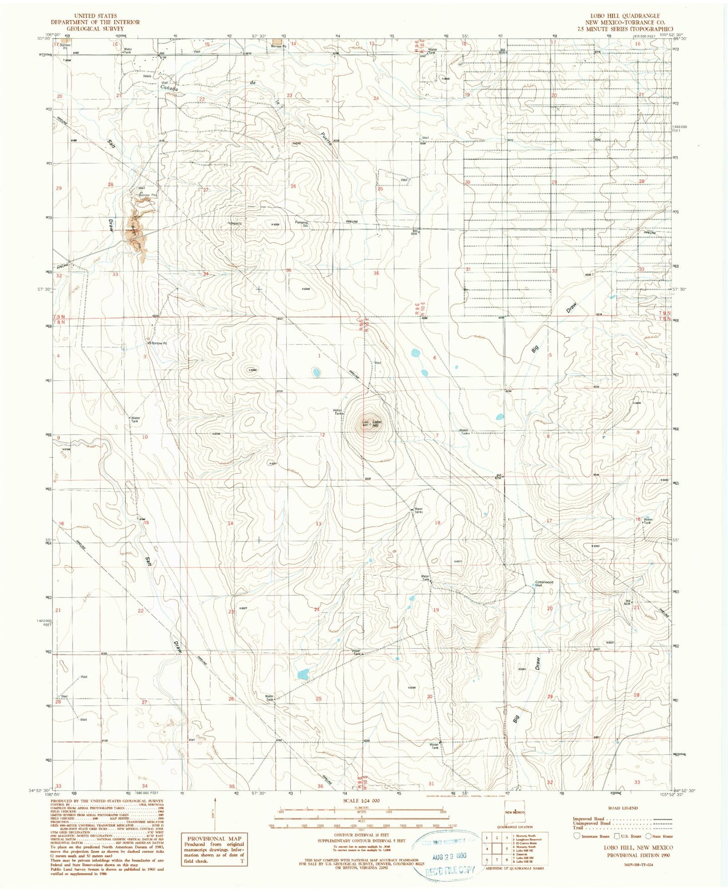
Historical USGS topographic quad map of Lobo Hill in the state of New Mexico. Map scale may vary for some years, but is generally around 1:24,000. Print size is approximately 24" x 27"
This quadrangle is in the following counties: Torrance.
The map contains contour lines, roads, rivers, towns, and lakes. Printed on high-quality waterproof paper with UV fade-resistant inks, and shipped rolled.
Contains the following named places: 10213 Water Well, 10214 Water Well, 87035, Big Draw, Canada de la Puerta, Chavez Draw, Cottonwood Well, D Williams Ranch, Davis Ranch, Estancia Ranchettes, L Williams Ranch, Lamb Homestead, Lobo Hill, Middle Well, Ranch Huntley, West Well