MyTopo
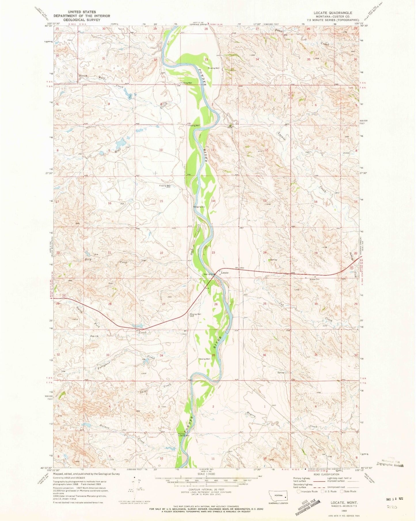
Classic USGS Locate Montana 7.5'x7.5' Topo Map
Couldn't load pickup availability
Historical USGS topographic quad map of Locate in the state of Montana. Map scale may vary for some years, but is generally around 1:24,000. Print size is approximately 24" x 27"
This quadrangle is in the following counties: Custer.
The map contains contour lines, roads, rivers, towns, and lakes. Printed on high-quality waterproof paper with UV fade-resistant inks, and shipped rolled.
Contains the following named places: 08N51E09ACAC01 Well, 08N51E10DDAA01 Well, 08N51E10DDAD01 Well, 08N51E14CBBD01 Well, 08N51E14DC__01 Well, 08N51E15ABDA01 Well, 08N51E22DD__01 Well, 08N51E23DD__01 Well, 08N51E25BACA01 Well, 08N51E26BBBA01 Well, 08N51E26CC__01 Well, 08N51E33CACB01 Well, 08N53E33AABA01 Well, Bixler Number 2 Dam, Bixler Number 5 Dam, Cox Creek, Deep Creek, Fortyfour Creek, Griffin Number 2 Dam, Holmes Creek, Holmes Flowing Well, Locate, Locate Creek, Locate Creek Bridge, Locate Post Office, Locate School, Meyers Creek, North Fork Smith Creek, North Wolf Creek, Odegard Number 2 Dam, Powder River Bridge, Powder River Historical Marker, Rabbidge Creek, Short Creek, Smith Creek, Wolf Creek