MyTopo
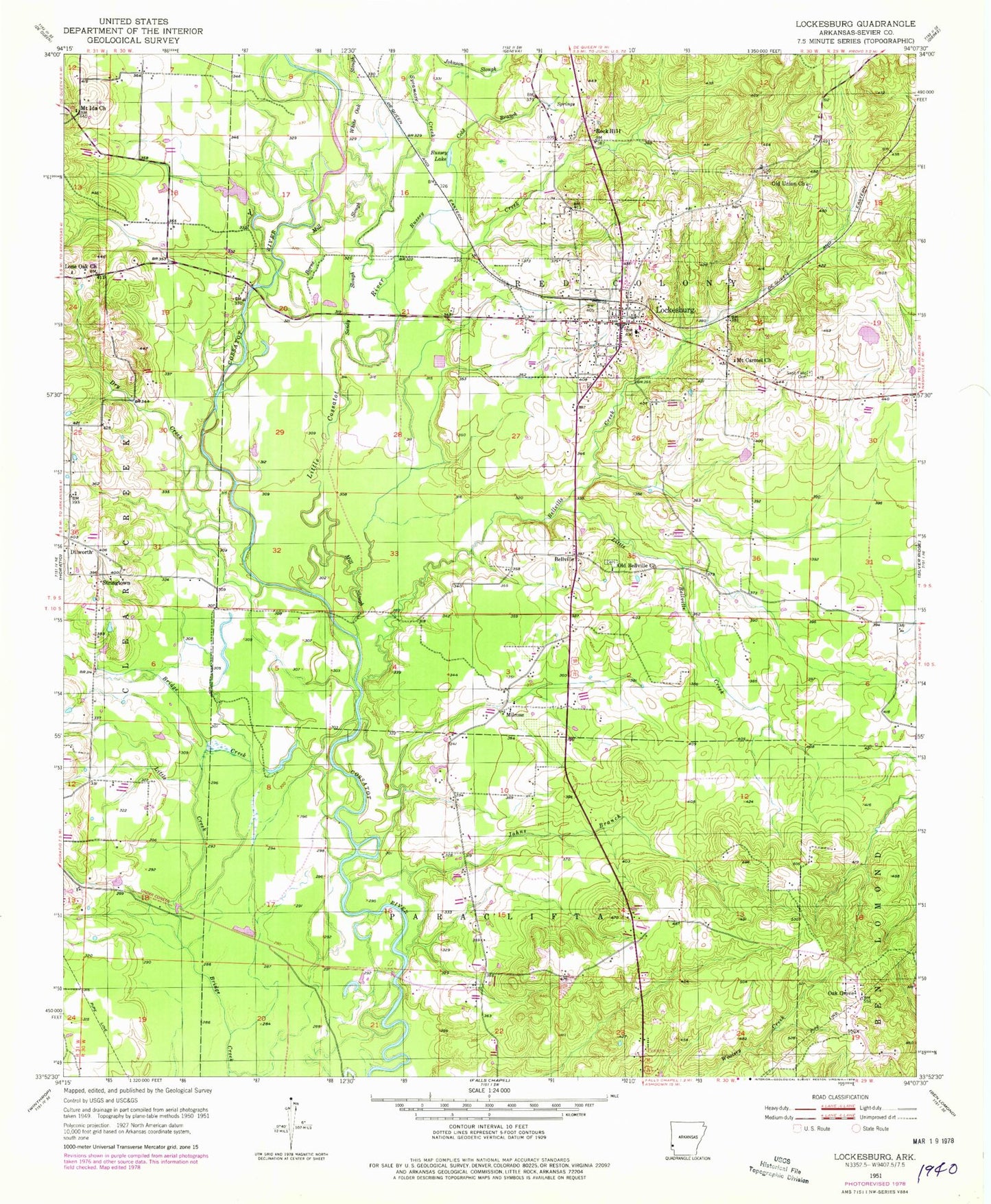
Classic USGS Lockesburg Arkansas 7.5'x7.5' Topo Map
Couldn't load pickup availability
Historical USGS topographic quad map of Lockesburg in the state of Arkansas. Map scale may vary for some years, but is generally around 1:24,000. Print size is approximately 24" x 27"
This quadrangle is in the following counties: Sevier.
The map contains contour lines, roads, rivers, towns, and lakes. Printed on high-quality waterproof paper with UV fade-resistant inks, and shipped rolled.
Contains the following named places: Bellville, Bellville Cemetery, Bellville Creek, Borne Mill Slough, City of Lockesburg, Cold Branch, Coulter Lake, Coulter Lake Dam, Dilworth, Dry Creek, Fraser Pond, Fraser Pond Dam, Johns Branch, Johnson Slough, Little Bellville Creek, Little Cossatot River, Little Creek, Lockesburg, Lockesburg Cemetery, Lockesburg Elementary School, Lockesburg Fire Department, Lockesburg High School, Lockesburg Post Office, Lone Oak Church, Melrose School, Mill Slough, Milrose, Mount Carmel Church, Mount Ida Church, Oak Grove, Oak Grove School, Old Bellville Church, Old Union Cemetery, Old Union Church, Pennys, Rock Hill, Russey Creek, Russey Lake, Sand Field Cemetery, Sandy Slough, Sevier County, Southwest Transport Service (Basic Life Support), Stringtown, Sycamore Creek, Tobin Lake, Tobin Lake Dam, United States Fish and Wildlife Pond Creek National Wildlife Refuge Park Security, White Oak Slough, ZIP Code: 71846