MyTopo
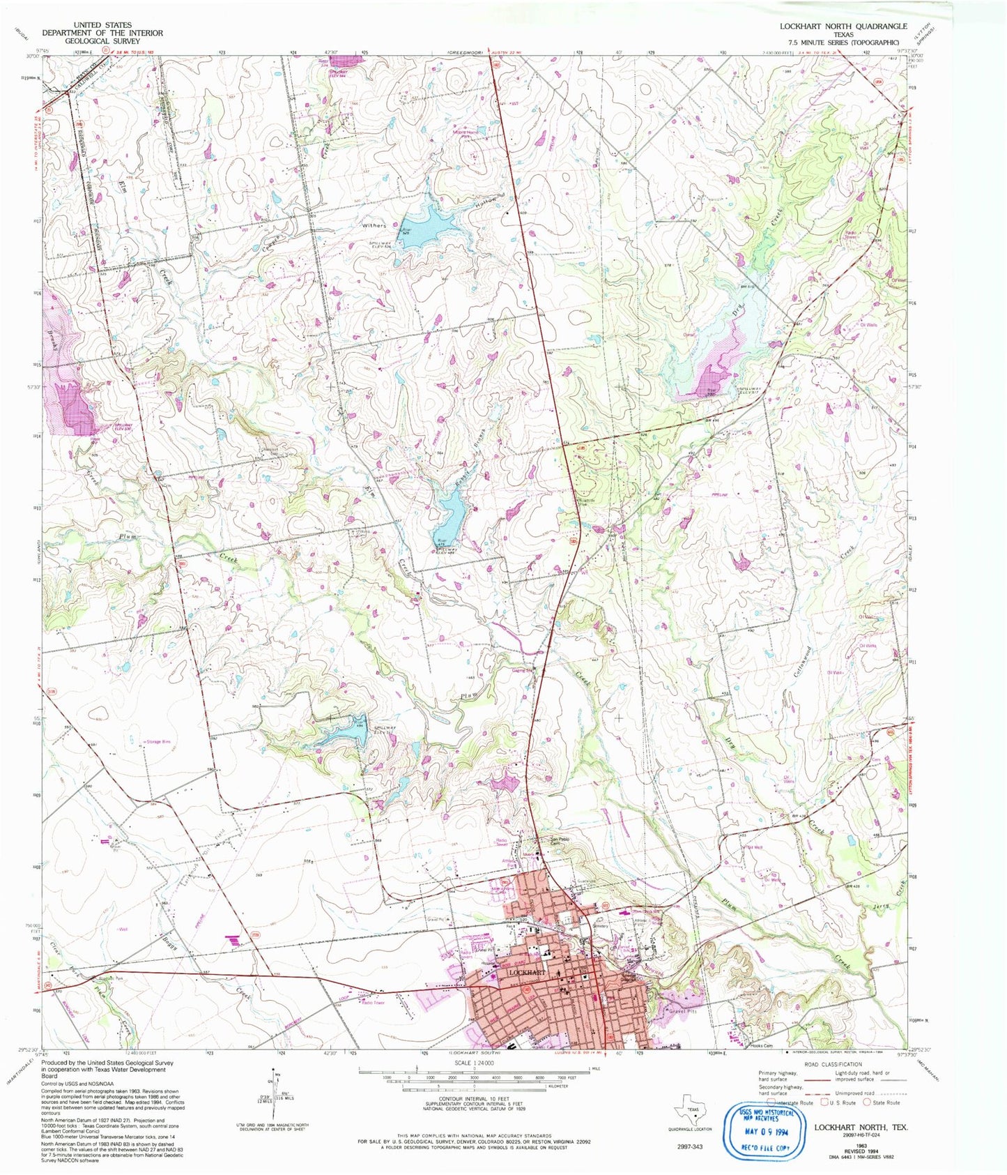
Classic USGS Lockhart North Texas 7.5'x7.5' Topo Map
Couldn't load pickup availability
Historical USGS topographic quad map of Lockhart North in the state of Texas. Map scale may vary for some years, but is generally around 1:24,000. Print size is approximately 24" x 27"
This quadrangle is in the following counties: Caldwell, Hays.
The map contains contour lines, roads, rivers, towns, and lakes. Printed on high-quality waterproof paper with UV fade-resistant inks, and shipped rolled.
Contains the following named places: American Indian Horse Museum, Barth Lake, Barth Lake Dam, Brazos Street Baptist Church, Brooks Place Airport, Brushy Creek, Caldwell County Constable's Office Precinct 1, Caldwell County Constable's Office Precinct 4, Caldwell County Courthouse Historic District, Caldwell County Jail, Caldwell County Museum, Caldwell County Sheriff's Office, Carver High School, Carver School, Center Union Missionary Church, Chisholm Trail Fire and Rescue Station 3, Church of Christ, City of Lockhart, Cottonwood Creek, Cowpen Creek, Dry Creek, Elm Creek, Emmanuel Episcopal Church, First Apostolic Church, First Presbyterian Church, Guadalupe Cemetery, Hooks Cemetery, Jerry Creek, KFIT-AM (Lockhart), Lockhart, Lockhart City Hall, Lockhart City Park, Lockhart Division, Lockhart Fire Rescue Department Station 1, Lockhart Junior High School, Lockhart Post Office, Lockhart Vocational High School, Mason Lone Oak Baptist Church, Ohlendorf Cemetery, Plum Creek Elementary School, Polonia Cemetery, Pride School, Rabbit Branch, Saint James African Methodist Episcopal Church, Saint Marks United Methodist Church, San Pablo Cemetery, Second Presbyterian Church, Segler Lake Dam, Site Number Eighteen, Site Number Fifteen, Site Number Twenty, Site Number Twentyone, Soil Conservation Service Site 14 Dam, Soil Conservation Service Site 14 Reservoir, Soil Conservation Service Site 15 Dam, Soil Conservation Service Site 15 Reservoir, Soil Conservation Service Site 18 Dam, Soil Conservation Service Site 18 Reservoir, Soil Conservation Service Site 20 Dam, Soil Conservation Service Site 21 Dam, State Highway 3-A Bridge, Town Branch, Trinity Baptist Church, Withers Hollow