MyTopo
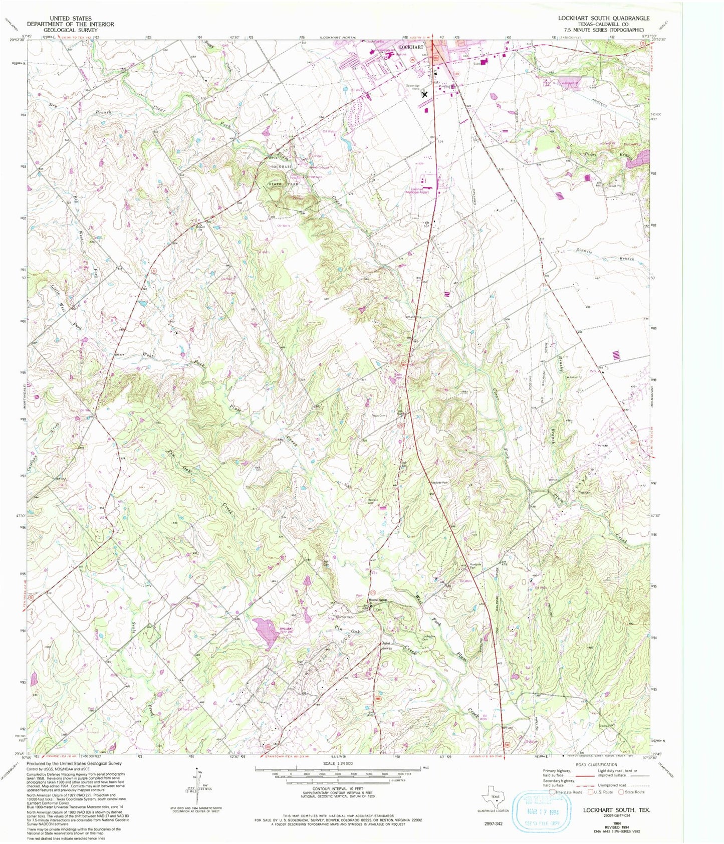
Classic USGS Lockhart South Texas 7.5'x7.5' Topo Map
Couldn't load pickup availability
Historical USGS topographic quad map of Lockhart South in the state of Texas. Map scale may vary for some years, but is generally around 1:24,000. Print size is approximately 24" x 27"
This quadrangle is in the following counties: Caldwell.
The map contains contour lines, roads, rivers, towns, and lakes. Printed on high-quality waterproof paper with UV fade-resistant inks, and shipped rolled.
Contains the following named places: Big West Fork Plum Creek, Boggy Creek, Brushy Branch, Caldwell County Medical Assist Team, City of Lockhart Emergency Medical Services, Dry Branch, Golden Age Home, Hall Family Cemetery, Harrison Cemetery, Joliet, Koonsen Cemetery, Little West Fork Plum Creek, Lockhart Fire / Rescue Station 2, Lockhart Municipal Airport, Lockhart Police Department, Lockhart State Park, Lockhart State Park Trail, Loehmann Cemetery, Luling Oil Field, M A Withers House, Mid - county Volunteer Fire Department, Mineral Springs, Mineral Springs Church, Pin Oak Creek, Popps Cemetery, Saint Johns United Baptist Church, Soil Conservation Service Site 23 Dam, Soil Conservation Service Site 23 Reservoir, Soil Conservation Service Site 37 Dam, Soil Conservation Service Site 37 Reservoir, Someday Ranch Airport, Teas Cemetery, Texas Department of Criminal Justice Lockhart Correctional Facility, Vogel Cemetery, ZIP Code: 78644