MyTopo
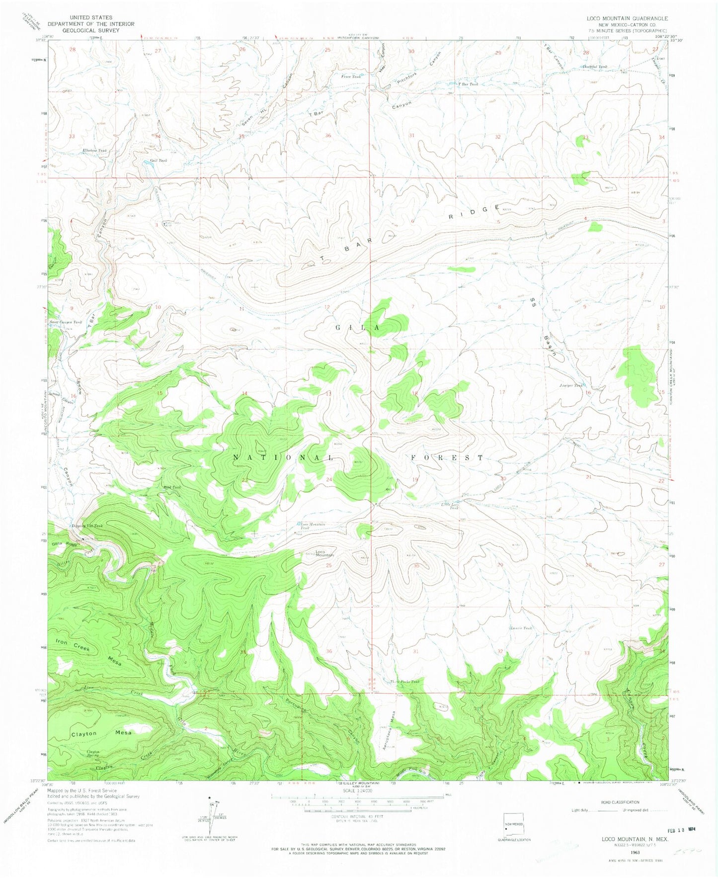
Classic USGS Loco Mountain New Mexico 7.5'x7.5' Topo Map
Couldn't load pickup availability
Historical USGS topographic quad map of Loco Mountain in the state of New Mexico. Typical map scale is 1:24,000, but may vary for certain years, if available. Print size: 24" x 27"
This quadrangle is in the following counties: Catron.
The map contains contour lines, roads, rivers, towns, and lakes. Printed on high-quality waterproof paper with UV fade-resistant inks, and shipped rolled.
Contains the following named places: Aeroplane Mesa, Clayton Creek, Clayton Mesa, Clayton Spring, Dipping Vat Tank, Doubtful Tank, Elladene Tank, Ewe Canyon, Fence Tank, Gail Tank, Gilita Creek, Hay Canyon, Iron Creek, Juniper Tank, Laurie Tank, Little Loco Tank, Loco Mountain, Loco Mountain Tank, Moonshine Canyon, Pitchfork Canyon, Porcupine Canyon, Quaking Aspen Creek, Reed Tank, S S Basin, School Canyon, Seven HL Canyon, Snow Canyon, T Bar Canyon, T Bar Ridge, T Bar Tank, Three Forks Tank, Fresno Tank, Snow Lake, Snow Lake Dam, Snow Lake, Kathy Tank