MyTopo
Classic USGS Locomotive Butte SW Montana 7.5'x7.5' Topo Map
Regular price
$16.95
Regular price
Sale price
$16.95
Unit price
per
Couldn't load pickup availability
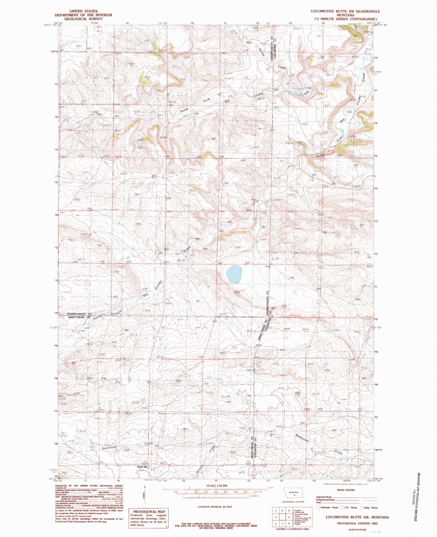
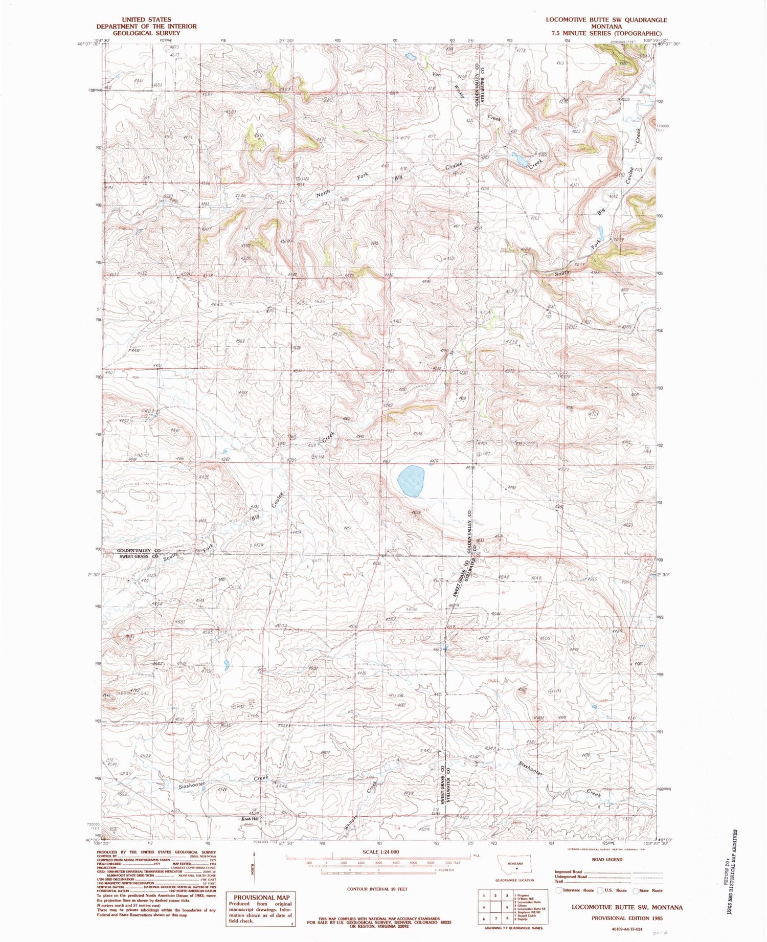
Historical USGS topographic quad map of Locomotive Butte SW in the state of Montana. Map scale may vary for some years, but is generally around 1:24,000. Print size is approximately 24" x 27"
This quadrangle is in the following counties: Golden Valley, Stillwater, Sweet Grass.
The map contains contour lines, roads, rivers, towns, and lakes. Printed on high-quality waterproof paper with UV fade-resistant inks, and shipped rolled.
Contains the following named places: 03N18E04____01 Well, 03N18E15ADCB01 Well, 03N19E07DA__01 Well, 03N19E17CD__01 Well, Knob Hill, North Fork Big Coulee Creek, South Fork Big Coulee Creek, Van Winkle Creek, Weppler Number 1 Dam, Weppler Number 2 Dam, Whitney Creek