MyTopo
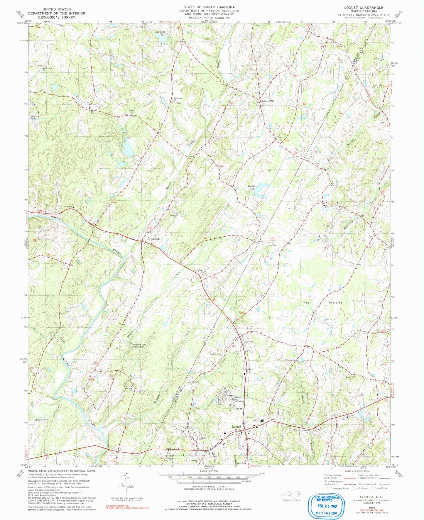
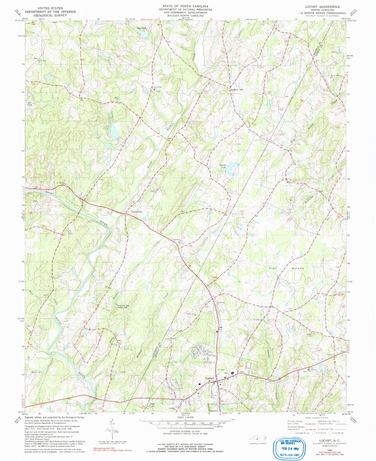
Classic USGS Locust North Carolina 7.5'x7.5' Topo Map
Couldn't load pickup availability
Historical USGS topographic quad map of Locust in the state of North Carolina. Typical map scale is 1:24,000, but may vary for certain years, if available. Print size: 24" x 27"
This quadrangle is in the following counties: Cabarrus, Stanly.
The map contains contour lines, roads, rivers, towns, and lakes. Printed on high-quality waterproof paper with UV fade-resistant inks, and shipped rolled.
Contains the following named places: Bethel Church, Bost Creek, Brown Hill Church, Center Grove Church, Dutch Buffalo Creek, Flat Woods, Friendship Church, Locust, Miami Church, Mission Church, Pine Bluff Church, Providence Church, Saint Martins Church, Saint Stephens Church, Pharrs Lake Dam, Pharrs Lake, Smiths Lake Dam, Furr Lake, Furr Lake Dam, Oak Cliff Lake Dam, Oak Cliff Lake, Carolina Church, Meadow Creek Church, Little Meadow Creek, Meadow Creek, Bosts Mill (historical), Furrs (historical), Garmons (historical), Locust School, Barriers Mill, Georgeville, Anderson Creek, Rocky Ridge Church, Reed Gold Mine (historical), Smiths Lake, Community Church, Herrins Grove Church, Oak Grove Church, Stephens Church, Oak Cliffs, Township 9-Georgeville, City of Locust, West Stanly Fire Department, Georgeville Volunteer Fire Department, Willow Creek Airport, Locust Police Department, Locust Post Office, Wolf Pit Airport, Reed Mine Airport