MyTopo
Classic USGS Lodge South Carolina 7.5'x7.5' Topo Map
Couldn't load pickup availability
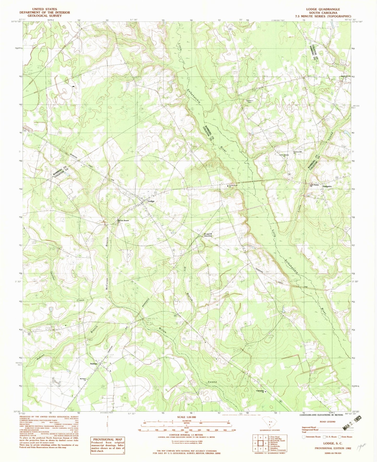
Historical USGS topographic quad map of Lodge in the state of South Carolina. Map scale may vary for some years, but is generally around 1:24,000. Print size is approximately 24" x 27"
This quadrangle is in the following counties: Bamberg, Colleton.
The map contains contour lines, roads, rivers, towns, and lakes. Printed on high-quality waterproof paper with UV fade-resistant inks, and shipped rolled.
Contains the following named places: Ashton, Ashton Branch, Ashton Cemetery, Ashton Church, Ashton School, Berea Advent Church, Bethany Cemetery, Bethany Church, Caldwell, Carter Ford Cemetery, Carter Ford Church, Colleton, Colleton Fire Department Station 23, Colleton Fire Department Station 3, Community Church, Copeland Drain, Dry Branch, Dryer School, Fender Creek, George School, Goodwin Cemetery, H and B Junction, Hagan Cemetery, Hickory Hill Church, Jones Cemetery, Little Swamp Baptist Church, Little Swamp Cemetery, Little Swamp Church, Little Swamp Fire Department Station 7, Little Swamp School, Lodge, Lodge Cemetery, Lodge Lookout Tower, Lodge Methodist Church, Lodge Post Office, McCuren Branch, McCuren Branch Church, Mount Nebo Church, Oak Grove School, Padgetts, Rum Gully School, Smith Drain, Town of Lodge, ZIP Code: 29082