MyTopo
Classic USGS Lodi Arkansas 7.5'x7.5' Topo Map
Couldn't load pickup availability
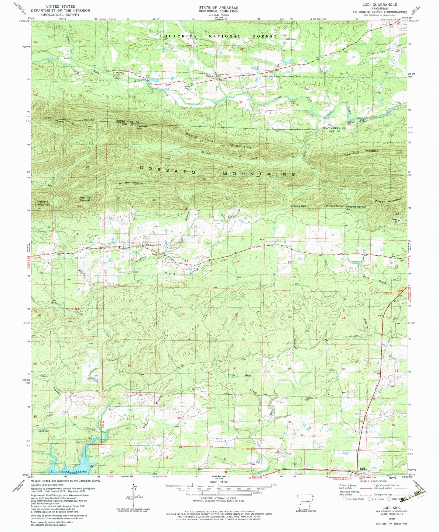
Historical USGS topographic quad map of Lodi in the state of Arkansas. Map scale may vary for some years, but is generally around 1:24,000. Print size is approximately 24" x 27"
This quadrangle is in the following counties: Montgomery, Pike.
The map contains contour lines, roads, rivers, towns, and lakes. Printed on high-quality waterproof paper with UV fade-resistant inks, and shipped rolled.
Contains the following named places: Beaver Creek, Brooks Gap, Brushy Mountain, Buck Mountain, Coffman Cemetery, Cooper, Cowlick Branch, Dripping Springs, Dripping Springs Gap, Dunlap, Forrester Branch, Free Will Baptist Church, High Top Mountain, Hopper, Hopper Cemetery, Hopper Church of Christ, Ikes Creek, Kirby, Kirby Census Designated Place, Little Bear Creek, Little Beaver Creek, Lodi, Lodi Missionary Baptist Church, Lodi School, Lodi Volunteer Fire Station, Mile Branch, Mill Creek, Palestine Cemetery, Palestine Church, Parks School, Reeves Branch, Self Creek, Shields Creek, South Fork Mountains, Township of Eagle, Tweedle Mountain, Wilson Mountain, Zebulon, ZIP Code: 71950