MyTopo
Classic USGS Lodi Mississippi 7.5'x7.5' Topo Map
Couldn't load pickup availability
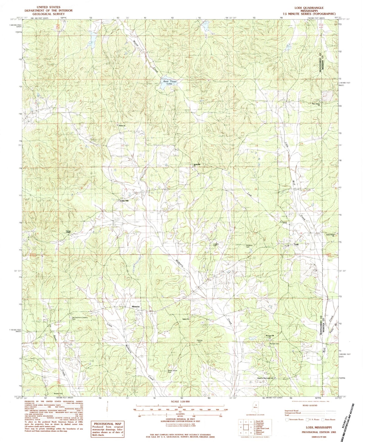
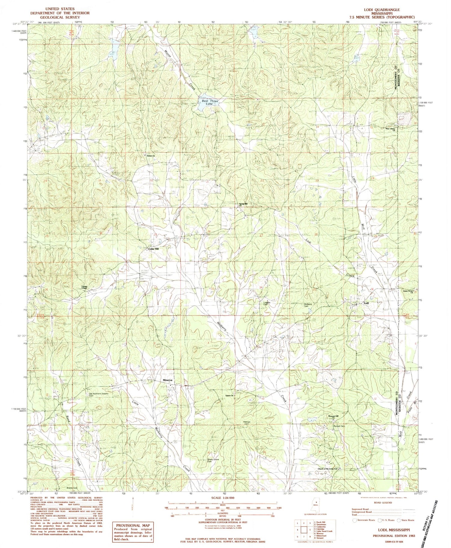
Historical USGS topographic quad map of Lodi in the state of Mississippi. Map scale may vary for some years, but is generally around 1:24,000. Print size is approximately 24" x 27"
This quadrangle is in the following counties: Montgomery, Webster.
The map contains contour lines, roads, rivers, towns, and lakes. Printed on high-quality waterproof paper with UV fade-resistant inks, and shipped rolled.
Contains the following named places: Beat Three Lake, Bogue Watershed Y-30-52 Dam, Bogue Watershed Y-30-89 Dam, Bogue Watershed Y-54-38 Dam, Bronte Cemetery, Campbells Branch, Cedar Hill, Choctawville, Church of the Living God, Dabney, Edwards School, Laura, Lodi, Lodi Creek, Loggins Cemetery, Minerva, Mulberry Baptist Church, Mulberry Cemetery, New Liberty Baptist Church, New Liberty Baptist Church Cemetery, Old Northern Grocery Cemetery, Patts Branch, Pittman Cemetery, Pleasant Hill Church, Purnell Cemetery, Salem Cemetery, Salem Church, Shady Grove Cemetery, Shady Grove Church, Shiloh Baptist Church, Shiloh Cemetery, Spring Hill Cemetery, Spring Hill Church, Spring Hill School, Sugar Hill, Supervisor District 3, Union Grove Missionary Baptist Church, Young School, Youngs Chapel