MyTopo
Classic USGS Lodi New York 7.5'x7.5' Topo Map
Couldn't load pickup availability
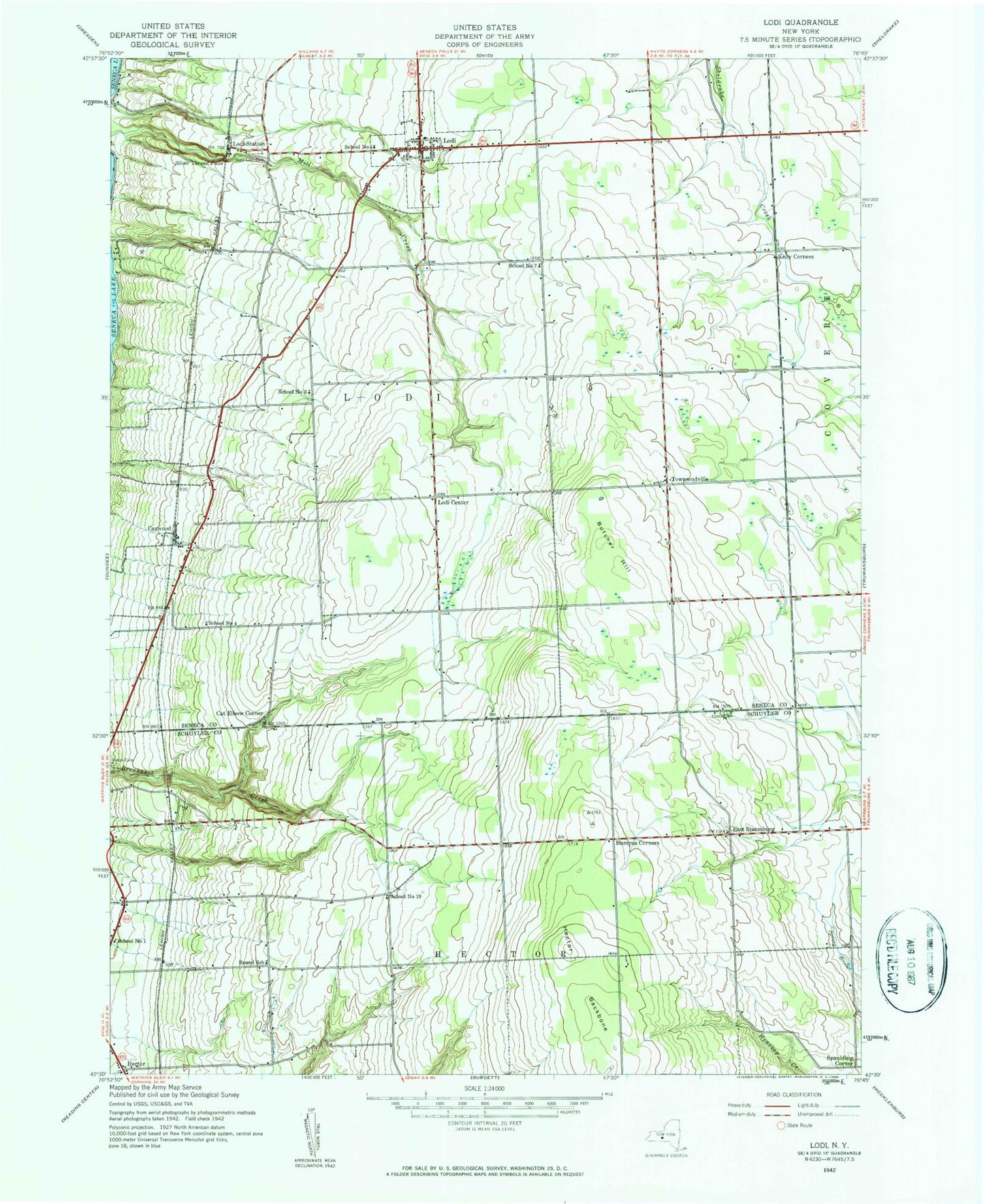
Historical USGS topographic quad map of Lodi in the state of New York. Typical map scale is 1:24,000, but may vary for certain years, if available. Print size: 24" x 27"
This quadrangle is in the following counties: Schuyler, Seneca.
The map contains contour lines, roads, rivers, towns, and lakes. Printed on high-quality waterproof paper with UV fade-resistant inks, and shipped rolled.
Contains the following named places: Lodi Landing, Bumpus Corners, Butcher Hill, Cat Elbow Corner, Caywood, Cronk Cemetery, East Steamburg, Hector, Hector Backbone, Kelly Corners, Lodi, Lodi Center, Lodi Station, Round School (historical), Silver Thread Falls, Spaulding Corner, Townsendville, West Lodi Cemetery, Interloken Trail, School Number 1 (historical), School Number 1 (historical), School Number 19 (historical), School Number 3 (historical), School Number 4 (historical), School Number 7 (historical), Town of Lodi, Finger Lakes National Forest, Green Mountain National Forest-Hector Ranger District, Village of Lodi, Hector Presbyterian Church, Townsendville Cemetery, Westwind Farms, Adventureland Farm, Alexander Farms, Wagner Farms, Wagner Vineyards, Gold Seal Vineyards, Shalestone Vineyards, Dalrymple Farms, Venture Vineyards, Lodi Whittier Library, Lodi Post Office