MyTopo
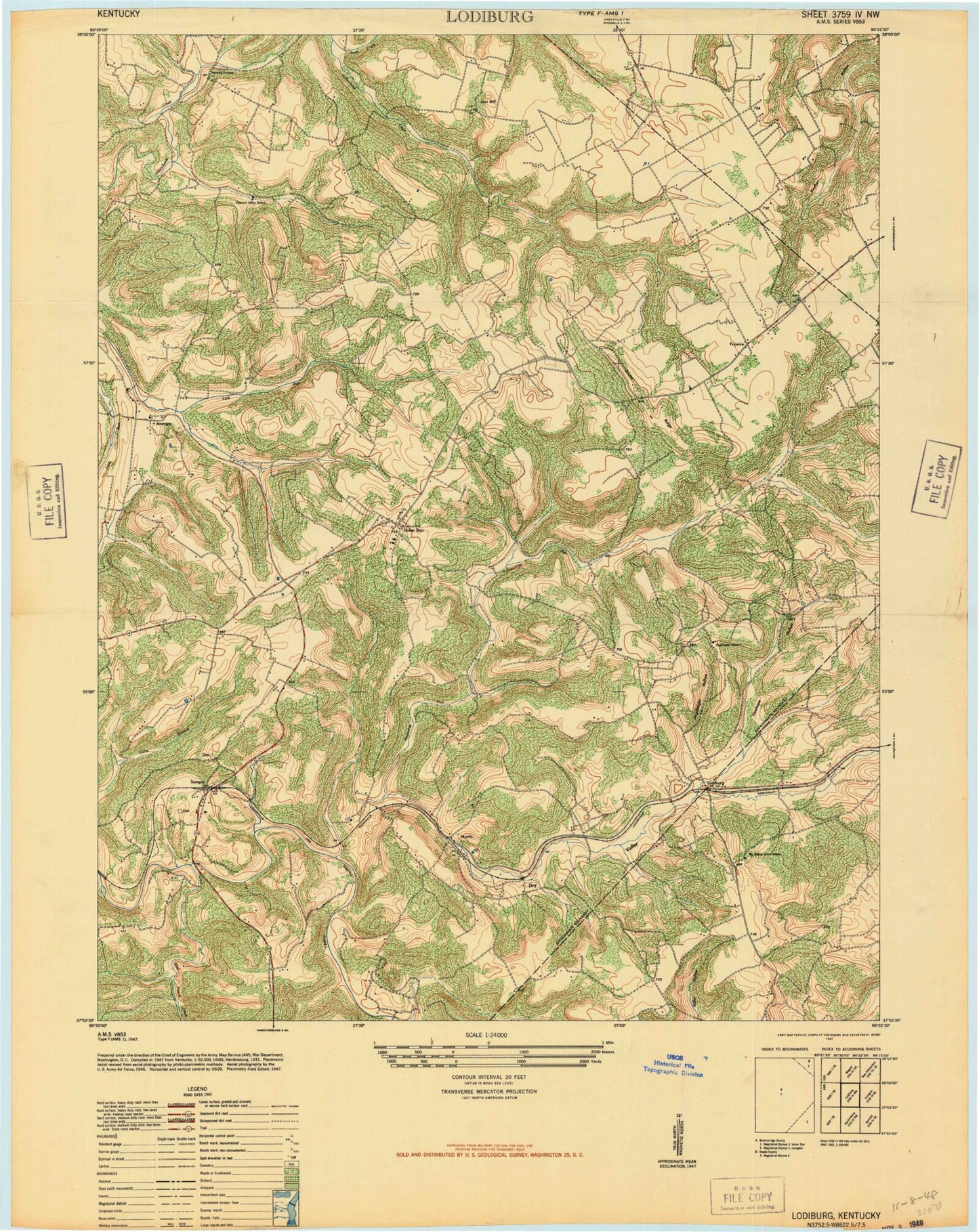
Classic USGS Lodiburg Kentucky 7.5'x7.5' Topo Map
Couldn't load pickup availability
Historical USGS topographic quad map of Lodiburg in the state of Kentucky. Map scale may vary for some years, but is generally around 1:24,000. Print size is approximately 24" x 27"
This quadrangle is in the following counties: Breckinridge, Meade.
The map contains contour lines, roads, rivers, towns, and lakes. Printed on high-quality waterproof paper with UV fade-resistant inks, and shipped rolled.
Contains the following named places: Ammons, Argabright Hollow, Bennett Ridge, Bruner Cemetery Number 3, Bruner Ridge, Buck Creek, Caney Fork, Dry Valley, Dry Valley Baptist Church, Flint Run, Frymire, Frymire School, Jolly Cemetery, Levi Hill, Lodiburg, Manning Crossing, Mystic, Newhope Hollow, Preston, Sample, Shelman Cemetery, Shot Pouch Creek, Sugar Tree Run, Union Star, Walnut Grove Church, ZIP Code: 40171