MyTopo
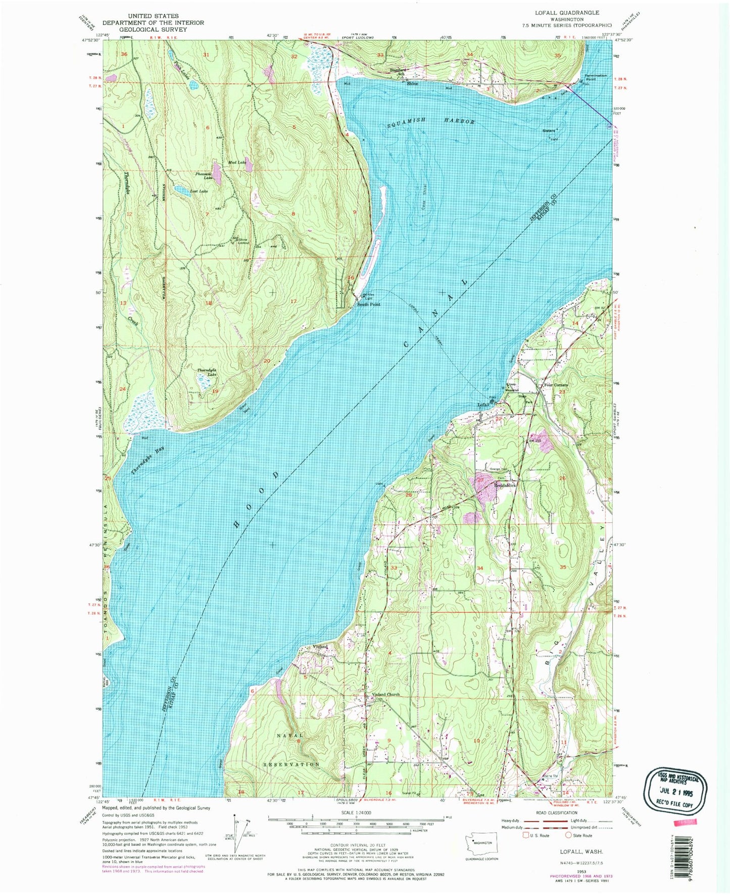
Classic USGS Lofall Washington 7.5'x7.5' Topo Map
Couldn't load pickup availability
Historical USGS topographic quad map of Lofall in the state of Washington. Map scale may vary for some years, but is generally around 1:24,000. Print size is approximately 24" x 27"
This quadrangle is in the following counties: Jefferson, Kitsap.
The map contains contour lines, roads, rivers, towns, and lakes. Printed on high-quality waterproof paper with UV fade-resistant inks, and shipped rolled.
Contains the following named places: Big Valley, Breidablick, Breidablik Baptist Church, Breidablik Cemetery, Breidablik Elementary School, Bridgehaven, Case Shoal, Cattail Lake, Cattail Lake Dam, Church of the Nazarene, Criss Creek, Four Corners, Jefferson County Fire Protection District 3 Port Ludlow Fire and Rescue Station 33, Jump Off Creek, Kitsap Fire District 18 Poulsbo Fire Department Station 72 Surfrest, Kitsap Fire District 18 Poulsbo Fire Department Station 77 - Pioneer Hill, Kitsap Memorial State Park, Lofall, Lofall Census Designated Place, Lofall Pit, Lost Lake, Mud Lake, Pheasant Lake, Pioneer Pit, Poulsbo Division, Poulsbo Elementary School, Rock Island, Saint Elizabeth Orthodox Mission, Settle Pit, Shine, Shine Lookout, Shine Quarry, Shine-Gri-La, Sisters, South Point, Squamish Harbor, Standard School, Termination Point, Thorndyke Bay, Thorndyke Creek, Thorndyke Lake, True Vine Pentecostal Church, Tule Lake, Twin Lakes, Vinland, Vinland Church, Vinland Elementary School, Vinland Lutheran Church Cemetery, Wahl Lake, West Sound Community Church, ZIP Code: 98370