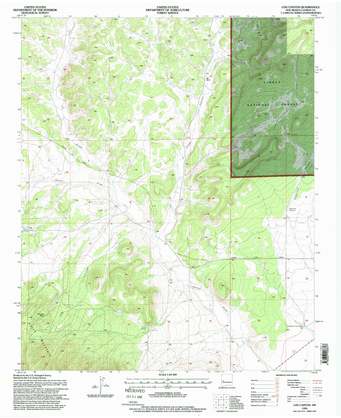
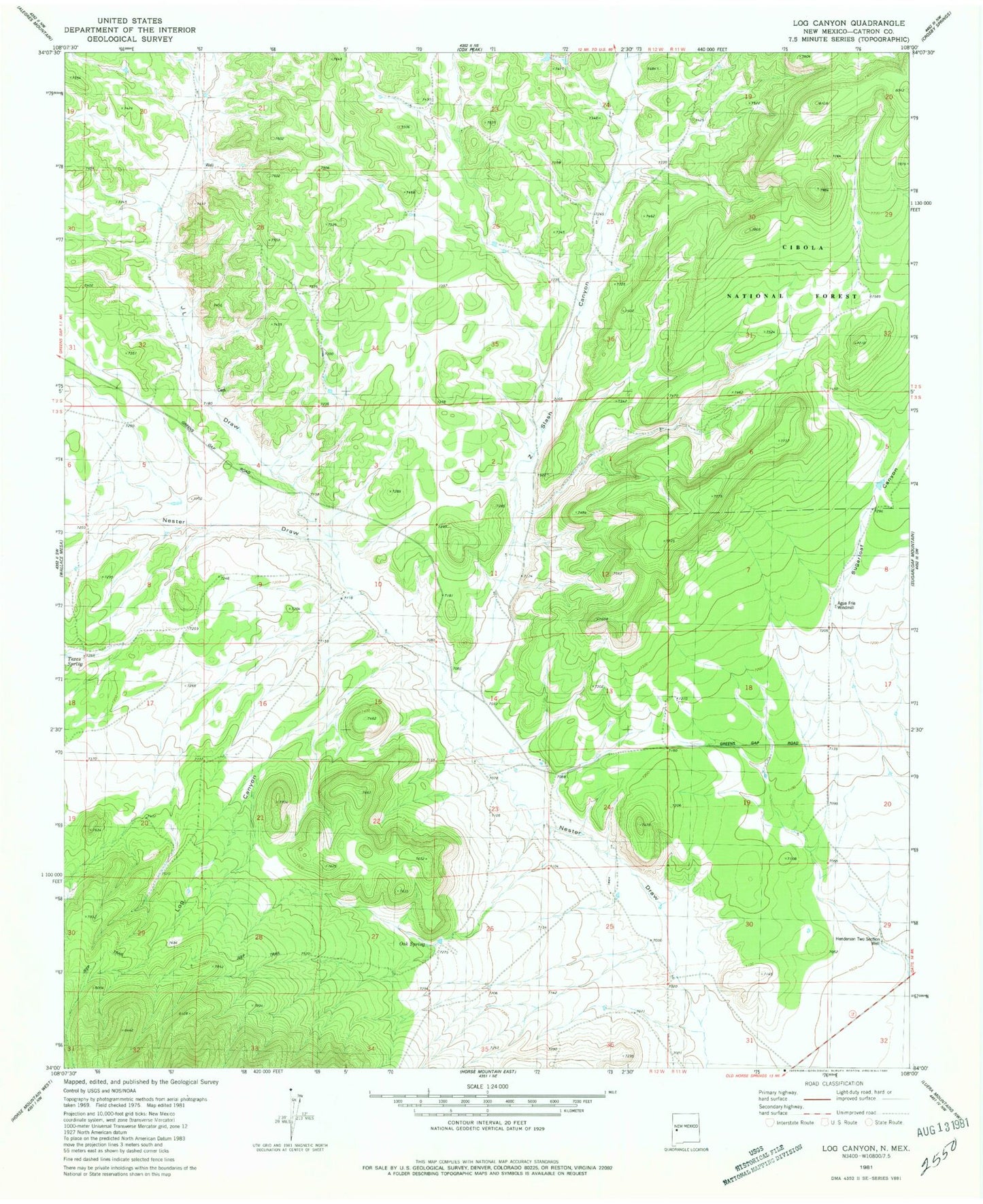
MyTopo
Classic USGS Log Canyon New Mexico 7.5'x7.5' Topo Map
Couldn't load pickup availability
Historical USGS topographic quad map of Log Canyon in the state of New Mexico. Map scale may vary for some years, but is generally around 1:24,000. Print size is approximately 24" x 27"
This quadrangle is in the following counties: Catron.
The map contains contour lines, roads, rivers, towns, and lakes. Printed on high-quality waterproof paper with UV fade-resistant inks, and shipped rolled.
Contains the following named places: 10011 Water Well, Agua Fria Water Well, Agua Fria Windmill, Bull Ranch, Happy Mountain Airport, Henderson Two Section Well, Horse Mountain Fire Department and Emergency Medical Services, J L Draw, Log Canyon, Oak Spring, RG-27460 Water Well, Saulsberry, Thurmond Ranch, Z Slash Canyon