MyTopo
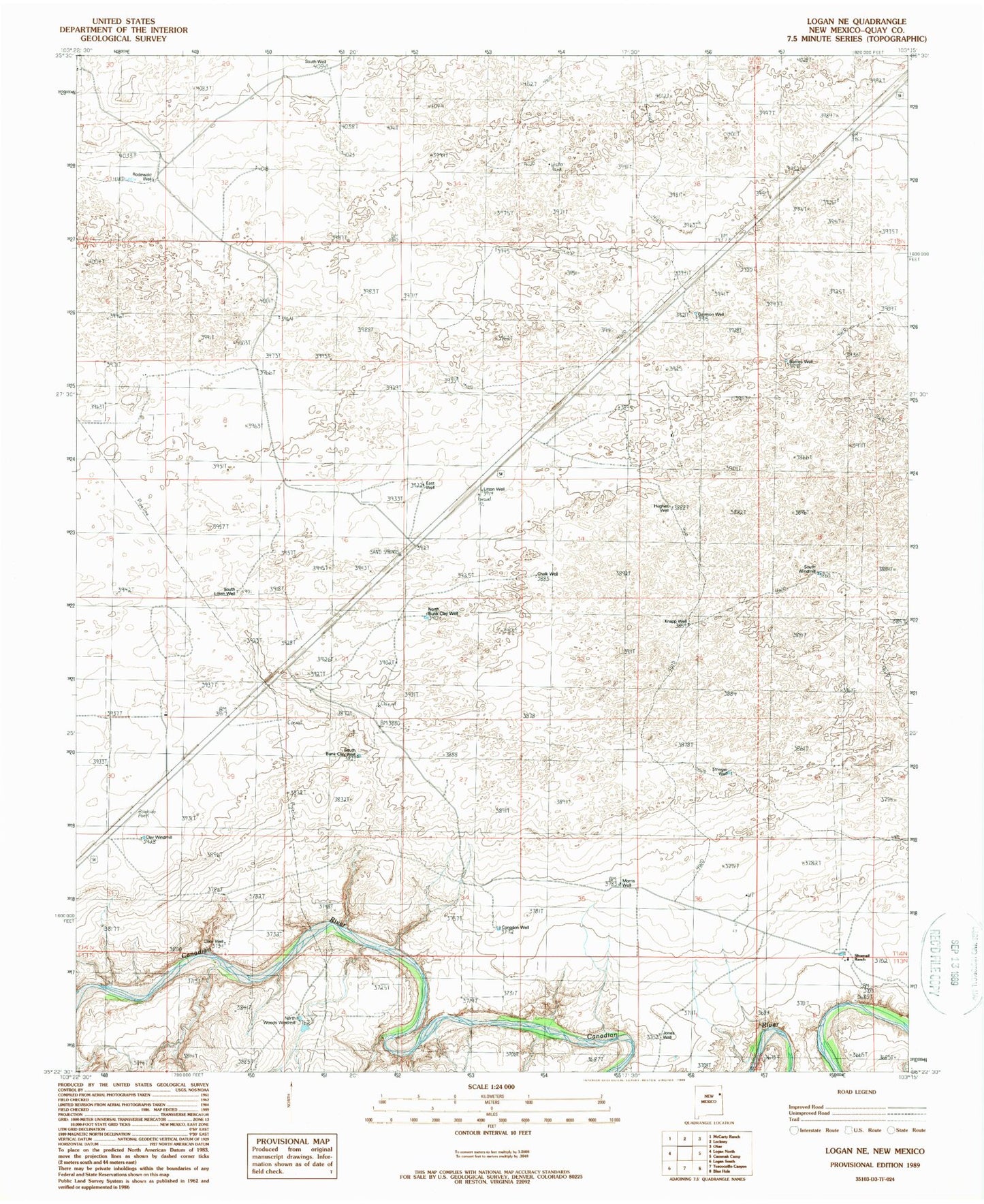
Classic USGS Logan NE New Mexico 7.5'x7.5' Topo Map
Couldn't load pickup availability
Historical USGS topographic quad map of Logan NE in the state of New Mexico. Map scale may vary for some years, but is generally around 1:24,000. Print size is approximately 24" x 27"
This quadrangle is in the following counties: Quay.
The map contains contour lines, roads, rivers, towns, and lakes. Printed on high-quality waterproof paper with UV fade-resistant inks, and shipped rolled.
Contains the following named places: 05235 Water Well, 05236 Water Well, 05237 Water Well, 05238 Water Well, 05239 Water Well, 05242 Water Well, 05244 Water Well, 05262 Water Well, 05263 Water Well, 05475 Water Well, 05488 Water Well, 05489 Water Well, 05490 Water Well, 05491 Water Well, 05492 Water Well, 05493 Water Well, 05494 Water Well, 05495 Water Well, 05497 Water Well, Barnes Well, Bunk Clay Place, Canode, Canode Post Office, Chalk Well, Claer Well, Clay Windmill, Congdon Well, East Well, Garrison Well, Hadden Ranch, Hughes Well, Jones Well, Knapp Well, Litton Well, Meeks, Meeks Ranch, Morris Well, North Bunk Clay Well, North Woods Windmill, Pyle, Rodewald, Rodewald Ranch, Rodewald Well, Sand Springs, Sand Springs Ranch, Schneider Ranch, Shallow Well Draw, Shoenail Ranch, South Bunk Clay Well, South Litton Well, South Well, South Windmill, Stringer Well