MyTopo
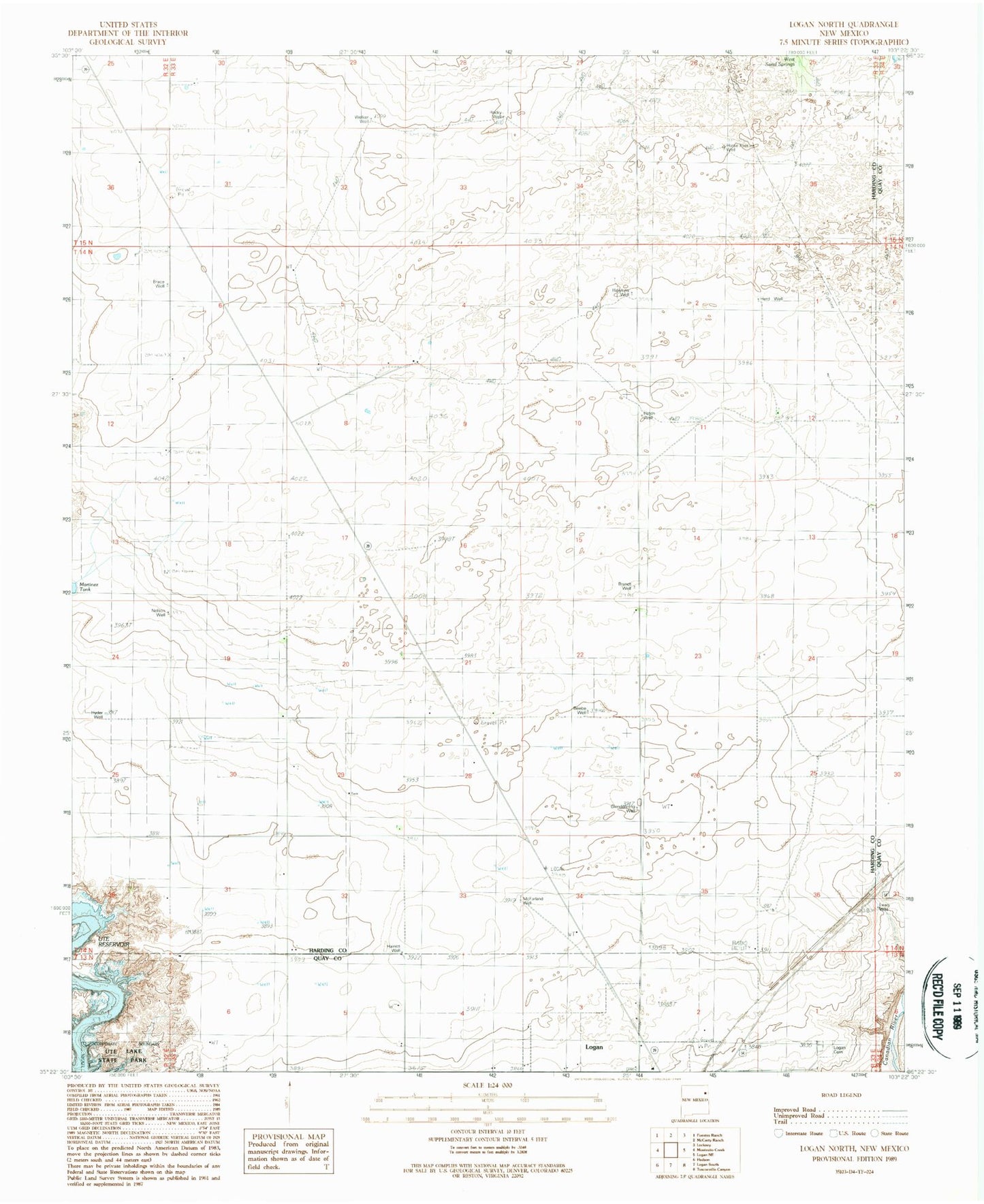
Classic USGS Logan North New Mexico 7.5'x7.5' Topo Map
Couldn't load pickup availability
Historical USGS topographic quad map of Logan North in the state of New Mexico. Map scale may vary for some years, but is generally around 1:24,000. Print size is approximately 24" x 27"
This quadrangle is in the following counties: Harding, Quay.
The map contains contour lines, roads, rivers, towns, and lakes. Printed on high-quality waterproof paper with UV fade-resistant inks, and shipped rolled.
Contains the following named places: 05002 Water Well, 05003 Water Well, 05004 Water Well, 05008 Water Well, 05010 Water Well, 05011 Water Well, 05012 Water Well, 05013 Water Well, 05014 Water Well, 05015 Water Well, 05016 Water Well, 05055 Water Well, 05056 Water Well, 05241 Water Well, Bates Place, Beebe Well, Bogard Well, Brace Well, Brandt Well, Bruhn, Brulm Ranch, Byers Well, Cain Ranch, Clay Ranch, Clay Well, Clendenning Well, Fitzner Ranch, Haines Well, Hatch Well, Hawkins Well, Helms Ranch, Henderson, Herd Well, Horse Pasture Well, Hyder Well, Lears Well, Liles, Logan Cemetery, Mathis Ranch, McFarland Well, Nelson Well, Osborne Well, Pyle Ranch, Red Windmill, Rocky Well, Terry, Welker Well, West Sand Springs, Wheeler Pit, Williamson Well