MyTopo
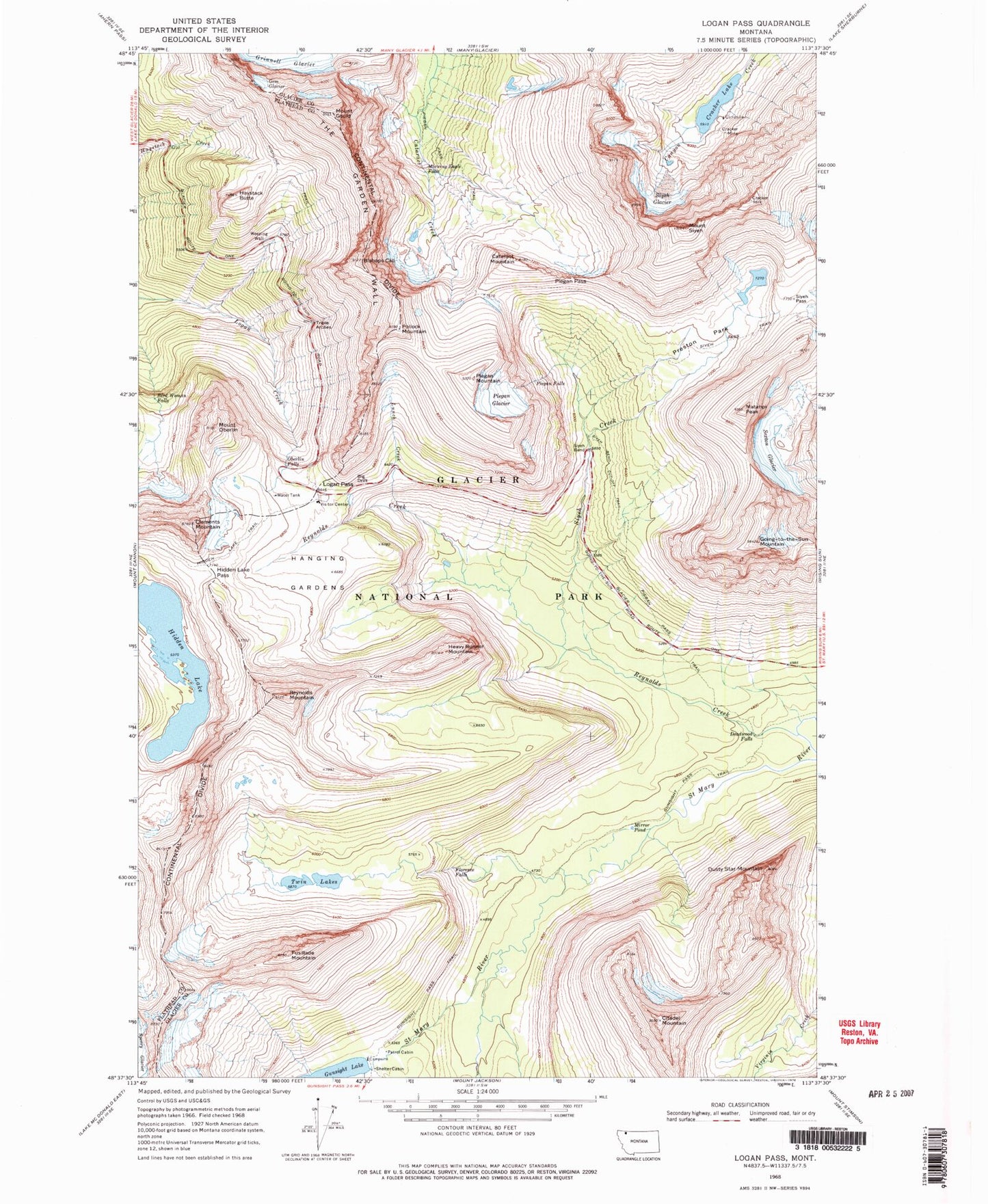
USGS Classic Logan Pass Montana 7.5'x7.5' Topo Map
Couldn't load pickup availability
Historical USGS topographic quad map of Logan Pass in the state of Montana. Scale: 1:24000. Print size: 24" x 27"
This quadrangle is in the following counties: Flathead, Glacier.
The map contains contour lines, roads, rivers, towns, lakes, and grids including latitude / longitude and UTM / MGRS. Printed on high-quality waterproof paper with UV fade-resistant inks.
Contains the following named places: Preston Park, Big Drift, Bird Woman Falls, Bishops Cap, Cataract Mountain, Citadel Mountain, Cracker Lake, Cracker Mine, Deadwood Falls, Dusty Star Mountain, Florence Falls, Fusillade Mountain, Gem Glacier, Going-to-the-Sun Mountain, Mount Gould, Hanging Gardens, Haystack Butte, Heavy Runner Mountain, Hidden Lake, Hidden Lake Pass, Hidden Lake Trail, Logan Pass, Lunch Creek, Matahpi Peak, Mirror Pond, Morning Eagle Falls, Oberlin Falls, Mount Oberlin, Piegan Falls, Piegan Glacier, Piegan Mountain, Piegan Pass, Pollock Mountain, Reynolds Creek, Reynolds Mountain, Sexton Glacier, Siyeh Bend, Siyeh Bend Cut-Off Trail, Siyeh Creek, Siyeh Glacier, Siyeh Pass, Mount Siyeh, Triple Arches, Twin Lakes, Weeping Wall, Clements Mountain, Gunsight Pass Trail