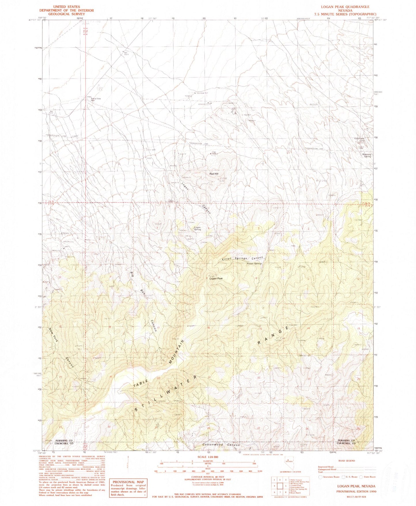
MyTopo
Classic USGS Logan Peak Nevada 7.5'x7.5' Topo Map
Regular price
$16.95
Regular price
Sale price
$16.95
Unit price
per
Couldn't load pickup availability
Historical USGS topographic quad map of Logan Peak in the state of Nevada. Map scale may vary for some years, but is generally around 1:24,000. Print size is approximately 24" x 27"
This quadrangle is in the following counties: Churchill, Pershing.
The map contains contour lines, roads, rivers, towns, and lakes. Printed on high-quality waterproof paper with UV fade-resistant inks, and shipped rolled.
Contains the following named places: Band M Mine, Big Ben Canyon, Buena Vista Windmill, Fencemaker Camp, Freckles Mine, Hot Spring, Kitten Springs, Kitten Springs Canyon, Logan Canyon, Logan Peak, Logan Spring, Mustang Spring, Red Hill, Storm Mine, Table Mountain, Table Mountain Mining District, Victory Mine