MyTopo
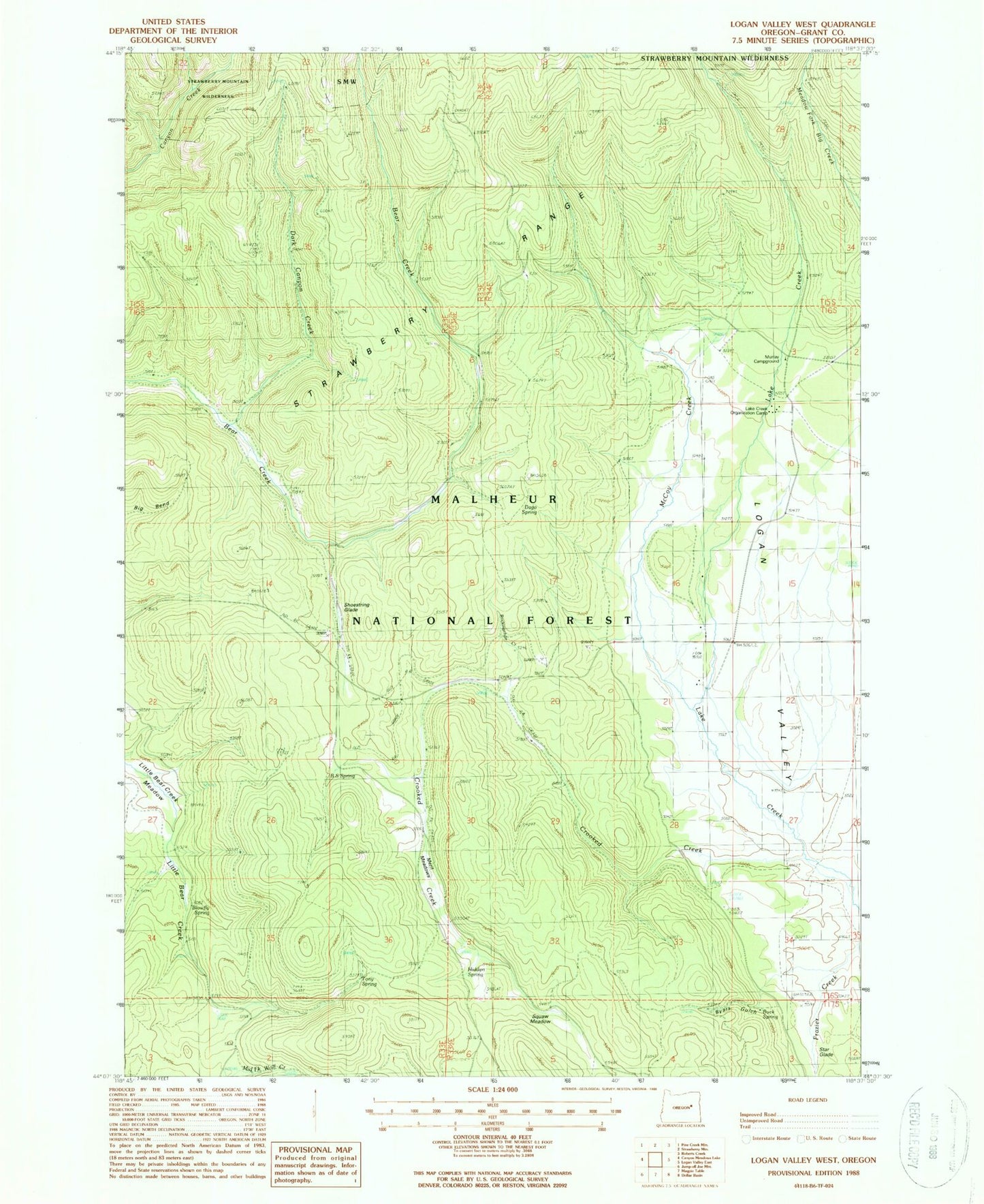
Classic USGS Logan Valley West Oregon 7.5'x7.5' Topo Map
Couldn't load pickup availability
Historical USGS topographic quad map of Logan Valley West in the state of Oregon. Map scale may vary for some years, but is generally around 1:24,000. Print size is approximately 24" x 27"
This quadrangle is in the following counties: Grant.
The map contains contour lines, roads, rivers, towns, and lakes. Printed on high-quality waterproof paper with UV fade-resistant inks, and shipped rolled.
Contains the following named places: B S Spring, Big Creek, Blowfly Spring, Buck Spring, Byars Gulch, Crooked Creek, Dago Spring, Dark Canyon Creek, Davenport Cabin, Frazier Creek, Hidden Spring, Italian Spring, Lake Creek, Lake Creek Guard Station, Lake Creek Organization Camp, Lake Creek Trail, Little Bear Creek Meadow, McCoy Creek, Merit Meadows, Merit Meadows Spring, Murray Recreation Site, Mystery Spring, Ok Truck Barn, Rockingchair Creek, Shoestring Glade, Shootingstar Meadow, Star Glade, Tony Spring