MyTopo
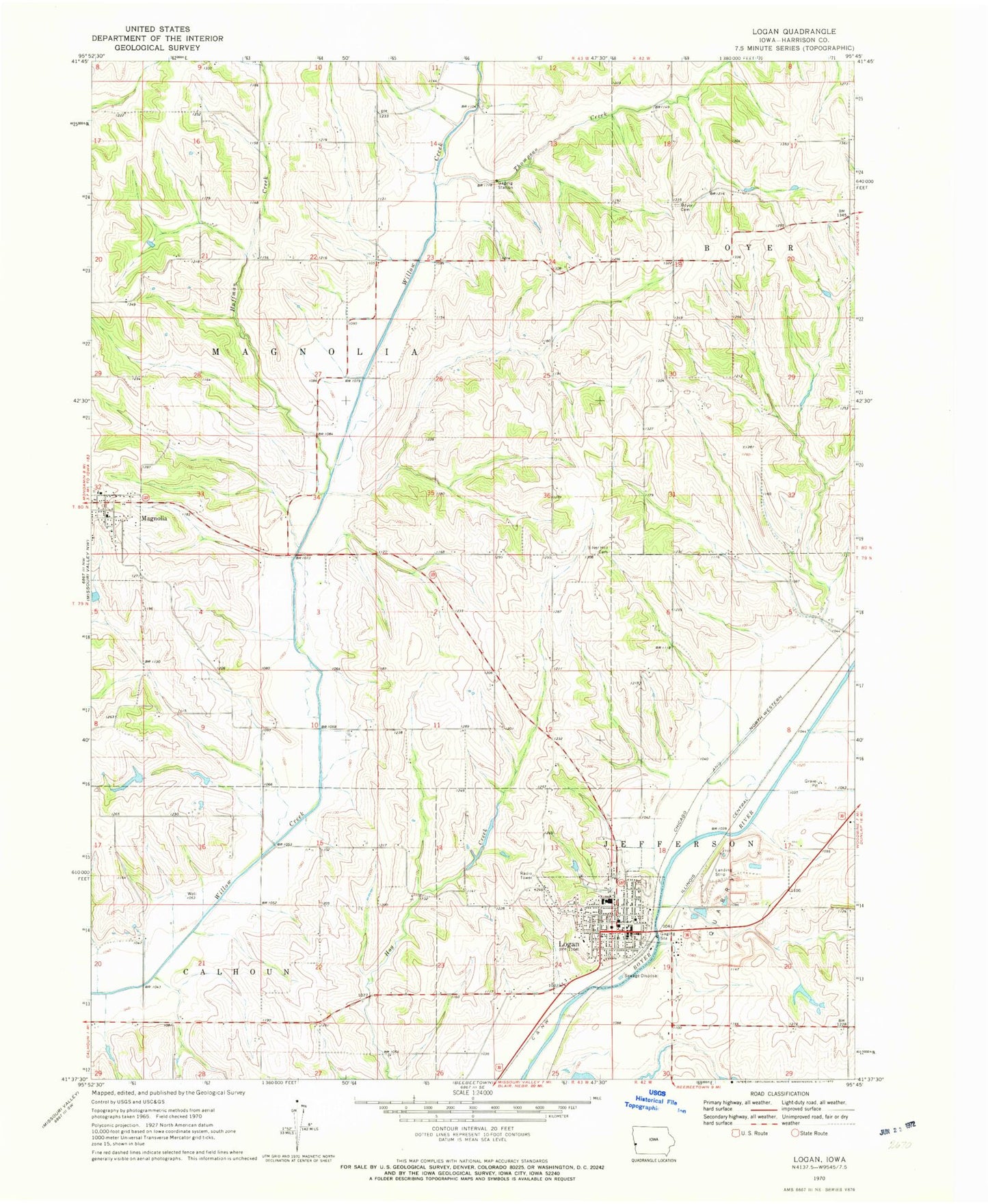
Classic USGS Logan Iowa 7.5'x7.5' Topo Map
Couldn't load pickup availability
Historical USGS topographic quad map of Logan in the state of Iowa. Map scale may vary for some years, but is generally around 1:24,000. Print size is approximately 24" x 27"
This quadrangle is in the following counties: Harrison.
The map contains contour lines, roads, rivers, towns, and lakes. Printed on high-quality waterproof paper with UV fade-resistant inks, and shipped rolled.
Contains the following named places: Alegent Health Logan Clinic, Biglers Grove Cemetery, Christian Church, City of Logan, City of Magnolia, Harrison County, Harrison County Courthouse, Harrison County Sheriff's Office, Hoffman Creek, Immanuel Lutheran Church, Landmark Baptist Mission, Logan, Logan - Magnolia Elementary School, Logan - Magnolia Junior - Senior High School, Logan Cemetery, Logan City Hall, Logan City Police Department, Logan Community Center, Logan Family Dentistry Center, Logan Post Office, Logan Public Library, Logan Quarry, Logan Volunteer Fire and Rescue Association, Magnolia Volunteer Fire and Rescue Association, Museum of Religious Arts, Purcell Cemetery, Reorganized Church of Jesus Christ of Latter Day Saints, Saint Annes Parish, Silver Hill Cemetery, The Church of Jesus Christ of Latter Day Saints, Thompson Creek, Township of Calhoun, Township of Magnolia, United Methodist Church, Westmont Care Center, Zion Lutheran Church, ZIP Codes: 51546, 51550