MyTopo
Classic USGS Logan Kansas 7.5'x7.5' Topo Map
Couldn't load pickup availability
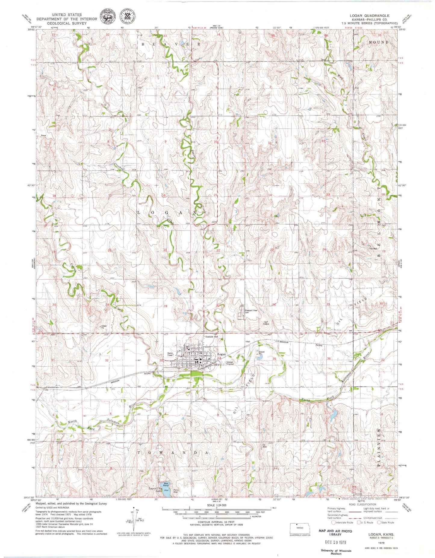
Historical USGS topographic quad map of Logan in the state of Kansas. Map scale may vary for some years, but is generally around 1:24,000. Print size is approximately 24" x 27"
This quadrangle is in the following counties: Phillips.
The map contains contour lines, roads, rivers, towns, and lakes. Printed on high-quality waterproof paper with UV fade-resistant inks, and shipped rolled.
Contains the following named places: Almena Agri - Services Grain Elevator Number 2, Beaver Creek, Cactus Creek, Church of the Transfiguration, City of Logan, Crooked Creek, Dane G Hansen Memorial Museum, First Christian Church, Logan, Logan Area Historical Museum, Logan City Dam, Logan City Hall, Logan City Lake, Logan Elementary School, Logan High School, Logan Post Office, Logan Public Library, Logan United Methodist Church, Logan Volunteer Fire Department, Logan Wastewater Treatment Facility, Old Logan Cemetery, Pleasant View Cemetery, Rangeland Co - Operative Grain Elevator Number 3, Saint John Catholic Church, Saint Peters Evangelical Lutheran Cemetery, Township of Logan, ZIP Code: 67646