MyTopo
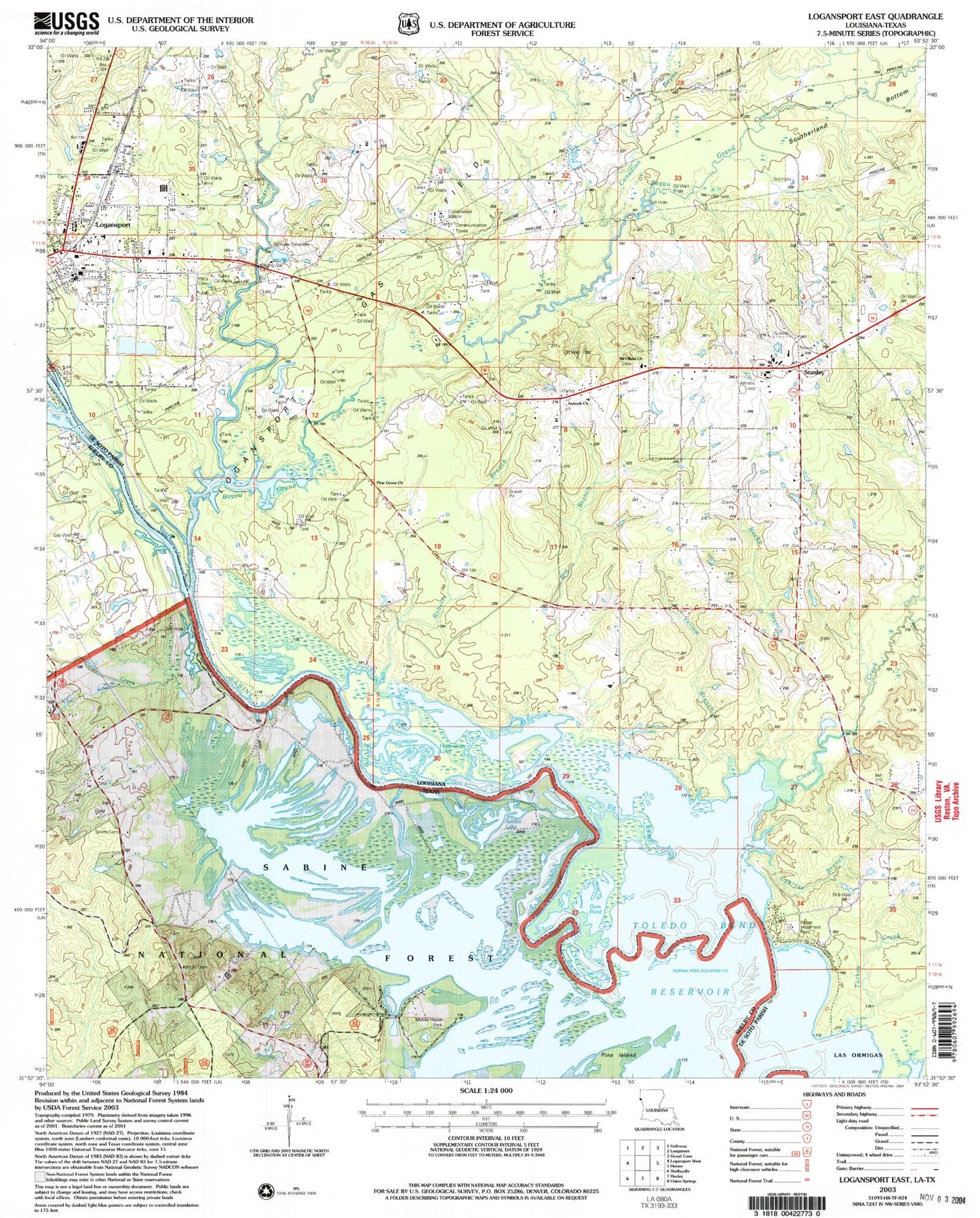
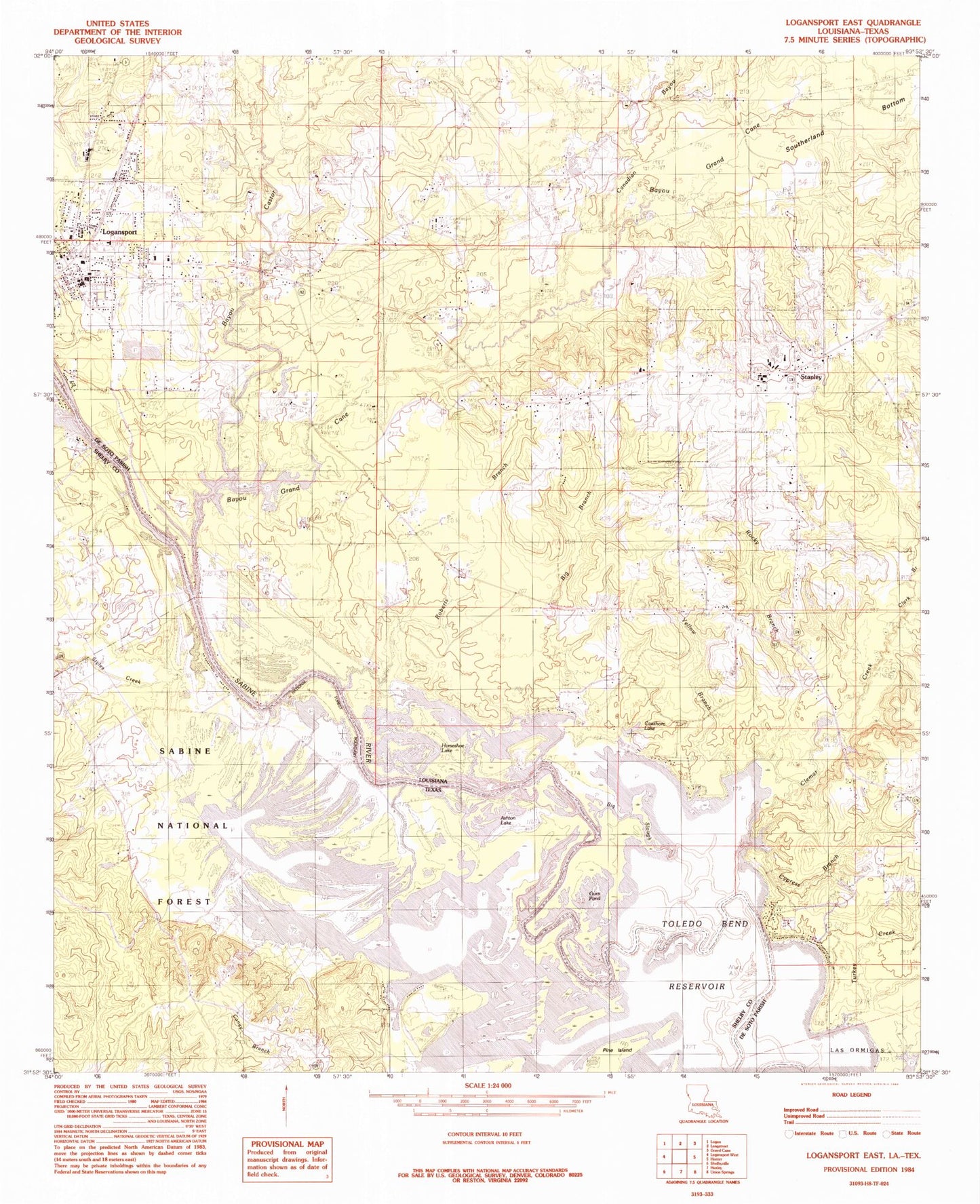
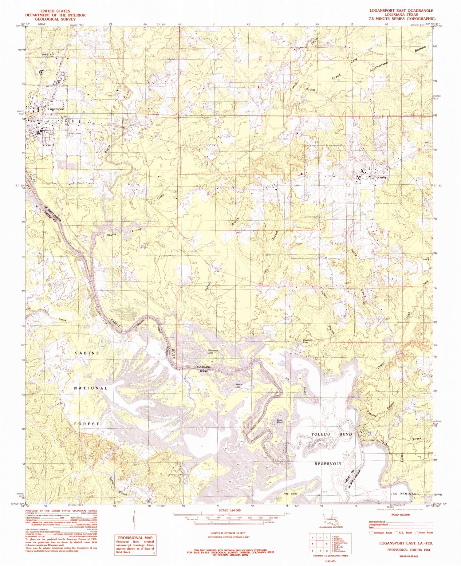
Classic USGS Logansport East Louisiana 7.5'x7.5' Topo Map
Couldn't load pickup availability
Historical USGS topographic quad map of Logansport East in the states of Louisiana, Texas. Map scale may vary for some years, but is generally around 1:24,000. Print size is approximately 24" x 27"
This quadrangle is in the following counties: De Soto, Shelby.
The map contains contour lines, roads, rivers, towns, and lakes. Printed on high-quality waterproof paper with UV fade-resistant inks, and shipped rolled.
Contains the following named places: Antioch Church, Ashton Cemetery, Ashton Lake, Ashton School, Bayou Castor, Bayou Grand Cane, Big Branch, Big Slough, Canadian Bayou, Cawthorn Lake, Clark Branch, Clemar Creek, Cypress Branch, Cypress Branch Gas Field, De Soto Fire District 5, First Baptist Church, Gum Pond, Horseshoe Lake, Logansport, Logansport Gas Field, Mount Olivet Baptist Church, North Toledo Bend Wildlife Mangement Area, O E Price Memorial Park, Paragon, Petty Creek, Pine Grove Church, Pine Island, Roberts Branch, Rocky Branch, Smith Cemetery, Stanley, Stanley High School, Styles Creek, Town of Logansport, Village of Stanley, Ward Eight, Yellow Branch