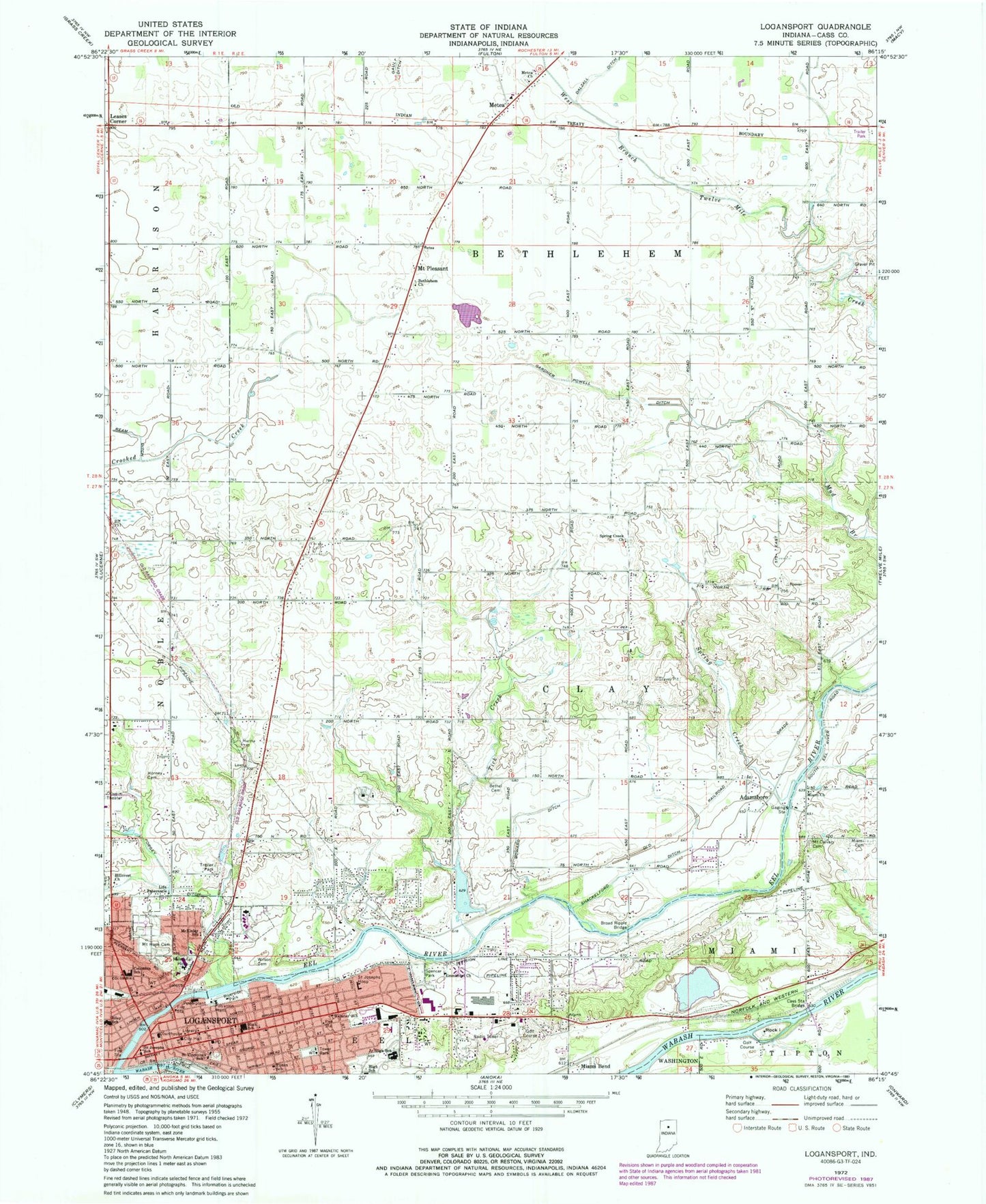
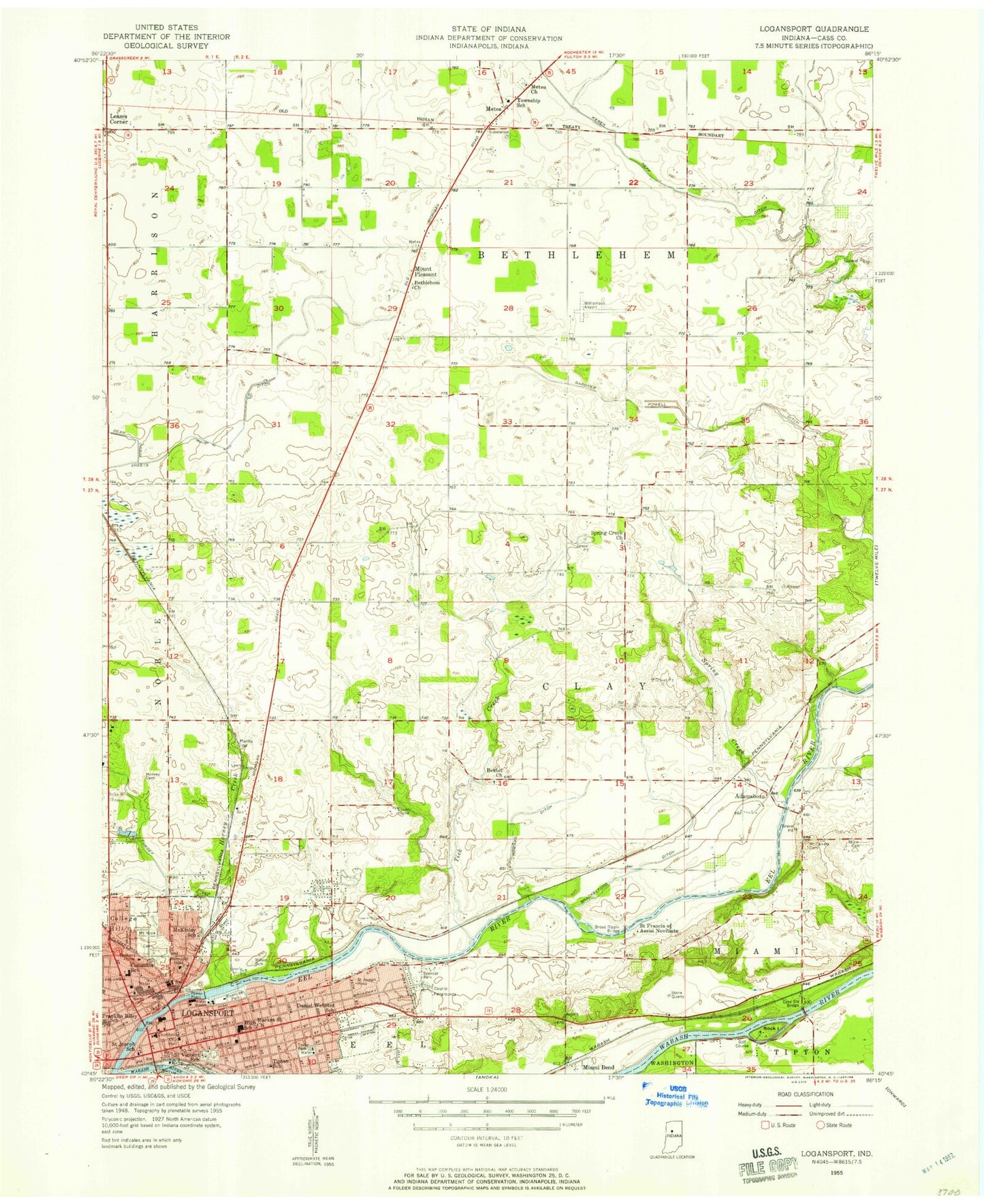
MyTopo
Classic USGS Logansport Indiana 7.5'x7.5' Topo Map
Couldn't load pickup availability
Historical USGS topographic quad map of Logansport in the state of Indiana. Map scale may vary for some years, but is generally around 1:24,000. Print size is approximately 24" x 27"
This quadrangle is in the following counties: Cass.
The map contains contour lines, roads, rivers, towns, and lakes. Printed on high-quality waterproof paper with UV fade-resistant inks, and shipped rolled.
Contains the following named places: Adamsboro, Bethel Methodist Cemetery, Bethlehem Church, Broad Ripple Bridge, Cass County, Cass County Sheriff's Office, Cass Station Bridge, Columbia Middle School, Danes, Daniel Webster Elementary School, Eel River, Emmanuel Church, Forgey Ditch, Four County Counseling Center, Gardner Powell Ditch, Gault Ditch, Hillcrest Church, Horney Cemetery, Howard Ditch, Lake Perry, Lake Perry Dam, Leases Corner, Life Tabernacle, Logansport, Logansport - Cass County Public Library, Logansport City Fire Department Station 3, Logansport Fire Department Headquarters, Logansport Memorial Hospital, Logansport Police Department, Logansport Post Office, McKinley Elementary School, Metea, Metea Church, Metea Post Office, Miami Baptist Cemetery, Miami Bend, Miami Church, Mount Calvary Brethren Cemetery, Mount Hope Cemetery, Mount Pleasant, Old Adamsboro, Ream Ditch, Riley School, Riverside Park, Rock Island, Saint Josephs Hospital, Saint Josephs School, Saint Vincents School, Shackelford Ditch, Spencer Park, Spring Creek, Spring Creek Church, Tick Creek, Tipton Elementary School, Tower Park, Township of Bethlehem, Township of Clay, Township of Eel, Verona, Williamson Airport, Wilson Family Cemetery, WSAL-AM (Logansport)