MyTopo
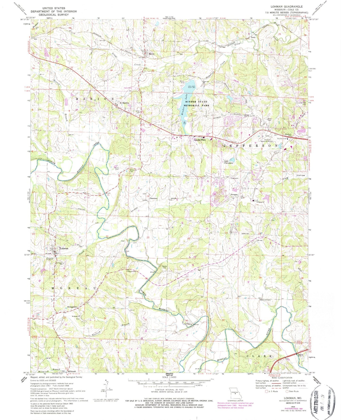
Classic USGS Lohman Missouri 7.5'x7.5' Topo Map
Couldn't load pickup availability
Historical USGS topographic quad map of Lohman in the state of Missouri. Map scale may vary for some years, but is generally around 1:24,000. Print size is approximately 24" x 27"
This quadrangle is in the following counties: Cole.
The map contains contour lines, roads, rivers, towns, and lakes. Printed on high-quality waterproof paper with UV fade-resistant inks, and shipped rolled.
Contains the following named places: Anderson Lake, Anderson Lake Dam, Apache Flats, Bennie Branch, Binder Lake, Binder Lake Dam, Binder Memorial Park, Capital Mall, City of Lohman, City of Saint Martins, Clarence Lawson Elementary School, Cole County, Cole County Fire Protection District Station 1, Cole County Fire Protection District Station 4 Headquarters, Corinth School, Dickerson Creek, Eberhardt Cemetery, Eberhardt Ford, Elston, Fish Trap Bridge, Gordon Cemetery, Harmony School, Hawthorn Memorial Gardens, Hemstreet Bridge, Islamic Cemetery of Mid Missouri, Jefferson City Fire Department Station 5, Kautsch Branch, Kohler Bridge, Lake Claradean, Lake Claradean Dam, Logan Creek, Lohman, Lohman Post Office, Long View Cemetery, Moreau, Old Catholic Cemetery, Old Catholic Church, Pleasant View School, Plummer, Regional West Fire Protection District Station 2, Regional West Fire Protection District Station 3 Headquarters, Renns Lake Dam, Russellville - Lohman Fire Protection District Station 2 Lohman, Saddle Bridge, Saint Johns Cemetery, Saint Johns Church, Saint Martins, Saint Pauls Cemetery, Saint Pauls Church, Scott, Scruggs, South Moreau Creek, Stone Cemetery, Stringtown, Stringtown School, Thomas Jefferson Middle School, Walser Bridge, West Union School, Wilkerson Cemetery, Woodward Lake, Woodward Lake Dam, Zion Cemetery, Zion Church, ZIP Code: 65109