MyTopo
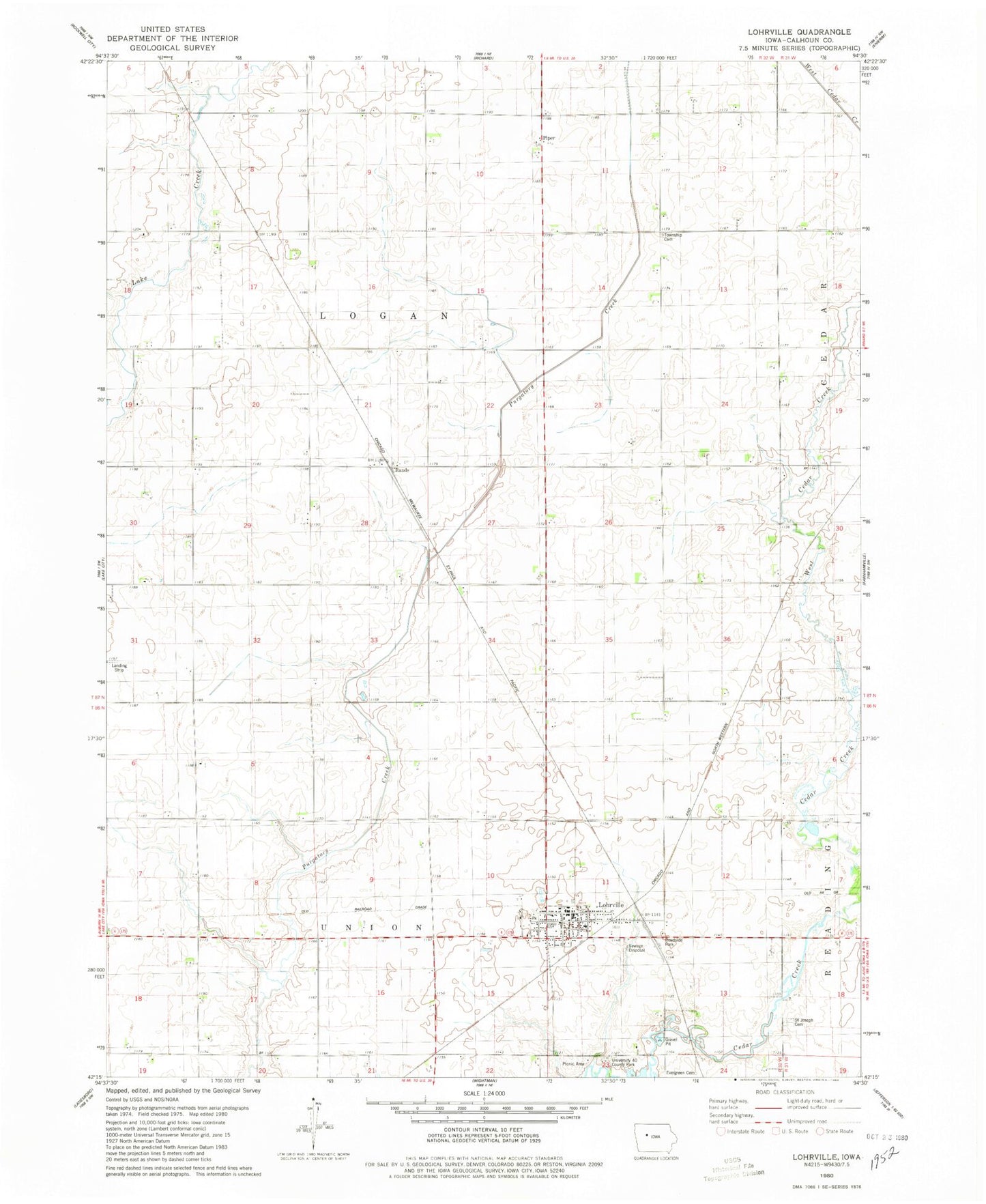
Classic USGS Lohrville Iowa 7.5'x7.5' Topo Map
Couldn't load pickup availability
Historical USGS topographic quad map of Lohrville in the state of Iowa. Map scale may vary for some years, but is generally around 1:24,000. Print size is approximately 24" x 27"
This quadrangle is in the following counties: Calhoun.
The map contains contour lines, roads, rivers, towns, and lakes. Printed on high-quality waterproof paper with UV fade-resistant inks, and shipped rolled.
Contains the following named places: Calhoun Post Office, Christian Church, Church of Christ, City of Lohrville, East Cedar Creek, Evergreen Cemetery, J J Hands Library, Johnson Prairie, Logan Township Cemetery, Lohrville, Lohrville Ambulance Service, Lohrville City Hall, Lohrville Fire Station, Lohrville Post Office, New Cooperative Incorporated Elevator, Piper, Piper Cemetery, Rands, Rands Post Office, Riedesel Private Airport, Saint Joseph Cemetery, Saint Joseph Church, Share Group Fellowship Church, South Central Calhoun Elementary School - Lohrville, Stimsons, Township of Logan, Township of Union, United Methodist Church, University Forty County Park, West Cedar Creek, ZIP Code: 51453