MyTopo
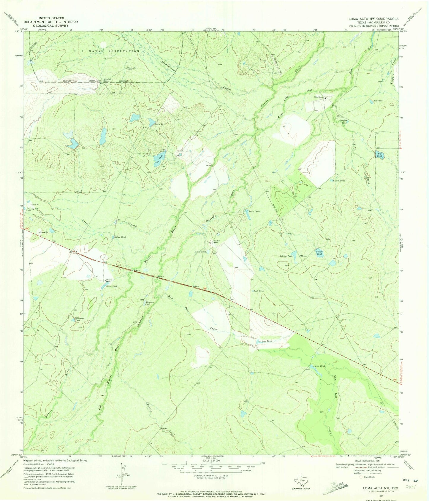
Classic USGS Loma Alta NW Texas 7.5'x7.5' Topo Map
Couldn't load pickup availability
Historical USGS topographic quad map of Loma Alta NW in the state of Texas. Map scale may vary for some years, but is generally around 1:24,000. Print size is approximately 24" x 27"
This quadrangle is in the following counties: McMullen.
The map contains contour lines, roads, rivers, towns, and lakes. Printed on high-quality waterproof paper with UV fade-resistant inks, and shipped rolled.
Contains the following named places: Alamo Tank, Alligator Lake, Arthur Tank, Big Tank, Big Tank Dam, Bob Hinces Lake Number 1, Bob Hinces Lake Number 1 Dam, Bob Hinces Lake Number 2, Bob Hinces Lake Number 2 Dam, Bob Hinces Lake Number 3, Bob Hinces Lake Number 3 Dam, Chimney Ranch, Cicero Tank, Dinosaur Tank, Douglas Tank, Elm Creek, George Tank, Green Branch, Guadalupe Creek, House Tank, Joe Tank, Little Tank, Lost Tank, Miles Ranch, Miller Tank, Old Nueces River Channel, Outside Slue, Raleigh Tank, Roy Tank, Roy Tank Dam, San Jose Creek, San Jose Ranch, Twin Tanks, Winn Lake Slue, Yankee Target Range, Ygnacio Creek