MyTopo
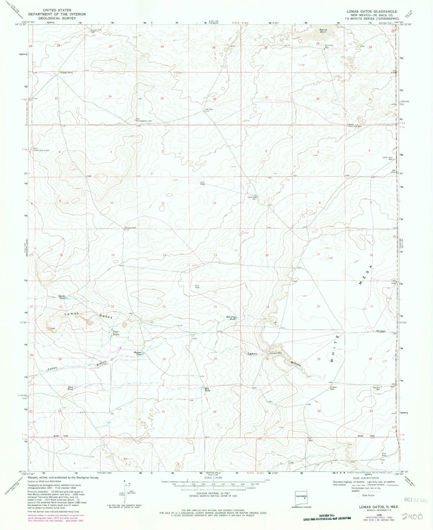
Classic USGS Lomas Gatos New Mexico 7.5'x7.5' Topo Map
Couldn't load pickup availability
Historical USGS topographic quad map of Lomas Gatos in the state of New Mexico. Map scale may vary for some years, but is generally around 1:24,000. Print size is approximately 24" x 27"
This quadrangle is in the following counties: De Baca.
The map contains contour lines, roads, rivers, towns, and lakes. Printed on high-quality waterproof paper with UV fade-resistant inks, and shipped rolled.
Contains the following named places: Blanco Cemetery, Bonner Well, Canyon Well, Dry Tank, East Headquarters Well, East Tank, East Well, Hall Ranch, Hanibus Well, Hopper Tank, Hutten Well, Lena Lewis Well, Lomas Gatos, Lone Tree Well, North Tank, Red Fry Tank, Sand Hill, Sand Hill Well, Sanders Well, South Sand Hill Well, Triangle Cattle Company, Triangle Ranch, Twin Tanks, West Headquarters Well, ZIP Code: 88134