
MyTopo
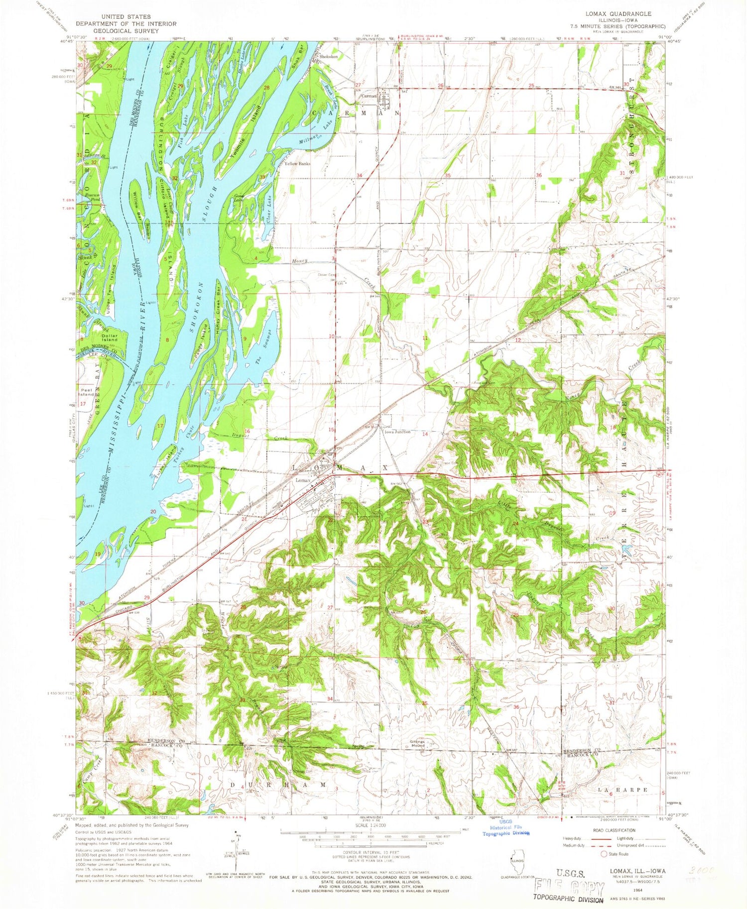
Classic USGS Lomax Illinois 7.5'x7.5' Topo Map
Couldn't load pickup availability
Historical USGS topographic quad map of Lomax in the states of Illinois, Iowa. Map scale may vary for some years, but is generally around 1:24,000. Print size is approximately 24" x 27"
This quadrangle is in the following counties: Des Moines, Hancock, Henderson, Lee.
The map contains contour lines, roads, rivers, towns, and lakes. Printed on high-quality waterproof paper with UV fade-resistant inks, and shipped rolled.
Contains the following named places: Beaver Island, Brush Lake, Burlington Island, Carman, Carman Cemetery, Carman Census Designated Place, Carman Post Office, Clear Lake, Clifford Island, Clover Cemetery, Craigel Island, Craigel Slough, Crane Cemetery, Dallas City Rural Fire Protection District - Lomax Station, Dollar Island, Dugout Creek, Enterprise School, Fish Lake, Freeland Cemetery, Gittings Cemetery, Gittings Mound, Gittings Mound Cemetery, Goose Lake, Goose Pond, Honey Creek, Honey Creek Bar, Iowa Junction, Johnson Farm Airport, Kemper, La Harpe Reservoir, La Harpe Reservoir Dam, Little Dugout Creek, Lomax, Lomax Ambulance Service, Lomax Post Office, Lower Cutoff, Magee Lake, Maple Island, Millman Lake, Millville School, Paddy Island, Pin Oak Point, Pleasant Grove School, Roscum Pond, Shaw Cemetery, Shok Bar, Shokokon, Shokokon Slough, Silver Creek, Skunk River, Skunk Slough, Sourwine Cemetery, Spring Creek, Sullivan Slough, Sullivan Slough Mississippi River Access, Talbert Family Cemetery, The Swamps, Tiwappity School, Township of Lomax, Turkey Chute, Turkey Island, Twomile Island, Upper Twin Island, Vaughn Lake, Village of Lomax, Weaver Branch, Willow Bar, Yellow Banks, ZIP Code: 61454


